TopoQuest Logo
Do you find TopoQuest useful?
Help keep TopoQuest running and adding new maps/features by donating!
Bitcoin:  19c7KJd3qBynnjoSw5npx9KScwjBe4ifkT
Litecoin:  LXs6TkuXGGXo1vDsWCkWVdjQX94eUKd6ui
Home View Maps Find Maps Find Places Resources & Links


Sumpter, Oregon Topographic Map

USGS Map Title: Sumpter, OR
USGS Map MRC: 44118F2
DRG (GeoTIFF) Download: o44118f2.tif


Neighboring USGS Topographic Map Quads:


  Mount Ireland, OR  
44118G3
 

  Bourne, OR  
44118G2
 

  Elkhorn Peak, OR  
44118G1
 

  Whitney, OR  
44118F3
 

  Sumpter, OR  
44118F2
 

  Phillips Lake, OR  
44118F1
 

  Pogue Point, OR  
44118E3
 

  Unity Reservoir, OR  
44118E2
 

  Beaverdam Creek, OR  
44118E1


Map MRC Location:

N45°
W119°
N45°
W118°
H8 H7 H6 H5 H4 H3 H2 H1
G8 G7 G6 G5 G4 G3 G2 G1
F8 F7 F6 F5 F4 F3 F2 F1
E8 E7 E6 E5 E4 E3 E2 E1
D8 D7 D6 D5 D4 D3 D2 D1
C8 C7 C6 C5 C4 C3 C2 C1
B8 B7 B6 B5 B4 B3 B2 B1
A8 A7 A6 A5 A4 A3 A2 A1
N44°
W119°
N44°
W118°

Sumpter, OR USGS 1:24K Topographic Map Preview:
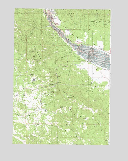
Sumpter, OR USGS Topographic Map
Click on map above to begin viewing in our Map Viewer.

This topographic map contains these locations and features:
Feature Name Type Latitude Longitude GNIS ID View Map
Adobe PondLakeN44.6700°W118.2372°1137025View Map
Alder CreekStreamN44.6565°W118.2172°1137071View Map
Alder Creek MeadowFlatN44.6577°W118.2138°1137084View Map
Alder SpringSpringN44.6714°W118.2071°1137107View Map
Alder Springs (historical)LocaleN44.6846°W118.2138°1699689View Map
Antelope SpringSpringN44.7050°W118.2369°1137252View Map
Baker County Library Sumpter Branch LibraryBuildingN44.7443°W118.2021°2700373View Map
Bear GulchValleyN44.7179°W118.1580°1137719View Map
Big Fir SpringSpringN44.6775°W118.2095°1138024View Map
Big Huckleberry ButteSummitN44.6693°W118.1636°1156748View Map
Blue Mountain CemeteryCemeteryN44.7315°W118.1821°1138320View Map
Camp SpringSpringN44.6848°W118.2251°1139270View Map
City of SumpterCivilN44.7435°W118.1975°2412002View Map
Cracker CreekStreamN44.7415°W118.2061°1140349View Map
Cracker Creek Museum of MiningBuildingN44.7399°W118.2014°2699268View Map
Earmuff SpringSpringN44.6595°W118.1862°1141502View Map
Elk Camp SpringSpringN44.6295°W118.1281°1141741View Map
Harris CreekStreamN44.6821°W118.1477°1143332View Map
Hawley DitchCanalN44.7168°W118.1499°1143386View Map
Hawley GulchValleyN44.7163°W118.1355°1143387View Map
Huckleberry CreekStreamN44.7038°W118.1558°1143871View Map
Huckleberry MountainSummitN44.6707°W118.1802°1143881View Map
Huckleberry SpringSpringN44.6682°W118.1798°1143889View Map
Huff SpringSpringN44.7460°W118.1418°1143893View Map
Iris PondLakeN44.6811°W118.2319°1144104View Map
Juniper FlatFlatN44.6832°W118.2263°1144455View Map
Justus SpringSpringN44.6438°W118.2158°1144470View Map
Larch (historical)LocaleN44.6788°W118.2066°1154089View Map
Larch SummitGapN44.6824°W118.1916°1144828View Map
Lockhart CreekStreamN44.6863°W118.1405°1145315View Map
Lower Mud SpringSpringN44.7362°W118.1295°1145631View Map
Maggie SpringSpringN44.6604°W118.2345°1145730View Map
McCully ForkStreamN44.7415°W118.2061°1145961View Map
McEwen Valley DitchCanalN44.6879°W118.1519°1145976View Map
Metsker SpringSpringN44.6663°W118.1457°1146120View Map
Midway PondLakeN44.6427°W118.2015°1146192View Map
Morin SpringSpringN44.7102°W118.2266°1146458View Map
Morris SpringSpringN44.6729°W118.2018°1146473View Map
Pole Bridge CreekStreamN44.6493°W118.1699°1147836View Map
Powder River - Mosquito Flat North Rural Fire Protection DistrictBuildingN44.7205°W118.1734°2576711View Map
Powerline SpringSpringN44.6803°W118.2036°1147969View Map
Railroad PondLakeN44.6821°W118.2268°1148164View Map
Reed SpringSpringN44.6870°W118.2437°1125926View Map
Sawmill GulchValleyN44.7349°W118.2024°1149094View Map
Slide SpringSpringN44.7051°W118.2223°1149719View Map
South Wye (historical)LocaleN44.7346°W118.1999°1699688View Map
Spruce GulchValleyN44.7102°W118.1774°1150208View Map
Stickler SpringSpringN44.7022°W118.2204°1150426View Map
SumpterPopulated PlaceN44.7457°W118.2022°1150647View Map
Sumpter City HallBuildingN44.7468°W118.2010°2700423View Map
Sumpter Post OfficePost OfficeN44.7434°W118.2010°1166006View Map
Sumpter Utilities Manager OfficeBuildingN44.7468°W118.2010°2700422View Map
Sumpter Valley Gold Dredge MuseumBuildingN44.7425°W118.2041°1851920View Map
Sumpter Volunteer Fire DepartmentBuildingN44.7468°W118.2009°2577136View Map
Sumpter Wastewater Treatment LagoonLocaleN44.7285°W118.1908°2697195View Map
Swale PondLakeN44.6618°W118.2060°1150724View Map
Telephone SpringSpringN44.6884°W118.2289°1150953View Map
Three M SpringSpringN44.6434°W118.1796°1116710View Map
Tuck SpringSpringN44.6709°W118.2010°1128268View Map
Upper Mud SpringSpringN44.7380°W118.1262°1151693View Map
Worley CreekStreamN44.6949°W118.1263°1152649View Map
Worley SpringSpringN44.6801°W118.1580°1152650View Map

Note: Coordinates in the location and feature list above are referenced to NAD83 datum.


Copyright (C) 2008-2025 Ryan Niemi / Sunset Dynamics ... All Rights Reserved