TopoQuest Logo
Do you find TopoQuest useful?
Help keep TopoQuest running and adding new maps/features by donating!
Bitcoin:  19c7KJd3qBynnjoSw5npx9KScwjBe4ifkT
Litecoin:  LXs6TkuXGGXo1vDsWCkWVdjQX94eUKd6ui
Home View Maps Find Maps Find Places Resources & Links


Cream, Wisconsin Topographic Map

USGS Map Title: Cream, WI
USGS Map MRC: 44091C7
DRG (GeoTIFF) Download: o44091c7.tif


Neighboring USGS Topographic Map Quads:


  Urne, WI  
44091D8
 

  Modena, WI  
44091D7
 

  Gilmanton, WI  
44091D6
 

  Alma, WI  
44091C8
 

  Cream, WI  
44091C7
 

  Waumandee, WI  
44091C6
 

  Weaver, MN  
44091B8
 

  Cochrane, WI  
44091B7
 

  Fountain City, WI  
44091B6


Map MRC Location:

N45°
W92°
N45°
W91°
H8 H7 H6 H5 H4 H3 H2 H1
G8 G7 G6 G5 G4 G3 G2 G1
F8 F7 F6 F5 F4 F3 F2 F1
E8 E7 E6 E5 E4 E3 E2 E1
D8 D7 D6 D5 D4 D3 D2 D1
C8 C7 C6 C5 C4 C3 C2 C1
B8 B7 B6 B5 B4 B3 B2 B1
A8 A7 A6 A5 A4 A3 A2 A1
N44°
W92°
N44°
W91°

Cream, WI USGS 1:24K Topographic Map Preview:
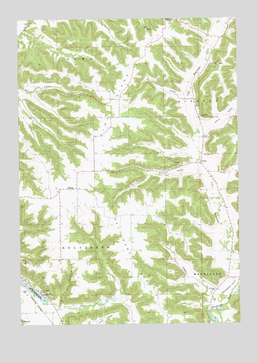
Cream, WI USGS Topographic Map
Click on map above to begin viewing in our Map Viewer.

This topographic map contains these locations and features:
Feature Name Type Latitude Longitude GNIS ID View Map
0.24 ReservoirReservoirN44.3450°W91.8652°1792325View Map
1.3 ReservoirReservoirN44.3333°W91.8668°1792321View Map
1.3 ReservoirReservoirN44.3400°W91.8602°1792327View Map
1.4 ReservoirReservoirN44.3339°W91.8657°1792323View Map
1.5 ReservoirReservoirN44.3483°W91.8585°1792329View Map
5.1 ReservoirReservoirN44.2602°W91.8235°1792333View Map
Alma Mill 2 D6519 DamDamN44.3333°W91.8668°1792320View Map
Alma Mill 3 D6519 DamDamN44.3333°W91.8652°1792322View Map
Alma Mill 4 D6519 DamDamN44.3450°W91.8652°1792324View Map
Alma Mill 5 D6519 DamDamN44.3400°W91.8602°1792326View Map
Alma Mill 6 D6519 DamDamN44.3483°W91.8585°1792328View Map
Alma RidgeRidgeN44.3202°W91.8313°1560799View Map
Alma Ridge School (historical)SchoolN44.3561°W91.8088°1578538View Map
Anchorage (historical)Populated PlaceN44.2686°W91.7571°1837495View Map
Anchorage CemeteryCemeteryN44.2638°W91.7638°1560851View Map
Anchorage School (historical)SchoolN44.2686°W91.7540°1578539View Map
Belvidere RidgeRidgeN44.2530°W91.7924°1561551View Map
CreamPopulated PlaceN44.3161°W91.7718°1563518View Map
Garden Valley 10 E597 DamDamN44.2600°W91.8252°1792332View Map
HeroldPopulated PlaceN44.3055°W91.8421°1566324View Map
Jahns CreekStreamN44.3304°W91.7733°2760565View Map
Jahns ValleyValleyN44.3317°W91.7710°1567089View Map
Lakeview School (historical)SchoolN44.2655°W91.8671°1578543View Map
Lincoln CemeteryCemeteryN44.3350°W91.7721°1568066View Map
Little Bluebell School (historical)SchoolN44.2769°W91.8515°1578544View Map
Lizzy Pauls PondReservoirN44.2626°W91.8655°1568472View Map
Rose ValleyValleyN44.2555°W91.8516°1572600View Map
Rose Valley School (historical)SchoolN44.2616°W91.8218°1578548View Map
Schmidt ValleyValleyN44.3429°W91.7810°1573786View Map
Schultz ValleyValleyN44.3126°W91.7742°1573819View Map
Tell ChurchChurchN44.3730°W91.8696°1575296View Map
Town of BelvidereCivilN44.2664°W91.8360°1582793View Map
Yaeger ValleyValleyN44.2616°W91.7658°1577069View Map
Zion CemeteryCemeteryN44.3191°W91.7701°1577140View Map
Zion ChurchChurchN44.3264°W91.7693°1577160View Map

Note: Coordinates in the location and feature list above are referenced to NAD83 datum.


Copyright (C) 2008-2025 Ryan Niemi / Sunset Dynamics ... All Rights Reserved