TopoQuest Logo
Do you find TopoQuest useful?
Help keep TopoQuest running and adding new maps/features by donating!
Bitcoin:  19c7KJd3qBynnjoSw5npx9KScwjBe4ifkT
Litecoin:  LXs6TkuXGGXo1vDsWCkWVdjQX94eUKd6ui
Home View Maps Find Maps Find Places Resources & Links


Hindustan, Indiana Topographic Map

USGS Map Title: Hindustan, IN
USGS Map MRC: 39086C4
DRG (GeoTIFF) Download: o39086c4.tif


Neighboring USGS Topographic Map Quads:


  Paragon, IN  
39086D5
 

  Martinsville, IN  
39086D4
 

  Cope, IN  
39086D3
 

  Modesto, IN  
39086C5
 

  Hindustan, IN  
39086C4
 

  Morgantown, IN  
39086C3
 

  Bloomington, IN  
39086B5
 

  Unionville, IN  
39086B4
 

  Belmont, IN  
39086B3


Map MRC Location:

N40°
W87°
N40°
W86°
H8 H7 H6 H5 H4 H3 H2 H1
G8 G7 G6 G5 G4 G3 G2 G1
F8 F7 F6 F5 F4 F3 F2 F1
E8 E7 E6 E5 E4 E3 E2 E1
D8 D7 D6 D5 D4 D3 D2 D1
C8 C7 C6 C5 C4 C3 C2 C1
B8 B7 B6 B5 B4 B3 B2 B1
A8 A7 A6 A5 A4 A3 A2 A1
N39°
W87°
N39°
W86°

Hindustan, IN USGS 1:24K Topographic Map Preview:
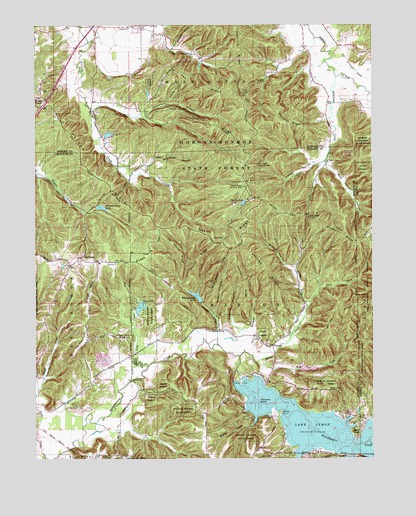
Hindustan, IN USGS Topographic Map
Click on map above to begin viewing in our Map Viewer.

This topographic map contains these locations and features:
Feature Name Type Latitude Longitude GNIS ID View Map
Bald KnobSummitN39.2695°W86.3875°430448View Map
Bean Blossom DamDamN39.2950°W86.4400°448632View Map
Beanblossom LakeReservoirN39.2959°W86.4403°430611View Map
Beecher HollowValleyN39.2887°W86.4269°430736View Map
Brown Elementary SchoolSchoolN39.3225°W86.4758°431634View Map
Bryant Creek LakeReservoirN39.3224°W86.4755°452024View Map
Bryant Creek Lake DamDamN39.3228°W86.4778°448631View Map
Buck CreekStreamN39.2503°W86.4967°431727View Map
Bud Davis HollowValleyN39.3349°W86.3922°431758View Map
Cemetery IslandIslandN39.2659°W86.4167°432297View Map
Cherry LakeReservoirN39.3239°W86.4226°432445View Map
Cherry Lake DamDamN39.3234°W86.4250°448630View Map
Cracky RidgeRidgeN39.3562°W86.4472°433075View Map
Deadman HollowValleyN39.3496°W86.4589°433390View Map
East Fork Honey CreekStreamN39.2998°W86.3944°433891View Map
Egenolf LakeReservoirN39.2761°W86.3996°447292View Map
Egenolf Lake DamDamN39.2767°W86.4017°447291View Map
Farr RidgeRidgeN39.3073°W86.4642°434411View Map
FleenerPopulated PlaceN39.2825°W86.4125°434579View Map
Gorley RidgeRidgeN39.2950°W86.3878°435221View Map
Gose CreekStreamN39.3503°W86.4794°435225View Map
Greasy CreekStreamN39.2831°W86.4328°435377View Map
Green HollowValleyN39.2918°W86.4338°435403View Map
Happy HollowValleyN39.3359°W86.3948°435710View Map
Hatfield RidgeRidgeN39.3681°W86.4239°435876View Map
HindustanPopulated PlaceN39.3081°W86.4833°436233View Map
Honey CreekStreamN39.2795°W86.4244°436381View Map
Indiana Department of Natural Resources - Division of Forestry Fire Control HeadquartersBuildingN39.3234°W86.4253°2626600View Map
Ira Hacker RidgeRidgeN39.3112°W86.4475°436825View Map
Lake LemonReservoirN39.2592°W86.3927°437773View Map
Landram RidgeRidgeN39.3042°W86.4139°437610View Map
Lazy CreekStreamN39.2767°W86.4586°437688View Map
Lazy LakeReservoirN39.2937°W86.4609°437689View Map
Lazy Lake DamDamN39.2934°W86.4617°448629View Map
Liberty ChurchChurchN39.3742°W86.4656°437834View Map
Low GapGapN39.3198°W86.3992°438353View Map
Mason RidgeRidgeN39.3109°W86.4281°438697View Map
Mason Ridge Camping AreaParkN39.3284°W86.4231°450407View Map
Meetinghouse RidgeRidgeN39.3439°W86.4289°438967View Map
Monroe Mills Post Office (historical)Post OfficeN39.3234°W86.4256°452989View Map
North Fork Honey CreekStreamN39.2937°W86.3992°440252View Map
Oak Ridge Camping AreaParkN39.3348°W86.4178°450408View Map
Payne HollowValleyN39.2726°W86.4999°440947View Map
Pea RidgeRidgeN39.3603°W86.4436°440951View Map
Persimmon RidgeRidgeN39.2892°W86.4822°441042View Map
Peters RidgeRidgeN39.3292°W86.4722°441056View Map
Precint RidgeRidgeN39.3062°W86.4408°441573View Map
Rapid CreekStreamN39.2600°W86.4194°441776View Map
Reed PointCapeN39.2581°W86.3836°441856View Map
Reynolds RidgeRidgeN39.3467°W86.4083°441924View Map
Riddle PointCapeN39.2639°W86.4089°441985View Map
Robertson CreekStreamN39.3600°W86.3883°442165View Map
Robinson HollowValleyN39.2739°W86.4966°442181View Map
Scout Ridge Nature ReserveReserveN39.3320°W86.4161°450332View Map
Scout Ridge Youth CampgroundLocaleN39.2625°W86.4161°450333View Map
Shiloh CemeteryCemeteryN39.2623°W86.4375°443383View Map
Shipman RidgeRidgeN39.3137°W86.3833°443410View Map
Stepp CemeteryCemeteryN39.3137°W86.4300°444131View Map
Strickland BranchStreamN39.3323°W86.4617°444267View Map
Sweedy HollowValleyN39.2859°W86.4203°444477View Map
Taylor CemeteryCemeteryN39.3356°W86.3917°444586View Map
Three Lakes TrailTrailN39.3195°W86.4264°450334View Map
Tincher RidgeRidgeN39.3009°W86.4239°444770View Map
Turkey TrackPopulated PlaceN39.3545°W86.4983°444986View Map
Wheeler Mission CampgroundLocaleN39.2842°W86.4675°445890View Map
Wolf CreekStreamN39.2775°W86.4175°446242View Map

Note: Coordinates in the location and feature list above are referenced to NAD83 datum.


Copyright (C) 2008-2024 Ryan Niemi / Sunset Dynamics ... All Rights Reserved