TopoQuest Logo
Do you find TopoQuest useful?
Help keep TopoQuest running and adding new maps/features by donating!
Bitcoin:  19c7KJd3qBynnjoSw5npx9KScwjBe4ifkT
Litecoin:  LXs6TkuXGGXo1vDsWCkWVdjQX94eUKd6ui
Home View Maps Find Maps Find Places Resources & Links


Unionville, Indiana Topographic Map

USGS Map Title: Unionville, IN
USGS Map MRC: 39086B4
DRG (GeoTIFF) Download: o39086b4.tif


Neighboring USGS Topographic Map Quads:


  Modesto, IN  
39086C5
 

  Hindustan, IN  
39086C4
 

  Morgantown, IN  
39086C3
 

  Bloomington, IN  
39086B5
 

  Unionville, IN  
39086B4
 

  Belmont, IN  
39086B3
 

  Clear Creek, IN  
39086A5
 

  Allens Creek, IN  
39086A4
 

  Elkinsville, IN  
39086A3


Map MRC Location:

N40°
W87°
N40°
W86°
H8 H7 H6 H5 H4 H3 H2 H1
G8 G7 G6 G5 G4 G3 G2 G1
F8 F7 F6 F5 F4 F3 F2 F1
E8 E7 E6 E5 E4 E3 E2 E1
D8 D7 D6 D5 D4 D3 D2 D1
C8 C7 C6 C5 C4 C3 C2 C1
B8 B7 B6 B5 B4 B3 B2 B1
A8 A7 A6 A5 A4 A3 A2 A1
N39°
W87°
N39°
W86°

Unionville, IN USGS 1:24K Topographic Map Preview:
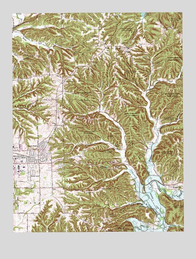
Unionville, IN USGS Topographic Map
Click on map above to begin viewing in our Map Viewer.

This topographic map contains these locations and features:
Feature Name Type Latitude Longitude GNIS ID View Map
Baby CreekStreamN39.2067°W86.3997°430379View Map
Bender HollowValleyN39.1598°W86.4157°430801View Map
Bender RidgeRidgeN39.1609°W86.4297°430802View Map
Benton Township Volunteer FireBuildingN39.2303°W86.4257°2701408View Map
Benton Township Volunteer Fire DepartmentBuildingN39.2303°W86.4258°2625591View Map
Bethal LakeReservoirN39.2193°W86.4979°447728View Map
Bethal Lake DamDamN39.2200°W86.4967°447729View Map
Bethel Lane ChurchChurchN39.2123°W86.4956°430955View Map
Bridge ChurchChurchN39.2487°W86.4228°431512View Map
Brown RidgeRidgeN39.1695°W86.4111°431630View Map
Brummett CreekStreamN39.1575°W86.3975°431661View Map
Brummett Creek ChurchChurchN39.1756°W86.3967°431662View Map
Buzzard Roost Recreation AreaLocaleN39.1278°W86.4639°453052View Map
College Mall Shopping CenterLocaleN39.1623°W86.4958°432773View Map
Conrad BranchStreamN39.1831°W86.3950°432896View Map
Danny Burr HollowValleyN39.2391°W86.4959°433313View Map
Devils BackboneRidgeN39.1517°W86.4039°433501View Map
DolanPopulated PlaceN39.2403°W86.4992°433612View Map
Dolan Ridge MissionChurchN39.2498°W86.4661°433613View Map
Eastern HeightsPopulated PlaceN39.1748°W86.4803°433945View Map
Epsom RidgeRidgeN39.1359°W86.4228°434224View Map
Friendship ChurchChurchN39.1298°W86.4017°434863View Map
Goodley BranchStreamN39.1259°W86.3883°450967View Map
Goose HollowValleyN39.2437°W86.4091°446872View Map
Helton HollowValleyN39.1414°W86.4053°435998View Map
Hoosier AcresPopulated PlaceN39.1578°W86.4869°436414View Map
Isominger HollowValleyN39.2042°W86.4042°436856View Map
Jimmy Sexton HillSummitN39.1287°W86.4180°437009View Map
Kerr CreekStreamN39.1667°W86.4200°437265View Map
Knight RidgePopulated PlaceN39.1253°W86.4330°437389View Map
Lampkin RidgeRidgeN39.1484°W86.4386°437587View Map
Little Union ChurchChurchN39.2295°W86.4200°438165View Map
Locust Grove ChurchChurchN39.2325°W86.4153°438211View Map
Mount Gilead ChurchChurchN39.1864°W86.4678°439567View Map
New UnionvillePopulated PlaceN39.2112°W86.4622°440120View Map
Penitentiary HollowValleyN39.2294°W86.4571°440993View Map
Philips SchoolSchoolN39.1498°W86.4708°441080View Map
Pike HillSummitN39.1648°W86.4280°441134View Map
Saint Marks ChurchChurchN39.1673°W86.4981°442678View Map
Schacht Lake DamDamN39.2067°W86.4350°447727View Map
Schact LakeReservoirN39.2080°W86.4349°447726View Map
Shuffle CreekStreamN39.2467°W86.4044°443464View Map
Stephens CreekStreamN39.1462°W86.4025°444128View Map
Sulphur Spring HollowValleyN39.2049°W86.4343°444379View Map
Township of BentonCivilN39.2500°W86.4199°453106View Map
UnionvillePopulated PlaceN39.2300°W86.4161°445140View Map
Unionville Elementary SchoolSchoolN39.2300°W86.4150°447355View Map
Unionville Middle SchoolSchoolN39.2300°W86.4150°447354View Map
WBWB-FM (Bloomington)TowerN39.1628°W86.4725°448941View Map
WFIU-FM (Bloomington)TowerN39.1423°W86.4953°448942View Map
Woodville HillsPopulated PlaceN39.1503°W86.3833°446322View Map
WTIU-TV (Bloomington)TowerN39.1423°W86.4953°446999View Map

Note: Coordinates in the location and feature list above are referenced to NAD83 datum.


Copyright (C) 2008-2025 Ryan Niemi / Sunset Dynamics ... All Rights Reserved