TopoQuest Logo
Do you find TopoQuest useful?
Help keep TopoQuest running and adding new maps/features by donating!
Bitcoin:  19c7KJd3qBynnjoSw5npx9KScwjBe4ifkT
Litecoin:  LXs6TkuXGGXo1vDsWCkWVdjQX94eUKd6ui
Home View Maps Find Maps Find Places Resources & Links


Mole Lake, Wisconsin Topographic Map

USGS Map Title: Mole Lake, WI
USGS Map MRC: 45088D8
DRG (GeoTIFF) Download: o45088d8.tif


Neighboring USGS Topographic Map Quads:


  Nashville, WI  
45089E1
 

  Crandon, WI  
45088E8
 

  Lake Lucerne, WI  
45088E7
 

  Post Lake, WI  
45089D1
 

  Mole Lake, WI  
45088D8
 

  Roberts Lake, WI  
45088D7
 

  Pearson, WI  
45089C1
 

  Pickerel, WI  
45088C8
 

  Lily, WI  
45088C7


Map MRC Location:

N46°
W89°
N46°
W88°
H8 H7 H6 H5 H4 H3 H2 H1
G8 G7 G6 G5 G4 G3 G2 G1
F8 F7 F6 F5 F4 F3 F2 F1
E8 E7 E6 E5 E4 E3 E2 E1
D8 D7 D6 D5 D4 D3 D2 D1
C8 C7 C6 C5 C4 C3 C2 C1
B8 B7 B6 B5 B4 B3 B2 B1
A8 A7 A6 A5 A4 A3 A2 A1
N45°
W89°
N45°
W88°

Mole Lake, WI USGS 1:24K Topographic Map Preview:
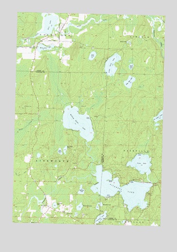
Mole Lake, WI USGS Topographic Map
Click on map above to begin viewing in our Map Viewer.

This topographic map contains these locations and features:
Feature Name Type Latitude Longitude GNIS ID View Map
Arbutus ChurchChurchN45.3855°W88.9721°1560920View Map
Arbutus School (historical)SchoolN45.3855°W88.9718°1840742View Map
Berendsen LakeLakeN45.4190°W88.9570°1561582View Map
Crane LakeLakeN45.4115°W88.8923°1563507View Map
Crystal LakeLakeN45.3791°W88.9254°1563586View Map
Deadman LakeLakeN45.3859°W88.9645°1563782View Map
Deep Hole LakeLakeN45.4601°W88.9040°1563807View Map
Duck LakeLakeN45.4693°W88.9029°1564151View Map
Gliske CreekStreamN45.4983°W88.9754°1565587View Map
Harper LakeLakeN45.3771°W88.9063°2784070View Map
Hollister LakeLakeN45.3951°W88.9425°1566554View Map
Horseshoe LakeLakeN45.3842°W88.9271°1566737View Map
K Lookout TowerTowerN45.4441°W88.9926°1581242View Map
Kingdom HallChurchN45.3814°W88.9546°1840778View Map
Lake AgnesLakeN45.4180°W88.9613°1560710View Map
Learned LakeLakeN45.4152°W88.9791°2784072View Map
Little Sand LakeLakeN45.4700°W88.9192°1568402View Map
Mole LakeLakeN45.4792°W88.9769°1569642View Map
Mole LakePopulated PlaceN45.4797°W88.9832°1569643View Map
Mole Lake Census Designated PlaceCensusN45.4859°W88.9823°2629810View Map
Oak LakeLakeN45.4751°W88.9359°1570658View Map
Outlet CreekStreamN45.4983°W88.9087°1570958View Map
Pickerel LakeLakeN45.3964°W88.9089°1571319View Map
Pickerel Volunteer Fire and Rescue Station 1BuildingN45.3855°W88.8861°2696842View Map
Rice LakeLakeN45.4934°W88.9724°1572260View Map
Rolling Stone LakeLakeN45.4351°W88.9465°1572552View Map
Saint Johns LakeLakeN45.4398°W88.8774°1580319View Map
Skunk LakeLakeN45.4834°W88.9056°1574254View Map
Sokaogon Chippewa CommunityCivilN45.4975°W88.9880°1577206View Map
Sunken LakeLakeN45.3808°W88.9464°2784147View Map
Tekakwitha LakeLakeN45.3853°W88.9436°1575295View Map
Town of AinsworthCivilN45.3783°W88.9874°1582662View Map
Woods IslandIslandN45.4016°W88.9204°1577022View Map

Note: Coordinates in the location and feature list above are referenced to NAD83 datum.


Copyright (C) 2008-2025 Ryan Niemi / Sunset Dynamics ... All Rights Reserved