TopoQuest Logo
Do you find TopoQuest useful?
Help keep TopoQuest running and adding new maps/features by donating!
Bitcoin:  19c7KJd3qBynnjoSw5npx9KScwjBe4ifkT
Litecoin:  LXs6TkuXGGXo1vDsWCkWVdjQX94eUKd6ui
Home View Maps Find Maps Find Places Resources & Links


Pickerel, Wisconsin Topographic Map

USGS Map Title: Pickerel, WI
USGS Map MRC: 45088C8
DRG (GeoTIFF) Download: o45088c8.tif


Neighboring USGS Topographic Map Quads:


  Post Lake, WI  
45089D1
 

  Mole Lake, WI  
45088D8
 

  Roberts Lake, WI  
45088D7
 

  Pearson, WI  
45089C1
 

  Pickerel, WI  
45088C8
 

  Lily, WI  
45088C7
 

  Bryant, WI  
45089B1
 

  Polar, WI  
45088B8
 

  White Lake, WI  
45088B7


Map MRC Location:

N46°
W89°
N46°
W88°
H8 H7 H6 H5 H4 H3 H2 H1
G8 G7 G6 G5 G4 G3 G2 G1
F8 F7 F6 F5 F4 F3 F2 F1
E8 E7 E6 E5 E4 E3 E2 E1
D8 D7 D6 D5 D4 D3 D2 D1
C8 C7 C6 C5 C4 C3 C2 C1
B8 B7 B6 B5 B4 B3 B2 B1
A8 A7 A6 A5 A4 A3 A2 A1
N45°
W89°
N45°
W88°

Pickerel, WI USGS 1:24K Topographic Map Preview:
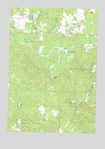
Pickerel, WI USGS Topographic Map
Click on map above to begin viewing in our Map Viewer.

This topographic map contains these locations and features:
Feature Name Type Latitude Longitude GNIS ID View Map
Ainsworth TownhallBuildingN45.3636°W88.9876°1840733View Map
Augustyn SpringsSpringN45.3058°W88.9376°1561016View Map
Baker LakeLakeN45.2818°W88.9069°1561104View Map
Big Twin LakeLakeN45.3549°W88.9149°1561782View Map
Camp Ma-Ka-Ja-WanLocaleN45.3669°W88.9596°1562632View Map
Duck PondLakeN45.3111°W88.9391°2784068View Map
Eddy LakeLakeN45.3494°W88.9395°2784069View Map
Evergreen CemeteryCemeteryN45.2819°W88.9920°1564766View Map
Fischer LakeLakeN45.2781°W88.9834°1564979View Map
Harper SpringsSpringN45.3719°W88.8876°1566079View Map
Hindu LakeLakeN45.3739°W88.9856°1566480View Map
Lake EthelLakeN45.3548°W88.9319°1564703View Map
Lawrence LakeLakeN45.2596°W88.9828°1567892View Map
Lawrence Lake State Natural AreaParkN45.2619°W88.9776°2057498View Map
Little Twin LakeLakeN45.3578°W88.9042°1568454View Map
Little Twin LakesLakeN45.3538°W88.9586°1568456View Map
Muskrat LakeLakeN45.3605°W88.9640°2784106View Map
New Saint Johns ChurchChurchN45.3502°W88.9073°1570234View Map
Pearson CemeteryCemeteryN45.3711°W88.9771°1571128View Map
Pearson School (historical)SchoolN45.3636°W88.9876°1840794View Map
PickerelPopulated PlaceN45.3594°W88.9109°1571309View Map
Pickerel Volunteer Fire and Rescue Station 2BuildingN45.3544°W88.9085°2696952View Map
Pickerel Volunteer Fire and Rescue Station 3BuildingN45.3674°W88.9767°2696849View Map
Spring LakeLakeN45.2975°W88.8782°1574671View Map
Spring LakeLakeN45.3668°W88.9628°1574672View Map
Squaw CreekStreamN45.3266°W88.9459°1574757View Map
Turtle LakeLakeN45.3149°W88.8788°1580666View Map

Note: Coordinates in the location and feature list above are referenced to NAD83 datum.


Copyright (C) 2008-2025 Ryan Niemi / Sunset Dynamics ... All Rights Reserved