TopoQuest Logo
Do you find TopoQuest useful?
Help keep TopoQuest running and adding new maps/features by donating!
Bitcoin:  19c7KJd3qBynnjoSw5npx9KScwjBe4ifkT
Litecoin:  LXs6TkuXGGXo1vDsWCkWVdjQX94eUKd6ui
Home View Maps Find Maps Find Places Resources & Links


Cordova, Minnesota Topographic Map

USGS Map Title: Cordova, MN
USGS Map MRC: 44093C6
DRG (GeoTIFF) Download: o44093c6.tif


Neighboring USGS Topographic Map Quads:


  Saint Thomas, MN  
44093D7
 

  Le Center, MN  
44093D6
 

  Montgomery, MN  
44093D5
 

  Cleveland, MN  
44093C7
 

  Cordova, MN  
44093C6
 

  Kilkenny, MN  
44093C5
 

  Madison Lake, MN  
44093B7
 

  Elysian, MN  
44093B6
 

  Waterville, MN  
44093B5


Map MRC Location:

N45°
W94°
N45°
W93°
H8 H7 H6 H5 H4 H3 H2 H1
G8 G7 G6 G5 G4 G3 G2 G1
F8 F7 F6 F5 F4 F3 F2 F1
E8 E7 E6 E5 E4 E3 E2 E1
D8 D7 D6 D5 D4 D3 D2 D1
C8 C7 C6 C5 C4 C3 C2 C1
B8 B7 B6 B5 B4 B3 B2 B1
A8 A7 A6 A5 A4 A3 A2 A1
N44°
W94°
N44°
W93°

Cordova, MN USGS 1:24K Topographic Map Preview:
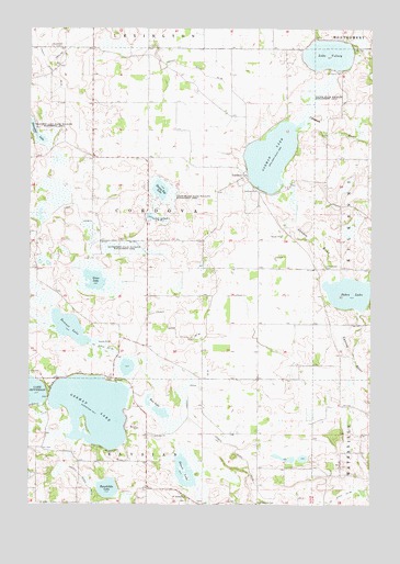
Cordova, MN USGS Topographic Map
Click on map above to begin viewing in our Map Viewer.

This topographic map contains these locations and features:
Feature Name Type Latitude Longitude GNIS ID View Map
Bossuot LakeLakeN44.2965°W93.7354°640392View Map
Chadderdon State Wildlife Management AreaParkN44.3175°W93.7166°641088View Map
CordovaPopulated PlaceN44.3364°W93.6716°641495View Map
Cordova Post Office (historical)Post OfficeN44.3364°W93.6714°2063543View Map
County Ditch Number FiftyCanalN44.3647°W93.6913°642165View Map
County Ditch Number SixtyeightCanalN44.2955°W93.6966°642268View Map
County Ditch Number SixtyfourCanalN44.3191°W93.7197°642252View Map
County Ditch Number ThirtysixCanalN44.2908°W93.7222°642001View Map
County Ditch Number TwentyCanalN44.2808°W93.6875°641791View Map
Factor State Wildlife Management AreaParkN44.3572°W93.6488°643484View Map
German LakeLakeN44.2751°W93.7263°644095View Map
German Lake CemeteryCemeteryN44.2828°W93.7200°2063582View Map
Goose LakeLakeN44.3091°W93.7262°644240View Map
Gorman CemeteryCemeteryN44.3325°W93.6661°644277View Map
Gorman LakeReservoirN44.3415°W93.6620°644279View Map
Gorman Lake DamDamN44.3344°W93.6580°1776153View Map
Haugenstein Cemetery (historical)CemeteryN44.2625°W93.7181°2063581View Map
Lake VolneyLakeN44.3681°W93.6411°653684View Map
Le Sueur CountyCivilN44.3714°W93.7301°659485View Map
Le Sueur ParkParkN44.3641°W93.6375°646549View Map
Little Cannon RiverStreamN44.3086°W93.6266°646774View Map
Paddy Marsh State Wildlife Management AreParkN44.3311°W93.7022°649109View Map
Phebe Jones Lakeside CemeteryCemeteryN44.2750°W93.7417°2063580View Map
Rice LakeLakeN44.2750°W93.7041°649977View Map
Roemhildts LakeLakeN44.2542°W93.7211°650218View Map
Sabre LakeLakeN44.3055°W93.6334°650448View Map
Sabre Lake CemeteryCemeteryN44.3122°W93.6422°650449View Map
Saint Pauls ChurchChurchN44.2827°W93.7188°650995View Map
Saint Peter's CemeteryCemeteryN44.2508°W93.6919°2063579View Map
Saint Peters ChurchChurchN44.2519°W93.6925°651026View Map
Sasse LakeLakeN44.2589°W93.6927°651228View Map
Shanghai LakeLakeN44.3463°W93.7473°651909View Map
Shanghai Lake State Wildlife Management AParkN44.3464°W93.7461°651910View Map
Sleepy Eye LakeLakeN44.3343°W93.7021°652153View Map
Township of CordovaCivilN44.3263°W93.7072°663869View Map
Woodlawn CemeteryCemeteryN44.3701°W93.7425°654371View Map

Note: Coordinates in the location and feature list above are referenced to NAD83 datum.


Copyright (C) 2008-2024 Ryan Niemi / Sunset Dynamics ... All Rights Reserved