TopoQuest Logo
Do you find TopoQuest useful?
Help keep TopoQuest running and adding new maps/features by donating!
Bitcoin:  19c7KJd3qBynnjoSw5npx9KScwjBe4ifkT
Litecoin:  LXs6TkuXGGXo1vDsWCkWVdjQX94eUKd6ui
Home View Maps Find Maps Find Places Resources & Links


Monticello South, Arkansas Topographic Map

USGS Map Title: Monticello South, AR
USGS Map MRC: 33091E7
DRG (GeoTIFF) Download: o33091e7.tif


Neighboring USGS Topographic Map Quads:


  Wilmar North, AR  
33091F8
 

  Monticello North, AR  
33091F7
 

  Collins NW, AR  
33091F6
 

  Wilmar South, AR  
33091E8
 

  Monticello South, AR  
33091E7
 

  Cominto, AR  
33091E6
 

  Longview, AR  
33091D8
 

  Ladelle, AR  
33091D7
 

  Mist NW, AR  
33091D6


Map MRC Location:

N34°
W92°
N34°
W91°
H8 H7 H6 H5 H4 H3 H2 H1
G8 G7 G6 G5 G4 G3 G2 G1
F8 F7 F6 F5 F4 F3 F2 F1
E8 E7 E6 E5 E4 E3 E2 E1
D8 D7 D6 D5 D4 D3 D2 D1
C8 C7 C6 C5 C4 C3 C2 C1
B8 B7 B6 B5 B4 B3 B2 B1
A8 A7 A6 A5 A4 A3 A2 A1
N33°
W92°
N33°
W91°

Monticello South, AR USGS 1:24K Topographic Map Preview:
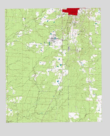
Monticello South, AR USGS Topographic Map
Click on map above to begin viewing in our Map Viewer.

This topographic map contains these locations and features:
Feature Name Type Latitude Longitude GNIS ID View Map
Arkansas Game and Fish Commission Law Enforcement Southeast Regional OfficeBuildingN33.6072°W91.8158°2118706View Map
Baker CemeteryCemeteryN33.5320°W91.7687°46030View Map
Bowser (historical)Populated PlaceN33.5846°W91.8137°78975View Map
Brooks Chapel Baptist ChurchChurchN33.5971°W91.8487°76424View Map
College HeightsPopulated PlaceN33.5904°W91.8007°47925View Map
Drew Central Elementary SchoolSchoolN33.5912°W91.8078°78996View Map
Drew Central High SchoolSchoolN33.5921°W91.8075°2039349View Map
Drew High SchoolSchoolN33.5921°W91.8065°76817View Map
Drew Memorial HospitalHospitalN33.6109°W91.8168°78997View Map
Drew Memorial Hospital HeliportAirportN33.6201°W91.8260°83782View Map
First Assembly of God ChurchChurchN33.6207°W91.7890°79001View Map
Friendship Baptist ChurchChurchN33.5298°W91.8740°79004View Map
Friendship CemeteryCemeteryN33.5295°W91.8737°49249View Map
Gethsemane Baptist ChurchChurchN33.5790°W91.7826°77011View Map
KHBM-AM (Monticello)TowerN33.6051°W91.7874°85119View Map
KHBM-FM (Monticello)TowerN33.6051°W91.7874°85228View Map
McCloy ParkParkN33.6196°W91.7987°51797View Map
Monticello Elementary SchoolSchoolN33.6102°W91.8095°2039346View Map
Monticello FarmLocaleN33.5990°W91.7774°52145View Map
Monticello Fire Department Station 2BuildingN33.5981°W91.8122°2116805View Map
Monticello High SchoolSchoolN33.6119°W91.8109°79037View Map
Monticello Intermediate SchoolSchoolN33.6112°W91.8111°2039347View Map
Monticello Junior High SchoolSchoolN33.6182°W91.7982°79038View Map
Monticello KindergartenSchoolN33.6243°W91.7946°79039View Map
Monticello Middle SchoolSchoolN33.6098°W91.8129°2039348View Map
New Light Baptist ChurchChurchN33.5587°W91.7618°77831View Map
Oakwoods (historical)Populated PlaceN33.5751°W91.8010°79056View Map
Ozmont Bluff (historical)Populated PlaceN33.5551°W91.7932°79065View Map
Paradise (historical)Populated PlaceN33.5418°W91.7932°79066View Map
Pine Grove ChurchChurchN33.5182°W91.8621°53424View Map
Red Neck (historical)Populated PlaceN33.5218°W91.8657°79078View Map
Reed Settlement (historical)Populated PlaceN33.5876°W91.7862°79080View Map
Rough and Ready (historical)Populated PlaceN33.6098°W91.7874°79086View Map
Rough and Ready CemeteryCemeteryN33.6084°W91.7893°54229View Map
Scrouge Out (historical)Populated PlaceN33.5790°W91.7826°79088View Map
Shady Grove ChurchChurchN33.5576°W91.8018°54703View Map
South Fork Clear CreekStreamN33.5107°W91.8376°78408View Map
Township of MarionCivilN33.6214°W91.7747°66516View Map
Union Ridge CemeteryCemeteryN33.5776°W91.7805°78626View Map
University of Arkansas at MonticelloSchoolN33.5904°W91.8132°76189View Map
University of Arkansas Monticello Campus PoliceBuildingN33.5911°W91.8088°2118705View Map
Wood CreekStreamN33.6126°W91.8371°56511View Map

Note: Coordinates in the location and feature list above are referenced to NAD83 datum.


Copyright (C) 2008-2025 Ryan Niemi / Sunset Dynamics ... All Rights Reserved