TopoQuest Logo
Do you find TopoQuest useful?
Help keep TopoQuest running and adding new maps/features by donating!
Bitcoin:  19c7KJd3qBynnjoSw5npx9KScwjBe4ifkT
Litecoin:  LXs6TkuXGGXo1vDsWCkWVdjQX94eUKd6ui
Home View Maps Find Maps Find Places Resources & Links


Cominto, Arkansas Topographic Map

USGS Map Title: Cominto, AR
USGS Map MRC: 33091E6
DRG (GeoTIFF) Download: o33091e6.tif


Neighboring USGS Topographic Map Quads:


  Monticello North, AR  
33091F7
 

  Collins NW, AR  
33091F6
 

  Selma, AR  
33091F5
 

  Monticello South, AR  
33091E7
 

  Cominto, AR  
33091E6
 

  Collins, AR  
33091E5
 

  Ladelle, AR  
33091D7
 

  Mist NW, AR  
33091D6
 

  Line, AR  
33091D5


Map MRC Location:

N34°
W92°
N34°
W91°
H8 H7 H6 H5 H4 H3 H2 H1
G8 G7 G6 G5 G4 G3 G2 G1
F8 F7 F6 F5 F4 F3 F2 F1
E8 E7 E6 E5 E4 E3 E2 E1
D8 D7 D6 D5 D4 D3 D2 D1
C8 C7 C6 C5 C4 C3 C2 C1
B8 B7 B6 B5 B4 B3 B2 B1
A8 A7 A6 A5 A4 A3 A2 A1
N33°
W92°
N33°
W91°

Cominto, AR USGS 1:24K Topographic Map Preview:
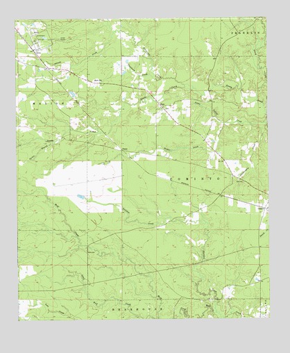
Cominto, AR USGS Topographic Map
Click on map above to begin viewing in our Map Viewer.

This topographic map contains these locations and features:
Feature Name Type Latitude Longitude GNIS ID View Map
Adcock CreekStreamN33.6190°W91.7010°45790View Map
ComintoPopulated PlaceN33.5457°W91.6268°76658View Map
Cominto Baptist ChurchChurchN33.5487°W91.6254°78988View Map
DeanePopulated PlaceN33.5704°W91.6971°71351View Map
Dickie BranchStreamN33.5751°W91.7290°76793View Map
Drew CountyCivilN33.5895°W91.7200°66851View Map
EnonPopulated PlaceN33.5884°W91.6779°76881View Map
Enon Baptist ChurchChurchN33.5882°W91.6782°78999View Map
Enon CemeteryCemeteryN33.5884°W91.6790°79000View Map
Enon SchoolSchoolN33.5993°W91.7110°48904View Map
Hurricane CreekStreamN33.5957°W91.6615°50445View Map
Jade (historical)Populated PlaceN33.5548°W91.6626°79020View Map
Jeter (historical)Populated PlaceN33.5832°W91.7121°79022View Map
KillinPopulated PlaceN33.6123°W91.7412°57078View Map
Little Wolf CreekStreamN33.5004°W91.6804°51344View Map
Moore CemeteryCemeteryN33.5282°W91.7154°52158View Map
Piney CreekStreamN33.5907°W91.6307°53480View Map
Puncheon CreekStreamN33.5996°W91.6785°53847View Map
Rainbow CreekStreamN33.5026°W91.6515°53879View Map
Rash CemeteryCemeteryN33.5570°W91.6371°53899View Map
Township of ComintoCivilN33.5600°W91.6513°66512View Map
Tucker CreekStreamN33.5812°W91.6468°55682View Map
Wolf PrairieAreaN33.5596°W91.7196°79111View Map

Note: Coordinates in the location and feature list above are referenced to NAD83 datum.


Copyright (C) 2008-2024 Ryan Niemi / Sunset Dynamics ... All Rights Reserved