TopoQuest Logo
Do you find TopoQuest useful?
Help keep TopoQuest running and adding new maps/features by donating!
Bitcoin:  19c7KJd3qBynnjoSw5npx9KScwjBe4ifkT
Litecoin:  LXs6TkuXGGXo1vDsWCkWVdjQX94eUKd6ui
Home View Maps Find Maps Find Places Resources & Links


Bedford West, Indiana Topographic Map

USGS Map Title: Bedford West, IN
USGS Map MRC: 38086G5
DRG (GeoTIFF) Download: o38086g5.tif


Neighboring USGS Topographic Map Quads:


  Owensburg, IN  
38086H6
 

  Oolitic, IN  
38086H5
 

  Bartlettsville, IN  
38086H4
 

  Williams, IN  
38086G6
 

  Bedford West, IN  
38086G5
 

  Bedford East, IN  
38086G4
 

  Huron, IN  
38086F6
 

  Georgia, IN  
38086F5
 

  Mitchell, IN  
38086F4


Map MRC Location:

N39°
W87°
N39°
W86°
H8 H7 H6 H5 H4 H3 H2 H1
G8 G7 G6 G5 G4 G3 G2 G1
F8 F7 F6 F5 F4 F3 F2 F1
E8 E7 E6 E5 E4 E3 E2 E1
D8 D7 D6 D5 D4 D3 D2 D1
C8 C7 C6 C5 C4 C3 C2 C1
B8 B7 B6 B5 B4 B3 B2 B1
A8 A7 A6 A5 A4 A3 A2 A1
N38°
W87°
N38°
W86°

Bedford West, IN USGS 1:24K Topographic Map Preview:
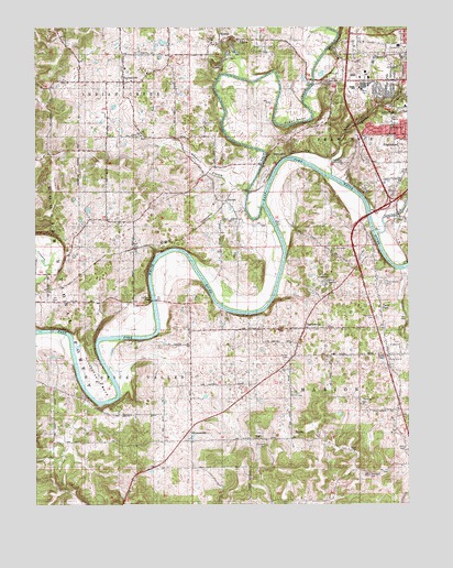
Bedford West, IN USGS Topographic Map
Click on map above to begin viewing in our Map Viewer.

This topographic map contains these locations and features:
Feature Name Type Latitude Longitude GNIS ID View Map
4-H Club FairgroundLocaleN38.8078°W86.5280°451839View Map
Adamson BranchStreamN38.8334°W86.5530°450621View Map
Bass CemeteryCemeteryN38.7648°W86.5005°450656View Map
Bedford Fire Department Englewood StationBuildingN38.8469°W86.5056°2701385View Map
Bedford Fire Department Station 3 EnglewoodBuildingN38.8468°W86.5055°2625928View Map
Bedford QuarryMineN38.8631°W86.5242°2634363View Map
BryantsvillePopulated PlaceN38.7687°W86.5730°450725View Map
Connelly CemeteryCemeteryN38.7662°W86.5475°451840View Map
Cox CemeteryCemeteryN38.8033°W86.6189°451843View Map
CoxtonPopulated PlaceN38.8295°W86.5611°450811View Map
Crest Haven CemeteryCemeteryN38.8073°W86.5092°450814View Map
EurekaPopulated PlaceN38.8709°W86.5628°450896View Map
FayettevillePopulated PlaceN38.8609°W86.5953°450908View Map
Gyger BendBendN38.8503°W86.5378°450995View Map
HartleyvillePopulated PlaceN38.7962°W86.5350°451018View Map
Horseshoe BendBendN38.7820°W86.6042°451063View Map
Indian Creek Volunteer Fire DepartmentBuildingN38.8610°W86.5948°2626355View Map
Indiana University Health Bedford HospitalHospitalN38.8601°W86.5130°2660426View Map
Knott CemeteryCemeteryN38.7889°W86.5394°451841View Map
Leatherwood CreekStreamN38.8212°W86.5103°451137View Map
Mitchell SpeedwayLocaleN38.7662°W86.5005°452365View Map
New Union ChurchChurchN38.8714°W86.5569°451274View Map
Old Union ChurchChurchN38.8467°W86.5894°451842View Map
Old Union Church CemeteryCemeteryN38.8467°W86.5894°451299View Map
Pearson Kaolin MinesMineN38.7703°W86.6214°451787View Map
Rariden HillSummitN38.7578°W86.5133°441778View Map
Red Cross CemeteryCemeteryN38.7995°W86.5108°451383View Map
ReddingPopulated PlaceN38.7745°W86.5039°451776View Map
RiverviewPopulated PlaceN38.8423°W86.5417°451838View Map
Salt CreekStreamN38.8284°W86.5480°451427View Map
Shiloh ChurchChurchN38.8712°W86.5656°451452View Map
Spider CreekStreamN38.8362°W86.5258°451822View Map
Stumphole BridgeBridgeN38.8037°W86.5856°451517View Map
Tarry ParkPopulated PlaceN38.8014°W86.5092°451540View Map
Thomason CemeteryCemeteryN38.7764°W86.5155°451560View Map
Township of Indian CreekCivilN38.8672°W86.6031°453425View Map
Township of Spice ValleyCivilN38.7614°W86.6220°453863View Map
Wesley ChapelChurchN38.7892°W86.5067°451616View Map

Note: Coordinates in the location and feature list above are referenced to NAD83 datum.


Copyright (C) 2008-2025 Ryan Niemi / Sunset Dynamics ... All Rights Reserved