TopoQuest Logo
Do you find TopoQuest useful?
Help keep TopoQuest running and adding new maps/features by donating!
Bitcoin:  19c7KJd3qBynnjoSw5npx9KScwjBe4ifkT
Litecoin:  LXs6TkuXGGXo1vDsWCkWVdjQX94eUKd6ui
Home View Maps Find Maps Find Places Resources & Links


Georgia, Indiana Topographic Map

USGS Map Title: Georgia, IN
USGS Map MRC: 38086F5
DRG (GeoTIFF) Download: o38086f5.tif


Neighboring USGS Topographic Map Quads:


  Williams, IN  
38086G6
 

  Bedford West, IN  
38086G5
 

  Bedford East, IN  
38086G4
 

  Huron, IN  
38086F6
 

  Georgia, IN  
38086F5
 

  Mitchell, IN  
38086F4
 

  Hillham, IN  
38086E6
 

  French Lick, IN  
38086E5
 

  Paoli, IN  
38086E4


Map MRC Location:

N39°
W87°
N39°
W86°
H8 H7 H6 H5 H4 H3 H2 H1
G8 G7 G6 G5 G4 G3 G2 G1
F8 F7 F6 F5 F4 F3 F2 F1
E8 E7 E6 E5 E4 E3 E2 E1
D8 D7 D6 D5 D4 D3 D2 D1
C8 C7 C6 C5 C4 C3 C2 C1
B8 B7 B6 B5 B4 B3 B2 B1
A8 A7 A6 A5 A4 A3 A2 A1
N38°
W87°
N38°
W86°

Georgia, IN USGS 1:24K Topographic Map Preview:
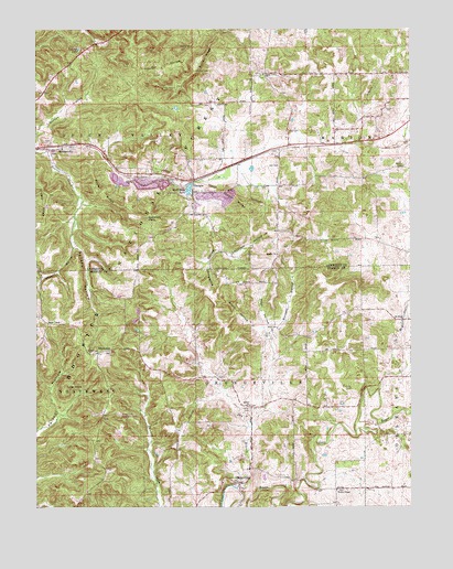
Georgia, IN USGS Topographic Map
Click on map above to begin viewing in our Map Viewer.

This topographic map contains these locations and features:
Feature Name Type Latitude Longitude GNIS ID View Map
Beech Grove ChurchChurchN38.6270°W86.6125°430724View Map
Benson HollowValleyN38.6934°W86.6120°450673View Map
Bethel ChurchChurchN38.6517°W86.5539°450677View Map
Black HollowValleyN38.6712°W86.5487°450685View Map
Bonds ChapelChurchN38.6731°W86.6211°450695View Map
Bosler RidgeRidgeN38.7073°W86.6028°450698View Map
Burnett HollowValleyN38.6712°W86.5450°450733View Map
Burton CemeteryCemeteryN38.7095°W86.5783°450734View Map
Burton CemeteryCemeteryN38.7145°W86.5019°450735View Map
Burton HollowValleyN38.7193°W86.6249°450736View Map
Burton RidgeRidgeN38.7423°W86.5700°450737View Map
Dry BranchStreamN38.6298°W86.5580°450865View Map
GeorgiaPopulated PlaceN38.7101°W86.5722°450950View Map
Georgia CemeteryCemeteryN38.7045°W86.5725°451836View Map
Gobblers KnobSummitN38.7003°W86.5880°450964View Map
Grodey CemeteryCemeteryN38.7173°W86.6197°451835View Map
Grodey RidgeRidgeN38.7067°W86.6205°450985View Map
Hager FarmsLocaleN38.6689°W86.5464°2649823View Map
Half Moon LakeLakeN38.7082°W86.5739°450997View Map
Hall CemeteryCemeteryN38.7234°W86.5403°451000View Map
HindostanPopulated PlaceN38.6656°W86.6044°451043View Map
Hindostan Falls Public Fishing AreaParkN38.6651°W86.6044°451765View Map
Independent Order of Odd Fellows CemeteryCemeteryN38.6506°W86.5536°451078View Map
Isom CemeteryCemeteryN38.7150°W86.5444°451091View Map
Landreth HollowValleyN38.6927°W86.5638°451132View Map
Liberty ChurchChurchN38.6912°W86.5444°451140View Map
Luke KnobSummitN38.6567°W86.6150°451184View Map
Mitchell QuarryMineN38.7097°W86.5878°2649595View Map
MoorestownPopulated PlaceN38.7187°W86.6158°451239View Map
Mount CemeteryCemeteryN38.6767°W86.5319°439556View Map
Mount Horeb ChurchChurchN38.6742°W86.5017°451246View Map
Mount Horeb DrainCanalN38.6709°W86.5044°451247View Map
OrangevillePopulated PlaceN38.6314°W86.5567°451304View Map
Pruett HollowValleyN38.6928°W86.6119°451369View Map
Sally HillSummitN38.7448°W86.5761°451426View Map
Shirley Creek Horsemans CampLocaleN38.6495°W86.5975°451837View Map
Spice Valley ChurchChurchN38.7384°W86.5489°451492View Map
Tincher CemeteryCemeteryN38.7392°W86.5717°451568View Map
Tincher HollowValleyN38.7393°W86.5890°451569View Map
Tincher LakeLakeN38.7448°W86.6104°451570View Map
Toliver RidgeRidgeN38.7062°W86.5578°451574View Map
Township of OrangevilleCivilN38.6367°W86.5526°453692View Map
Wadsworth HollowValleyN38.6923°W86.5648°451601View Map
Way HollowValleyN38.6723°W86.5473°445572View Map
Wesley ChapelChurchN38.6295°W86.5250°451615View Map

Note: Coordinates in the location and feature list above are referenced to NAD83 datum.


Copyright (C) 2008-2024 Ryan Niemi / Sunset Dynamics ... All Rights Reserved