TopoQuest Logo
Do you find TopoQuest useful?
Help keep TopoQuest running and adding new maps/features by donating!
Bitcoin:  19c7KJd3qBynnjoSw5npx9KScwjBe4ifkT
Litecoin:  LXs6TkuXGGXo1vDsWCkWVdjQX94eUKd6ui
Home View Maps Find Maps Find Places Resources & Links


Sayle, Montana Topographic Map

USGS Map Title: Sayle, MT
USGS Map MRC: 45105B8
DRG (GeoTIFF) Download: o45105b8.tif


Neighboring USGS Topographic Map Quads:


  Goodspeed Butte, MT  
45106C1
 

  Phillips Butte, MT  
45105C8
 

  Hodsdon Flats, MT  
45105C7
 

  Reanus Cone, MT  
45106B1
 

  Sayle, MT  
45105B8
 

  Bloom Creek, MT  
45105B7
 

  Sayle Hall, MT  
45106A1
 

  Bradshaw Creek, MT  
45105A8
 

  Moorhead, MT  
45105A7


Map MRC Location:

N46°
W106°
N46°
W105°
H8 H7 H6 H5 H4 H3 H2 H1
G8 G7 G6 G5 G4 G3 G2 G1
F8 F7 F6 F5 F4 F3 F2 F1
E8 E7 E6 E5 E4 E3 E2 E1
D8 D7 D6 D5 D4 D3 D2 D1
C8 C7 C6 C5 C4 C3 C2 C1
B8 B7 B6 B5 B4 B3 B2 B1
A8 A7 A6 A5 A4 A3 A2 A1
N45°
W106°
N45°
W105°

Sayle, MT USGS 1:24K Topographic Map Preview:
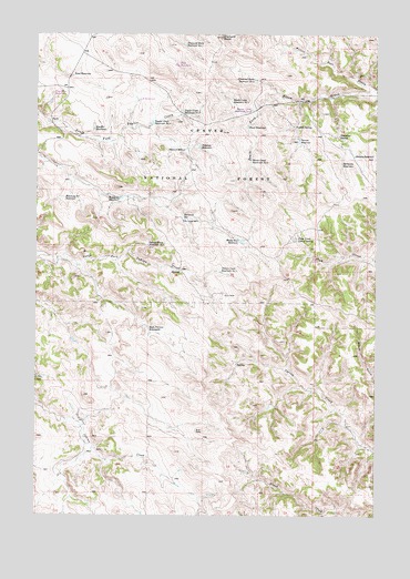
Sayle, MT USGS Topographic Map
Click on map above to begin viewing in our Map Viewer.

This topographic map contains these locations and features:
Feature Name Type Latitude Longitude GNIS ID View Map
07S47E21BABC01 WellWellN45.2228°W105.9795°808492View Map
07S47E27DBBA01 WellWellN45.2014°W105.9461°808405View Map
08S47E08DABC01 WellWellN45.1514°W105.9847°808190View Map
08S47E08DABC02 WellWellN45.1514°W105.9847°808191View Map
08S47E08DB__01 WellWellN45.1478°W105.9922°808184View Map
08S47E16BBCC01 WellWellN45.1417°W105.9792°808149View Map
08S48E17BBCB01 WellWellN45.1425°W105.8778°808154View Map
Antelope ReservoirReservoirN45.2208°W105.9404°779077View Map
Antelope WellWellN45.2200°W105.9467°779078View Map
Bloom Creek Reservoir Number OneReservoirN45.2325°W105.9288°780130View Map
Bloom Creek Reservoir Number TwoReservoirN45.2171°W105.9216°780131View Map
Buck Pasture ReservoirsReservoirN45.1741°W105.9597°780519View Map
Burnside ReservoirReservoirN45.2016°W105.9455°780623View Map
Burnside WellWellN45.2014°W105.9464°780624View Map
Diamond ButteSummitN45.2492°W105.9331°782351View Map
Diamond Butte Reservoir Number OneReservoirN45.2473°W105.9463°782352View Map
Diamond Butte Reservoir Number TwoReservoirN45.2381°W105.9201°782353View Map
Hailstone ReservoirReservoirN45.2164°W105.8882°784449View Map
Hailstone SpringSpringN45.2236°W105.8895°784450View Map
Hazel ReservoirReservoirN45.2259°W105.9229°784682View Map
Indian Creek Reservoir Number OneReservoirN45.1882°W105.9324°785263View Map
Indian Creek Reservoir Number TwoReservoirN45.1952°W105.9597°785264View Map
Kueffer ReservoirReservoirN45.2253°W105.9792°785858View Map
Plum Creek Corral SpringSpringN45.1967°W105.9045°789004View Map
Rainey ReservoirReservoirN45.2184°W105.8836°789349View Map
Road ReservoirReservoirN45.2390°W105.9871°789620View Map
SaylePopulated PlaceN45.2269°W105.9956°790096View Map
Shady Rest ReservoirReservoirN45.1962°W105.9252°790267View Map
Smith CreekStreamN45.1425°W105.9797°1689977View Map
Taylor Creek Reservoir Number OneReservoirN45.2268°W105.9581°791915View Map
Taylor Creek Reservoir Number TwoReservoirN45.2290°W105.9471°791916View Map
Willie Bull ProngStreamN45.2364°W105.8783°793336View Map
Wynkoop ReservoirReservoirN45.2061°W105.9724°793571View Map
Wynkoop SU ReservoirReservoirN45.2073°W105.9901°793572View Map
Yankee ReservoirReservoirN45.2226°W105.9039°793595View Map
Yankee SpringSpringN45.2261°W105.9056°793596View Map

Note: Coordinates in the location and feature list above are referenced to NAD83 datum.


Copyright (C) 2008-2025 Ryan Niemi / Sunset Dynamics ... All Rights Reserved