TopoQuest Logo
Do you find TopoQuest useful?
Help keep TopoQuest running and adding new maps/features by donating!
Bitcoin:  19c7KJd3qBynnjoSw5npx9KScwjBe4ifkT
Litecoin:  LXs6TkuXGGXo1vDsWCkWVdjQX94eUKd6ui
Home View Maps Find Maps Find Places Resources & Links


Moran, Georgia Topographic Map

USGS Map Title: Moran, GA
USGS Map MRC: 32083G8
DRG (GeoTIFF) Download: o32083g8.tif


Neighboring USGS Topographic Map Quads:


  Strouds, GA  
32084H1
 

  Smarr, GA  
32083H8
 

  Bolingbroke, GA  
32083H7
 

  Culloden, GA  
32084G1
 

  Moran, GA  
32083G8
 

  Lizella, GA  
32083G7
 

  Roberta, GA  
32084F1
 

  Knoxville, GA  
32083F8
 

  Byron, GA  
32083F7


Map MRC Location:

N33°
W84°
N33°
W83°
H8 H7 H6 H5 H4 H3 H2 H1
G8 G7 G6 G5 G4 G3 G2 G1
F8 F7 F6 F5 F4 F3 F2 F1
E8 E7 E6 E5 E4 E3 E2 E1
D8 D7 D6 D5 D4 D3 D2 D1
C8 C7 C6 C5 C4 C3 C2 C1
B8 B7 B6 B5 B4 B3 B2 B1
A8 A7 A6 A5 A4 A3 A2 A1
N32°
W84°
N32°
W83°

Moran, GA USGS 1:24K Topographic Map Preview:
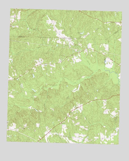
Moran, GA USGS Topographic Map
Click on map above to begin viewing in our Map Viewer.

This topographic map contains these locations and features:
Feature Name Type Latitude Longitude GNIS ID View Map
A G Smith Family CemeteryCemeteryN32.8426°W83.9794°2712021View Map
Anderson - Barnes - Bagley CemeteryCemeteryN32.8593°W83.9989°343013View Map
Bethel CemeteryCemeteryN32.7568°W83.9349°342910View Map
Bethel ChurchChurchN32.7568°W83.9349°354599View Map
Bowen Family CemeteryCemeteryN32.8097°W83.9954°2724909View Map
Camp Martha JohnstonLocaleN32.7718°W83.8791°312240View Map
CeresPopulated PlaceN32.8079°W83.9966°1946158View Map
Ceres ChurchChurchN32.8087°W83.9932°355101View Map
Clifton CreekStreamN32.8643°W83.9827°1988048View Map
Cloud CemeteryCemeteryN32.7888°W83.9235°342914View Map
Crawford County Fire Department Station 8BuildingN32.7559°W83.8916°2604361View Map
Cumby Spring BranchStreamN32.8015°W83.9560°313215View Map
DyasPopulated PlaceN32.8662°W83.9944°326253View Map
Greenville ChurchChurchN32.8490°W83.9394°314871View Map
Hammock BranchStreamN32.7513°W83.9157°315064View Map
Hancock CemeteryCemeteryN32.7740°W83.9340°2722983View Map
Hancock SubdivisionPopulated PlaceN32.7907°W83.8916°342931View Map
Hatcher LakeReservoirN32.8124°W83.9720°340953View Map
Hatcher Lake DamDamN32.8118°W83.9716°340952View Map
Herds PondReservoirN32.7735°W83.8832°336379View Map
Herds Pond DamDamN32.7735°W83.8832°336378View Map
Hughes LakeReservoirN32.8288°W83.9338°340955View Map
Hughes Lake DamDamN32.8285°W83.9332°340954View Map
Huneycut LakeReservoirN32.8584°W83.8894°340691View Map
Huneycut Lake DamDamN32.8568°W83.8899°340690View Map
Kelsey BranchStreamN32.8110°W83.9157°316367View Map
Lamar BranchStreamN32.8187°W83.8838°316587View Map
Little Echeconnee CreekStreamN32.8185°W83.9027°317064View Map
Little Rogers ChurchChurchN32.8651°W83.8863°317179View Map
McCallum - Hart CemeteryCemeteryN32.8535°W83.8995°2704339View Map
Montpelier (historical)Populated PlaceN32.8437°W83.8891°1672226View Map
Montpelier Institute (historical)SchoolN32.8732°W83.8827°334210View Map
MoranPopulated PlaceN32.8487°W83.9319°332416View Map
Morris BranchStreamN32.7674°W83.9063°318483View Map
Mosely LakeReservoirN32.7989°W83.9710°342261View Map
Mosely Lake DamDamN32.7968°W83.9699°342260View Map
Mount Calvary Church (historical)ChurchN32.8651°W83.8921°343079View Map
O'Neal Family CemeteryCemeteryN32.8203°W83.9710°2722990View Map
Rowell LakeReservoirN32.8275°W83.8919°340945View Map
Rowell Lake DamDamN32.8268°W83.8916°340944View Map
Salem CemeteryCemeteryN32.7621°W83.9821°342964View Map
Salem Primitive Baptist ChurchChurchN32.7629°W83.9816°322358View Map
Sandy PointPopulated PlaceN32.7690°W83.9396°322496View Map
Smith Family CemeteryCemeteryN32.7575°W83.9456°2712022View Map
Smiths ChapelChurchN32.8332°W83.9285°323158View Map
Spring Hill CemeteryCemeteryN32.7832°W83.9243°342968View Map
Spring Hill ChurchChurchN32.7840°W83.9244°323430View Map
Tabernacle CampgroundLocaleN32.8540°W83.9207°323869View Map
Walker LakeReservoirN32.7800°W83.9676°337762View Map
Walker Lake DamDamN32.7801°W83.9682°337761View Map
Walnut CreekStreamN32.8437°W83.9607°324805View Map

Note: Coordinates in the location and feature list above are referenced to NAD83 datum.


Copyright (C) 2008-2025 Ryan Niemi / Sunset Dynamics ... All Rights Reserved