TopoQuest Logo
Do you find TopoQuest useful?
Help keep TopoQuest running and adding new maps/features by donating!
Bitcoin:  19c7KJd3qBynnjoSw5npx9KScwjBe4ifkT
Litecoin:  LXs6TkuXGGXo1vDsWCkWVdjQX94eUKd6ui
Home View Maps Find Maps Find Places Resources & Links


Pinebergen, Arkansas Topographic Map

USGS Map Title: Pinebergen, AR
USGS Map MRC: 34091A8
DRG (GeoTIFF) Download: o34091a8.tif


Neighboring USGS Topographic Map Quads:


  Pine Bluff, AR  
34092B1
 

  Ladd, AR  
34091B8
 

  Moscow, AR  
34091B7
 

  Faith, AR  
34092A1
 

  Pinebergen, AR  
34091A8
 

  Tarry, AR  
34091A7
 

  Calmer, AR  
33092H1
 

  Glendale, AR  
33091H8
 

  Star City, AR  
33091H7


Map MRC Location:

N35°
W92°
N35°
W91°
H8 H7 H6 H5 H4 H3 H2 H1
G8 G7 G6 G5 G4 G3 G2 G1
F8 F7 F6 F5 F4 F3 F2 F1
E8 E7 E6 E5 E4 E3 E2 E1
D8 D7 D6 D5 D4 D3 D2 D1
C8 C7 C6 C5 C4 C3 C2 C1
B8 B7 B6 B5 B4 B3 B2 B1
A8 A7 A6 A5 A4 A3 A2 A1
N34°
W92°
N34°
W91°

Pinebergen, AR USGS 1:24K Topographic Map Preview:
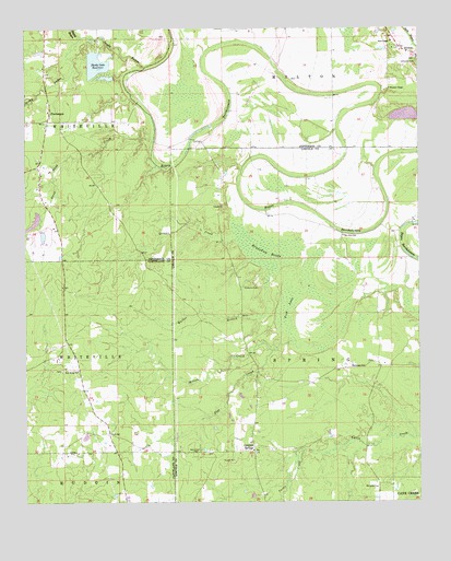
Pinebergen, AR USGS Topographic Map
Click on map above to begin viewing in our Map Viewer.

This topographic map contains these locations and features:
Feature Name Type Latitude Longitude GNIS ID View Map
Boggy BayouStreamN34.1226°W91.9824°46800View Map
Bradshaw BrakeSwampN34.0648°W91.9240°46901View Map
Canaan ChurchChurchN34.0787°W91.9376°47363View Map
EunicePopulated PlaceN34.0387°W91.9907°60988View Map
Fish LakeSwampN34.0585°W91.9131°49063View Map
Flat CreekStreamN34.0426°W91.9140°49094View Map
Grahams CemeteryCemeteryN34.0568°W91.9310°49539View Map
Grahams Chapel (historical)ChurchN34.0570°W91.9318°64059View Map
Greens CreekStreamN34.0693°W91.9332°49664View Map
Griffith SpringsSpringN34.0137°W91.9279°77079View Map
Harris Brake (historical)SwampN34.1198°W91.9068°63933View Map
HookerPopulated PlaceN34.1198°W91.8810°50288View Map
Jefferson CemeteryCemeteryN34.1162°W91.8751°50603View Map
KPBQ-FM (Pine Bluff)TowerN34.0662°W91.9601°85420View Map
Macedonia ChurchChurchN34.0357°W91.8926°51572View Map
Marks LakeReservoirN34.1021°W91.8791°80505View Map
Marks Lake DamDamN34.1034°W91.8835°80504View Map
Melton CreekStreamN34.0401°W91.9212°51904View Map
Mount Olive ChurchChurchN34.0704°W91.8990°64073View Map
Mount Olive SchoolSchoolN34.0704°W91.8987°52366View Map
New Harmony School (historical)SchoolN34.1007°W91.9935°63965View Map
New Home ChurchChurchN34.0348°W91.9837°52648View Map
New Home School (historical)SchoolN34.0348°W91.9882°63886View Map
New Owen CemeteryCemeteryN34.0134°W91.9476°52729View Map
Owens Chapel (historical)ChurchN34.0834°W91.9762°63974View Map
PinebergenPopulated PlaceN34.1029°W91.9924°58384View Map
Rust Foundation Lake Number One DamDamN34.0751°W91.9968°80506View Map
Rust Foundation Lake Number Two DamDamN34.0718°W91.9951°80508View Map
Rust Lake Number OneReservoirN34.0741°W91.9971°80507View Map
Rust Lake Number TwoReservoirN34.0702°W91.9944°80509View Map
Sandy BayouStreamN34.1154°W91.9621°54566View Map
Shady Oaks ReservoirReservoirN34.1155°W91.9773°80503View Map
Shell ChapelChurchN34.1218°W91.8835°54755View Map
Steep Bank CreekStreamN34.0968°W91.9590°55193View Map
Taliaferro Lake DamDamN34.1168°W91.9751°80502View Map
Taylors School (historical)SchoolN34.0940°W91.9529°64004View Map
Township of HudginCivilN34.0066°W91.9846°63735View Map
Township of MeltonCivilN34.1218°W91.9046°66737View Map
Township of SpringCivilN34.0400°W91.9013°66829View Map
Villa Vale (historical)Populated PlaceN34.0315°W91.9096°60276View Map
Walker BranchStreamN34.0615°W91.9218°55951View Map
Wheeler ChapelChurchN34.1093°W91.8840°56224View Map
Williams CemeteryCemeteryN34.0040°W91.8882°56387View Map

Note: Coordinates in the location and feature list above are referenced to NAD83 datum.


Copyright (C) 2008-2024 Ryan Niemi / Sunset Dynamics ... All Rights Reserved