TopoQuest Logo
Do you find TopoQuest useful?
Help keep TopoQuest running and adding new maps/features by donating!
Bitcoin:  19c7KJd3qBynnjoSw5npx9KScwjBe4ifkT
Litecoin:  LXs6TkuXGGXo1vDsWCkWVdjQX94eUKd6ui
Home View Maps Find Maps Find Places Resources & Links


Harrell Lake, Louisiana Topographic Map

USGS Map Title: Harrell Lake, LA
USGS Map MRC: 32092G1
DRG (GeoTIFF) Download: o32092g1.tif


Neighboring USGS Topographic Map Quads:


  Marion East, LA  
32092H2
 

  Fish Lake, LA  
32092H1
 

  Beekman, LA  
32091H8
 

  Haile, LA  
32092G2
 

  Harrell Lake, LA  
32092G1
 

  Bastrop, LA  
32091G8
 

  Rocky Branch, LA  
32092F2
 

  Sterlington, LA  
32092F1
 

  Collinston West, LA  
32091F8


Map MRC Location:

N33°
W93°
N33°
W92°
H8 H7 H6 H5 H4 H3 H2 H1
G8 G7 G6 G5 G4 G3 G2 G1
F8 F7 F6 F5 F4 F3 F2 F1
E8 E7 E6 E5 E4 E3 E2 E1
D8 D7 D6 D5 D4 D3 D2 D1
C8 C7 C6 C5 C4 C3 C2 C1
B8 B7 B6 B5 B4 B3 B2 B1
A8 A7 A6 A5 A4 A3 A2 A1
N32°
W93°
N32°
W92°

Harrell Lake, LA USGS 1:24K Topographic Map Preview:
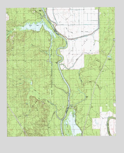
Harrell Lake, LA USGS Topographic Map
Click on map above to begin viewing in our Map Viewer.

This topographic map contains these locations and features:
Feature Name Type Latitude Longitude GNIS ID View Map
Alabama LandingPopulated PlaceN32.8737°W92.0846°541044View Map
Bayou de ButteStreamN32.8196°W92.0649°532402View Map
Boggy BayouStreamN32.7740°W92.0685°533280View Map
Boggy BayouStreamN32.8004°W92.0379°533281View Map
Carter CreekStreamN32.7957°W92.0960°544857View Map
Cashill LandingLocaleN32.7612°W92.0618°546673View Map
Cook CreekStreamN32.7657°W92.0621°559673View Map
Deep Slough PondReservoirN32.8271°W92.0078°554211View Map
Dry CreekStreamN32.8290°W92.0760°534608View Map
Edwards CreekStreamN32.8504°W92.1229°544858View Map
Finch BayouStreamN32.8679°W92.0815°534950View Map
Finch LakeLakeN32.8555°W92.0884°556505View Map
Haile CreekStreamN32.8496°W92.1229°544860View Map
Harrell LakeLakeN32.8293°W92.0760°554667View Map
High Tower LandingLocaleN32.7987°W92.0535°546699View Map
Hog CreekStreamN32.8468°W92.0576°544876View Map
Hog SloughStreamN32.8421°W92.0235°535706View Map
Hollands Woodyard LandingLocaleN32.8071°W92.0612°548714View Map
Hollman CreekStreamN32.7876°W92.0890°544861View Map
Hooker HolePopulated PlaceN32.8224°W92.0674°540618View Map
Joe Edwards CreekStreamN32.8004°W92.1151°544862View Map
Little Hog SloughStreamN32.8454°W92.0246°536557View Map
Mayhaw SloughStreamN32.8207°W92.0321°555256View Map
McGowen BrakeSwampN32.7519°W92.0544°555269View Map
Miller CreekStreamN32.8524°W92.1174°555323View Map
Papaw LakeLakeN32.7832°W92.0408°555593View Map
Possum BayouStreamN32.8662°W92.0849°538358View Map

Note: Coordinates in the location and feature list above are referenced to NAD83 datum.


Copyright (C) 2008-2025 Ryan Niemi / Sunset Dynamics ... All Rights Reserved