TopoQuest Logo
Do you find TopoQuest useful?
Help keep TopoQuest running and adding new maps/features by donating!
Bitcoin:  19c7KJd3qBynnjoSw5npx9KScwjBe4ifkT
Litecoin:  LXs6TkuXGGXo1vDsWCkWVdjQX94eUKd6ui
Home View Maps Find Maps Find Places Resources & Links


Fish Lake, Louisiana Topographic Map

USGS Map Title: Fish Lake, LA
USGS Map MRC: 32092H1
DRG (GeoTIFF) Download: o32092h1.tif


Neighboring USGS Topographic Map Quads:


  Huttig, AR  
33092A2
 

  Felsenthal Dam, AR  
33092A1
 

  Crossett South, AR  
33091A8
 

  Marion East, LA  
32092H2
 

  Fish Lake, LA  
32092H1
 

  Beekman, LA  
32091H8
 

  Haile, LA  
32092G2
 

  Harrell Lake, LA  
32092G1
 

  Bastrop, LA  
32091G8


Map MRC Location:

N33°
W93°
N33°
W92°
H8 H7 H6 H5 H4 H3 H2 H1
G8 G7 G6 G5 G4 G3 G2 G1
F8 F7 F6 F5 F4 F3 F2 F1
E8 E7 E6 E5 E4 E3 E2 E1
D8 D7 D6 D5 D4 D3 D2 D1
C8 C7 C6 C5 C4 C3 C2 C1
B8 B7 B6 B5 B4 B3 B2 B1
A8 A7 A6 A5 A4 A3 A2 A1
N32°
W93°
N32°
W92°

Fish Lake, LA USGS 1:24K Topographic Map Preview:
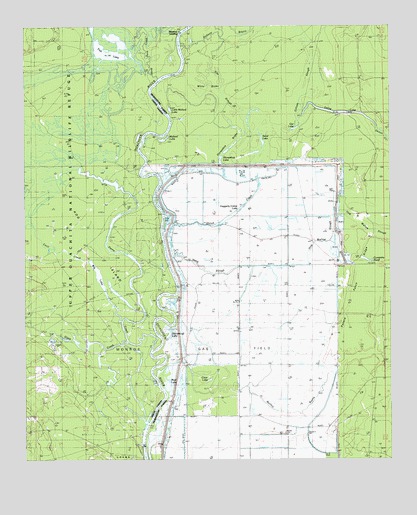
Fish Lake, LA USGS Topographic Map
Click on map above to begin viewing in our Map Viewer.

This topographic map contains these locations and features:
Feature Name Type Latitude Longitude GNIS ID View Map
Bear Brake (historical)SwampN32.9212°W92.0301°532824View Map
Big LakeLakeN32.9352°W92.1110°553653View Map
Brantley LandingPopulated PlaceN32.9979°W92.0735°543020View Map
Cecil CreekStreamN32.9151°W92.0926°533832View Map
Clear LakeLakeN32.8980°W92.0622°554020View Map
Company PondReservoirN32.9331°W92.0097°554063View Map
Deep SloughStreamN32.9329°W92.0762°534450View Map
Ditched-off LakeLakeN32.9120°W92.0763°554243View Map
Elm SloughGutN32.9798°W92.0576°534811View Map
Fish LakeLakeN32.9923°W92.0974°554412View Map
Gar LakeLakeN32.9709°W92.0321°554509View Map
Gilliam SloughStreamN32.9710°W92.0337°554529View Map
Glaze CreekStreamN32.9096°W92.0912°554537View Map
Haggerty Camp LakeLakeN32.9070°W92.0456°554640View Map
Halfway BayouStreamN32.9932°W92.0710°540623View Map
Halley Brake (historical)SwampN32.9382°W92.0660°535498View Map
Hog IslandIslandN32.9371°W92.1040°535698View Map
Hog Wallow SloughStreamN32.9335°W92.0279°546898View Map
Horseshoe BrakeSwampN32.9612°W92.0465°535813View Map
Horseshoe LakeLakeN32.9607°W92.0578°554777View Map
Irvine LakeLakeN32.9772°W92.0192°554840View Map
Irwin ReachChannelN32.9415°W92.0782°548715View Map
Little Mallard LakeLakeN32.9761°W92.0754°555089View Map
Long Brake (historical)SwampN32.9644°W92.0653°536681View Map
Mallard LakeLakeN32.9673°W92.0774°555223View Map
Mollicy BayouStreamN32.9085°W92.0649°546916View Map
Mud LakeLakeN32.8984°W92.0753°556507View Map
Pistol Brake (historical)SwampN32.9224°W92.0637°538222View Map
Potato Patch RidgeRidgeN32.9385°W92.0096°538363View Map
Round Brake (historical)SwampN32.9521°W92.0774°538740View Map
Sand LakeLakeN32.9668°W92.0437°555967View Map
Shiloh CreekStreamN32.9424°W92.0779°54799View Map
Shiloh Landing (historical)Populated PlaceN32.9662°W92.0882°543665View Map
Steep Bank CreekStreamN32.9846°W92.0804°539646View Map
Thirteen Points LandingPopulated PlaceN32.9565°W92.0857°543723View Map
Upper Ouachita National Wildlife RefugeParkN32.9190°W92.0757°540617View Map
White BrakeSwampN32.9812°W92.0646°540357View Map

Note: Coordinates in the location and feature list above are referenced to NAD83 datum.


Copyright (C) 2008-2025 Ryan Niemi / Sunset Dynamics ... All Rights Reserved