TopoQuest Logo
Do you find TopoQuest useful?
Help keep TopoQuest running and adding new maps/features by donating!
Bitcoin:  19c7KJd3qBynnjoSw5npx9KScwjBe4ifkT
Litecoin:  LXs6TkuXGGXo1vDsWCkWVdjQX94eUKd6ui
Home View Maps Find Maps Find Places Resources & Links


Mount Linnaeus, Utah Topographic Map

USGS Map Title: Mount Linnaeus, UT
USGS Map MRC: 37109G5
DRG (GeoTIFF) Download: o37109g5.tif


Neighboring USGS Topographic Map Quads:


  Cathedral Butte, UT  
37109H6
 

  Shay Mountain, UT  
37109H5
 

  Monticello Lake, UT  
37109H4
 

  Chippean Rocks, UT  
37109G6
 

  Mount Linnaeus, UT  
37109G5
 

  Abajo Peak, UT  
37109G4
 

  Cream Pots, UT  
37109F6
 

  Mancos Jim Butte, UT  
37109F5
 

  Blanding North, UT  
37109F4


Map MRC Location:

N38°
W110°
N38°
W109°
H8 H7 H6 H5 H4 H3 H2 H1
G8 G7 G6 G5 G4 G3 G2 G1
F8 F7 F6 F5 F4 F3 F2 F1
E8 E7 E6 E5 E4 E3 E2 E1
D8 D7 D6 D5 D4 D3 D2 D1
C8 C7 C6 C5 C4 C3 C2 C1
B8 B7 B6 B5 B4 B3 B2 B1
A8 A7 A6 A5 A4 A3 A2 A1
N37°
W110°
N37°
W109°

Mount Linnaeus, UT USGS 1:24K Topographic Map Preview:
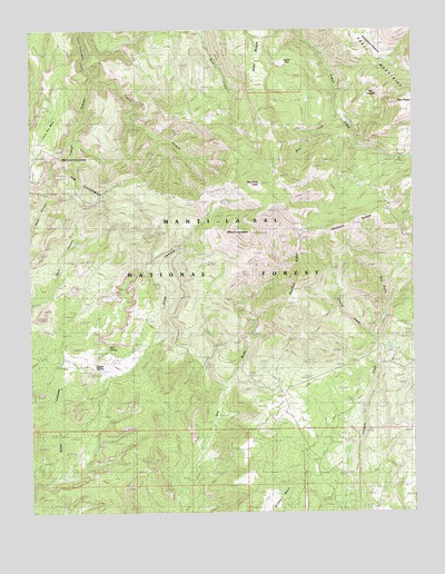
Mount Linnaeus, UT USGS Topographic Map
Click on map above to begin viewing in our Map Viewer.

This topographic map contains these locations and features:
Feature Name Type Latitude Longitude GNIS ID View Map
Abajo MountainsRangeN37.8505°W109.5471°1438111View Map
Aspen FlatFlatN37.8672°W109.5418°1438288View Map
Bayles CabinLocaleN37.8200°W109.5743°1451183View Map
Bayles RanchLocaleN37.7903°W109.5957°1438431View Map
Bayles SpringSpringN37.7872°W109.6051°1448114View Map
Bear CreekStreamN37.8519°W109.5235°1450241View Map
Blue Creek CabinLocaleN37.8533°W109.5637°1455186View Map
Blue Creek ReservoirReservoirN37.8646°W109.5695°1450005View Map
Bob Park PeakSummitN37.8361°W109.5507°1438982View Map
Cherry CreekStreamN37.7958°W109.5132°1455216View Map
Cliff Dwellers PastureFlatN37.7933°W109.5537°1450006View Map
Dry Wash Number Two DamDamN37.7750°W109.5390°1447650View Map
Dry Wash Number Two ReservoirReservoirN37.7750°W109.5390°1447649View Map
Dry Wash ReservoirReservoirN37.7844°W109.5450°1450016View Map
Duckett CabinLocaleN37.8242°W109.5390°1440708View Map
Duckett RidgeRidgeN37.8117°W109.5371°1455247View Map
Indian Creek Ranger StationLocaleN37.8375°W109.5112°1441995View Map
Jack SpringSpringN37.7925°W109.6007°1455336View Map
Little Dry MesaSummitN37.8461°W109.6221°1442707View Map
Mount LinnaeusSummitN37.8225°W109.5543°1442640View Map
Natural Arch Point of InterestLocaleN37.8064°W109.5935°1453038View Map
Red Bluff CampgroundLocaleN37.7930°W109.5037°1451338View Map
Red BluffsCliffN37.8105°W109.5140°1444762View Map
Red LedgesBenchN37.8708°W109.5293°1444812View Map
Shay RidgeRidgeN37.8725°W109.5607°1445477View Map
Skull and Crossbones Point of InterestLocaleN37.8408°W109.6151°1453025View Map
Skull and Crossbones SummitSummitN37.8436°W109.6157°1455514View Map
The CausewayRidgeN37.8333°W109.6173°1446426View Map
The CausewayRidgeN37.8375°W109.6246°1455211View Map
Trough CanyonValleyN37.8647°W109.6062°1446727View Map
Tuerto CanyonValleyN37.8650°W109.6062°1446755View Map
West MountainSummitN37.8300°W109.5468°1434099View Map

Note: Coordinates in the location and feature list above are referenced to NAD83 datum.


Copyright (C) 2008-2025 Ryan Niemi / Sunset Dynamics ... All Rights Reserved