TopoQuest Logo
Do you find TopoQuest useful?
Help keep TopoQuest running and adding new maps/features by donating!
Bitcoin:  19c7KJd3qBynnjoSw5npx9KScwjBe4ifkT
Litecoin:  LXs6TkuXGGXo1vDsWCkWVdjQX94eUKd6ui
Home View Maps Find Maps Find Places Resources & Links


Mother Lode Mountain, Oregon Topographic Map

USGS Map Title: Mother Lode Mountain, OR
USGS Map MRC: 44122G1
DRG (GeoTIFF) Download: o44122g1.tif


Neighboring USGS Topographic Map Quads:


  Bagby Hot Springs, OR  
44122H2
 

  Bull of the Woods, OR  
44122H1
 

  Mount Lowe, OR  
44121H8
 

  Battle Ax, OR  
44122G2
 

  Mother Lode Mountain, OR  
44122G1
 

  Breitenbush Hot Springs, OR  
44121G8
 

  Detroit, OR  
44122F2
 

  Idanha, OR  
44122F1
 

  Mount Bruno, OR  
44121F8


Map MRC Location:

N45°
W123°
N45°
W122°
H8 H7 H6 H5 H4 H3 H2 H1
G8 G7 G6 G5 G4 G3 G2 G1
F8 F7 F6 F5 F4 F3 F2 F1
E8 E7 E6 E5 E4 E3 E2 E1
D8 D7 D6 D5 D4 D3 D2 D1
C8 C7 C6 C5 C4 C3 C2 C1
B8 B7 B6 B5 B4 B3 B2 B1
A8 A7 A6 A5 A4 A3 A2 A1
N44°
W123°
N44°
W122°

Mother Lode Mountain, OR USGS 1:24K Topographic Map Preview:
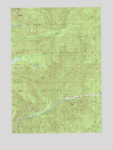
Mother Lode Mountain, OR USGS Topographic Map
Click on map above to begin viewing in our Map Viewer.

This topographic map contains these locations and features:
Feature Name Type Latitude Longitude GNIS ID View Map
Alder SwampSwampN44.8165°W122.0706°1153812View Map
Battle CreekStreamN44.8507°W122.0604°1137584View Map
Battle Creek ShelterLocaleN44.8496°W122.0615°1137591View Map
Byars CreekStreamN44.7662°W122.0998°1139086View Map
Cliffs CreekStreamN44.7698°W122.0781°1139835View Map
Cultus CreekStreamN44.7790°W122.0592°1140535View Map
Deadhorse CreekStreamN44.7673°W122.0967°1140719View Map
Deadhorse MountainSummitN44.7918°W122.1167°1639192View Map
Dunlap CreekStreamN44.8046°W122.0981°1141408View Map
Dunlap LakeLakeN44.8178°W122.0956°1141410View Map
Dunlap Lake Boat LaunchLocaleN44.8179°W122.0941°2699338View Map
Eagle RockSummitN44.7783°W122.0433°1141495View Map
East Humbug CreekStreamN44.7779°W122.0709°1162960View Map
Elk LakeLakeN44.8225°W122.1210°1141779View Map
Elk Lake TrailTrailN44.8676°W122.0456°1141782View Map
Fox CreekStreamN44.7818°W122.0537°1142389View Map
Fox Creek TrailTrailN44.8132°W122.0292°1142394View Map
Gold ButteSummitN44.8051°W122.0837°1142806View Map
Humbug CreekStreamN44.7704°W122.0742°1143904View Map
Humbug Recreation SiteLocaleN44.7721°W122.0779°1143905View Map
Humbug Ridge TrailTrailN44.8285°W122.0615°1143908View Map
Janus ButteRidgeN44.8640°W122.0151°1144221View Map
Leone CreekStreamN44.7782°W122.0034°1144952View Map
Leone LakeLakeN44.7548°W122.0031°1144953View Map
Mother Lode CreekStreamN44.8473°W122.0681°1146517View Map
Mother Lode MountainSummitN44.8666°W122.1164°1851720View Map
Mother Lode TrailTrailN44.8648°W122.0906°1146518View Map
Scorpion CreekStreamN44.7821°W122.0270°1149158View Map
Scorpion Mountain TrailTrailN44.8318°W122.0034°1149161View Map
Scorpion Ridge TrailTrailN44.8040°W122.0020°1149162View Map
Short MountainSummitN44.8138°W122.0028°1163269View Map
Slide CreekStreamN44.7660°W122.0887°1149710View Map
Twin LakesLakeN44.8573°W122.1187°1151565View Map
Twin Lakes TrailTrailN44.8598°W122.1176°1151569View Map
Welcome Lakes Ridge TrailTrailN44.8701°W122.0687°1152006View Map
Wind CreekStreamN44.7554°W122.1206°1152486View Map

Note: Coordinates in the location and feature list above are referenced to NAD83 datum.


Copyright (C) 2008-2024 Ryan Niemi / Sunset Dynamics ... All Rights Reserved