TopoQuest Logo
Do you find TopoQuest useful?
Help keep TopoQuest running and adding new maps/features by donating!
Bitcoin:  19c7KJd3qBynnjoSw5npx9KScwjBe4ifkT
Litecoin:  LXs6TkuXGGXo1vDsWCkWVdjQX94eUKd6ui
Home View Maps Find Maps Find Places Resources & Links


Mount of the Holy Cross, Colorado Topographic Map

USGS Map Title: Mount of the Holy Cross, CO
USGS Map MRC: 39106D4
DRG (GeoTIFF) Download: o39106d4.tif


Neighboring USGS Topographic Map Quads:


  Grouse Mountain, CO  
39106E5
 

  Minturn, CO  
39106E4
 

  Red Cliff, CO  
39106E3
 

  Mount Jackson, CO  
39106D5
 

  Mount of the Holy Cross, CO  
39106D4
 

  Pando, CO  
39106D3
 

  Nast, CO  
39106C5
 

  Homestake Reservoir, CO  
39106C4
 

  Leadville North, CO  
39106C3


Map MRC Location:

N40°
W107°
N40°
W106°
H8 H7 H6 H5 H4 H3 H2 H1
G8 G7 G6 G5 G4 G3 G2 G1
F8 F7 F6 F5 F4 F3 F2 F1
E8 E7 E6 E5 E4 E3 E2 E1
D8 D7 D6 D5 D4 D3 D2 D1
C8 C7 C6 C5 C4 C3 C2 C1
B8 B7 B6 B5 B4 B3 B2 B1
A8 A7 A6 A5 A4 A3 A2 A1
N39°
W107°
N39°
W106°

Mount of the Holy Cross, CO USGS 1:24K Topographic Map Preview:
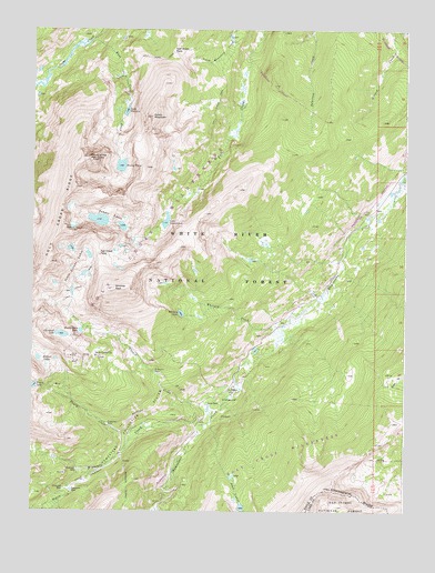
Mount of the Holy Cross, CO USGS Topographic Map
Click on map above to begin viewing in our Map Viewer.

This topographic map contains these locations and features:
Feature Name Type Latitude Longitude GNIS ID View Map
Bowl of TearsLakeN39.4646°W106.4708°179521View Map
Cleveland LakeLakeN39.4207°W106.4903°179530View Map
East Cross CreekStreamN39.4983°W106.4798°179518View Map
Fall Creek PassGapN39.4339°W106.4778°179527View Map
Fall Creek TrailTrailN39.4825°W106.4384°179524View Map
Fancy CreekStreamN39.3961°W106.4625°179538View Map
Fancy LakeLakeN39.4073°W106.4993°179535View Map
French CreekStreamN39.4014°W106.4395°179531View Map
Glengarry MineMineN39.4089°W106.4873°1684205View Map
Gold ParkLocaleN39.4014°W106.4395°179540View Map
Gold Park CampgroundLocaleN39.4033°W106.4356°197679View Map
Gold Park CemeteryCemeteryN39.4064°W106.4342°179539View Map
Half Moon PassGapN39.4942°W106.4534°179523View Map
Half Moon TrailTrailN39.4922°W106.4661°202664View Map
Holy Cross City (historical)Populated PlaceN39.4150°W106.4781°179537View Map
Holy Cross RidgeRidgeN39.4589°W106.4861°202661View Map
Hunky Dory LakeLakeN39.4216°W106.4838°179529View Map
Lake ConstantineLakeN39.4503°W106.4556°179532View Map
Lake PatriciaLakeN39.4787°W106.4690°179519View Map
Lost LakesLakeN39.3766°W106.4299°202665View Map
Missouri CreekStreamN39.3975°W106.4420°179515View Map
Missouri TunnelTunnelN39.3803°W106.4681°202663View Map
Morning MineMineN39.4005°W106.4406°1684206View Map
Mount of the Holy CrossSummitN39.4667°W106.4816°179522View Map
Mulhall LakesLakeN39.4133°W106.4953°179536View Map
Newman MineMineN39.4092°W106.4756°1684207View Map
Notch MountainSummitN39.4775°W106.4606°179520View Map
Seven Sisters LakesLakeN39.4433°W106.4875°179526View Map
Sopris CreekStreamN39.3847°W106.4800°179516View Map
Tuhare LakesLakeN39.4501°W106.4763°179525View Map
Whitney CreekStreamN39.4239°W106.4161°179533View Map
Whitney LakeLakeN39.4263°W106.4504°179534View Map
Whitney PeakSummitN39.4327°W106.4729°179528View Map

Note: Coordinates in the location and feature list above are referenced to NAD83 datum.


Copyright (C) 2008-2024 Ryan Niemi / Sunset Dynamics ... All Rights Reserved