TopoQuest Logo
Do you find TopoQuest useful?
Help keep TopoQuest running and adding new maps/features by donating!
Bitcoin:  19c7KJd3qBynnjoSw5npx9KScwjBe4ifkT
Litecoin:  LXs6TkuXGGXo1vDsWCkWVdjQX94eUKd6ui
Home View Maps Find Maps Find Places Resources & Links


Minturn, Colorado Topographic Map

USGS Map Title: Minturn, CO
USGS Map MRC: 39106E4
DRG (GeoTIFF) Download: o39106e4.tif


Neighboring USGS Topographic Map Quads:


  Edwards, CO  
39106F5
 

  Vail West, CO  
39106F4
 

  Vail East, CO  
39106F3
 

  Grouse Mountain, CO  
39106E5
 

  Minturn, CO  
39106E4
 

  Red Cliff, CO  
39106E3
 

  Mount Jackson, CO  
39106D5
 

  Mount of the Holy Cross, CO  
39106D4
 

  Pando, CO  
39106D3


Map MRC Location:

N40°
W107°
N40°
W106°
H8 H7 H6 H5 H4 H3 H2 H1
G8 G7 G6 G5 G4 G3 G2 G1
F8 F7 F6 F5 F4 F3 F2 F1
E8 E7 E6 E5 E4 E3 E2 E1
D8 D7 D6 D5 D4 D3 D2 D1
C8 C7 C6 C5 C4 C3 C2 C1
B8 B7 B6 B5 B4 B3 B2 B1
A8 A7 A6 A5 A4 A3 A2 A1
N39°
W107°
N39°
W106°

Minturn, CO USGS 1:24K Topographic Map Preview:
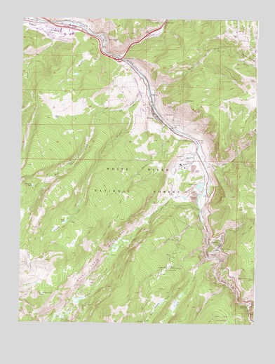
Minturn, CO USGS Topographic Map
Click on map above to begin viewing in our Map Viewer.

This topographic map contains these locations and features:
Feature Name Type Latitude Longitude GNIS ID View Map
Astor City (historical)Populated PlaceN39.5500°W106.4089°198185View Map
BeldenPopulated PlaceN39.5255°W106.3861°176127View Map
Ben Butler MineMineN39.5253°W106.3939°1684191View Map
Bishop GulchValleyN39.5424°W106.4043°176128View Map
Bolts DitchCanalN39.5522°W106.4117°176129View Map
Bolts LakeReservoirN39.5568°W106.4049°176144View Map
Bolts Lake DamDamN39.5567°W106.4031°200802View Map
Buffalo LakeLakeN39.5119°W106.4880°176121View Map
Cross CreekStreamN39.5703°W106.4064°176117View Map
Dowds JunctionPopulated PlaceN39.6083°W106.4478°176135View Map
Eagle MineMineN39.5339°W106.3953°176125View Map
Eagle River Fire Protection District Eagle - Vail Station 6BuildingN39.6214°W106.4835°2667085View Map
Eagle River Fire Protection District Station 5 MinturnBuildingN39.5875°W106.4318°2695558View Map
Eagle Vail Golf ClubLocaleN39.6194°W106.4904°2571077View Map
Eagle-Vail Census Designated PlaceCensusN39.6187°W106.4870°2408700View Map
Eagles EyeArchN39.5369°W106.3981°2677694View Map
Eagles NestPopulated PlaceN39.6183°W106.3861°176139View Map
Fall CreekStreamN39.5272°W106.4003°176116View Map
Fleck DitchCanalN39.6197°W106.4936°202335View Map
Game CreekStreamN39.5967°W106.4336°176138View Map
Game Creek BowlBasinN39.6086°W106.3836°202361View Map
GilmanPopulated PlaceN39.5328°W106.3939°204669View Map
Girard CreekStreamN39.5017°W106.3761°176114View Map
Gore CreekStreamN39.6089°W106.4492°176187View Map
Grouse CreekStreamN39.5955°W106.4334°176122View Map
Grouse LakeLakeN39.5417°W106.4758°176133View Map
Half Moon CampgroundLocaleN39.5014°W106.4314°176124View Map
Half Moon TrailheadLocaleN39.5005°W106.4331°197277View Map
Holy Cross Administrative SiteLocaleN39.5761°W106.4167°197266View Map
Homestake CreekStreamN39.5075°W106.3786°176113View Map
Homestake Creek MineMineN39.5003°W106.3845°1684192View Map
Homestake Peak SchoolSchoolN39.6187°W106.4734°197268View Map
KSKE-AM (Vail)TowerN39.5797°W106.4156°204073View Map
Line ShackLocaleN39.5889°W106.4750°197267View Map
LionsheadSummitN39.5908°W106.4136°176137View Map
Little Spring MineMineN39.5092°W106.3848°1684190View Map
Maloit ParkFlatN39.5647°W106.4139°176143View Map
Martin CreekStreamN39.5819°W106.4231°176132View Map
MinturnPopulated PlaceN39.5864°W106.4309°176136View Map
Minturn District Ranger StatonLocaleN39.5755°W106.4120°197271View Map
Minturn Police DepartmentBuildingN39.5860°W106.4305°2735534View Map
Minturn Post OfficePost OfficeN39.5862°W106.4305°2734614View Map
Minturn-Red Cliff DivisionCivilN39.5673°W106.4167°1935524View Map
New Jersey Zinc PitMineN39.5717°W106.4325°1684193View Map
Newhouse TunnelMineN39.5280°W106.3953°176126View Map
Notch Mountain CreekStreamN39.5100°W106.4150°176115View Map
Peterson CreekStreamN39.5164°W106.3898°176142View Map
Pine Marten MineMineN39.5225°W106.3942°1684194View Map
Red Cliff District MineMineN39.5342°W106.3925°1684189View Map
River View CemeteryCemeteryN39.5813°W106.4198°176131View Map
Rock CreekStreamN39.5322°W106.4003°176118View Map
Singing River RanchLocaleN39.6236°W106.4448°182511View Map
Stone CreekStreamN39.6230°W106.4900°176081View Map
Tigiwon Community HouseLocaleN39.5233°W106.4203°176123View Map
Tigiwon Post Office (historical)Post OfficeN39.5233°W106.4203°2026913View Map
Tip Top MineMineN39.5244°W106.3920°1684195View Map
Town of MinturnCivilN39.5462°W106.3872°2413005View Map
Traer CreekStreamN39.6225°W106.4695°175908View Map
Turkey CreekStreamN39.5072°W106.3786°176140View Map
Two Elk CreekStreamN39.5644°W106.4023°176119View Map
Vail Junction HeliportAirportN39.6164°W106.3845°204610View Map
Vail Ski and Snowboard AcademySchoolN39.5641°W106.4134°197270View Map
Vail Ski AreaLocaleN39.6142°W106.3750°176120View Map
Waterdog LakeLakeN39.5562°W106.4938°176134View Map
West Grouse CreekStreamN39.5889°W106.4428°176080View Map
Whiskey CreekStreamN39.6125°W106.4578°176141View Map

Note: Coordinates in the location and feature list above are referenced to NAD83 datum.


Copyright (C) 2008-2024 Ryan Niemi / Sunset Dynamics ... All Rights Reserved