TopoQuest Logo
Do you find TopoQuest useful?
Help keep TopoQuest running and adding new maps/features by donating!
Bitcoin:  19c7KJd3qBynnjoSw5npx9KScwjBe4ifkT
Litecoin:  LXs6TkuXGGXo1vDsWCkWVdjQX94eUKd6ui
Home View Maps Find Maps Find Places Resources & Links


Mitchell, Oregon Topographic Map

USGS Map Title: Mitchell, OR
USGS Map MRC: 44120E2
DRG (GeoTIFF) Download: o44120e2.tif


Neighboring USGS Topographic Map Quads:


  Painted Hills, OR  
44120F3
 

  Sutton Mountain, OR  
44120F2
 

  Toney Butte, OR  
44120F1
 

  Lawson Mountain, OR  
44120E3
 

  Mitchell, OR  
44120E2
 

  Keyes Mountain, OR  
44120E1
 

  Ochoco Butte, OR  
44120D3
 

  Mount Pisgah, OR  
44120D2
 

  Peterson Point, OR  
44120D1


Map MRC Location:

N45°
W121°
N45°
W120°
H8 H7 H6 H5 H4 H3 H2 H1
G8 G7 G6 G5 G4 G3 G2 G1
F8 F7 F6 F5 F4 F3 F2 F1
E8 E7 E6 E5 E4 E3 E2 E1
D8 D7 D6 D5 D4 D3 D2 D1
C8 C7 C6 C5 C4 C3 C2 C1
B8 B7 B6 B5 B4 B3 B2 B1
A8 A7 A6 A5 A4 A3 A2 A1
N44°
W121°
N44°
W120°

Mitchell, OR USGS 1:24K Topographic Map Preview:
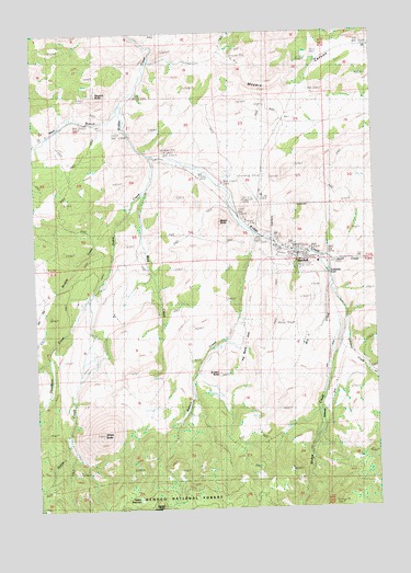
Mitchell, OR USGS Topographic Map
Click on map above to begin viewing in our Map Viewer.

This topographic map contains these locations and features:
Feature Name Type Latitude Longitude GNIS ID View Map
Bailey ButteSummitN44.5750°W120.1827°1117143View Map
Black Chunk CanyonValleyN44.5387°W120.2456°1159003View Map
City of MitchellCivilN44.5703°W120.1537°2411126View Map
Dollarhide PondReservoirN44.5613°W120.1430°1141161View Map
Five Minute DrawValleyN44.5485°W120.1761°1142194View Map
Gable CreekStreamN44.5837°W120.2100°1142547View Map
Gable Creek School (historical)SchoolN44.5576°W120.2289°1142548View Map
Hall DitchCanalN44.5387°W120.1442°1157460View Map
Hudspeth MillLocaleN44.6012°W120.2400°1153833View Map
Johnson CreekStreamN44.5487°W120.1364°1144342View Map
Juniper ButteSummitN44.5354°W120.1838°1144446View Map
Keyes CreekStreamN44.5657°W120.1453°1144588View Map
Lower Mitchell CemeteryCemeteryN44.5699°W120.1653°1157461View Map
Meyers CanyonValleyN44.6171°W120.2067°1146124View Map
Mill CreekStreamN44.5585°W120.1414°1146228View Map
MitchellPopulated PlaceN44.5665°W120.1533°1146370View Map
Mitchell Airstrip (historical)AirportN44.5832°W120.1706°1638210View Map
Mitchell CemeteryCemeteryN44.5648°W120.1432°1154537View Map
Mitchell City HallBuildingN44.5656°W120.1531°2700317View Map
Mitchell Justice CourtBuildingN44.5662°W120.1539°2700318View Map
Mitchell Post OfficePost OfficeN44.5672°W120.1563°1165648View Map
Mitchell SchoolSchoolN44.5650°W120.1533°2495537View Map
Mitchell Volunteer Fire DepartmentBuildingN44.5656°W120.1531°2576799View Map
Mud CreekStreamN44.5926°W120.2078°1146561View Map
Nelson CreekStreamN44.5724°W120.1706°1146771View Map
Nelson ReservoirReservoirN44.5026°W120.2143°1146774View Map
Paynes PondReservoirN44.5665°W120.1511°1159004View Map
Sargent ButteSummitN44.6091°W120.2276°1149075View Map
Shoemaker DitchCanalN44.5262°W120.1442°1158711View Map
Thompson CreekStreamN44.5557°W120.2314°1151097View Map
Weddle CreekStreamN44.5793°W120.2156°1151992View Map
West Branch Bridge CreekStreamN44.6062°W120.2183°1152027View Map
West Nelson CreekStreamN44.5401°W120.1900°1159005View Map
White ButteSummitN44.5193°W120.2272°1152223View Map

Note: Coordinates in the location and feature list above are referenced to NAD83 datum.


Copyright (C) 2008-2024 Ryan Niemi / Sunset Dynamics ... All Rights Reserved