TopoQuest Logo
Do you find TopoQuest useful?
Help keep TopoQuest running and adding new maps/features by donating!
Bitcoin:  19c7KJd3qBynnjoSw5npx9KScwjBe4ifkT
Litecoin:  LXs6TkuXGGXo1vDsWCkWVdjQX94eUKd6ui
Home View Maps Find Maps Find Places Resources & Links


Keyes Mountain, Oregon Topographic Map

USGS Map Title: Keyes Mountain, OR
USGS Map MRC: 44120E1
DRG (GeoTIFF) Download: o44120e1.tif


Neighboring USGS Topographic Map Quads:


  Sutton Mountain, OR  
44120F2
 

  Toney Butte, OR  
44120F1
 

  Richmond, OR  
44119F8
 

  Mitchell, OR  
44120E2
 

  Keyes Mountain, OR  
44120E1
 

  Frog Hollow, OR  
44119E8
 

  Mount Pisgah, OR  
44120D2
 

  Peterson Point, OR  
44120D1
 

  Derr Meadows, OR  
44119D8


Map MRC Location:

N45°
W121°
N45°
W120°
H8 H7 H6 H5 H4 H3 H2 H1
G8 G7 G6 G5 G4 G3 G2 G1
F8 F7 F6 F5 F4 F3 F2 F1
E8 E7 E6 E5 E4 E3 E2 E1
D8 D7 D6 D5 D4 D3 D2 D1
C8 C7 C6 C5 C4 C3 C2 C1
B8 B7 B6 B5 B4 B3 B2 B1
A8 A7 A6 A5 A4 A3 A2 A1
N44°
W121°
N44°
W120°

Keyes Mountain, OR USGS 1:24K Topographic Map Preview:
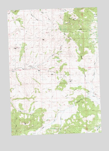
Keyes Mountain, OR USGS Topographic Map
Click on map above to begin viewing in our Map Viewer.

This topographic map contains these locations and features:
Feature Name Type Latitude Longitude GNIS ID View Map
Badger CreekStreamN44.5221°W120.0522°1137394View Map
Flock MountainSummitN44.6032°W120.0222°1120838View Map
H H Wheeler Historical MarkerParkN44.5682°W120.0936°1163717View Map
Harrison CreekStreamN44.5476°W120.0117°1121629View Map
Indian CreekStreamN44.5221°W120.0519°1144045View Map
Keyes MountainSummitN44.5944°W120.0375°1136437View Map
Keys Creek SummitGapN44.5526°W120.0428°1638454View Map
Lewis RockSummitN44.5112°W120.1075°1136475View Map
Looney SpringSpringN44.5601°W120.0650°1123477View Map
Marshall ButteSummitN44.5868°W120.1142°1123788View Map
Marshall CreekStreamN44.5365°W120.0094°1123790View Map
Maxwell SpringSpringN44.5646°W120.0831°1123861View Map
Mitchell Guard StationLocaleN44.5415°W120.0150°1131058View Map
Mitchell MountainSummitN44.5512°W120.0361°1133217View Map
Monroe RoughsSummitN44.6083°W120.0254°1124298View Map
Peggy ButteSummitN44.5943°W120.0744°1125275View Map
Thorn HollowValleyN44.5424°W120.0131°1128041View Map
Wood Camp CreekStreamN44.5257°W120.1147°1129291View Map

Note: Coordinates in the location and feature list above are referenced to NAD83 datum.


Copyright (C) 2008-2025 Ryan Niemi / Sunset Dynamics ... All Rights Reserved