TopoQuest Logo
Do you find TopoQuest useful?
Help keep TopoQuest running and adding new maps/features by donating!
Bitcoin:  19c7KJd3qBynnjoSw5npx9KScwjBe4ifkT
Litecoin:  LXs6TkuXGGXo1vDsWCkWVdjQX94eUKd6ui
Home View Maps Find Maps Find Places Resources & Links


Honeyville, Utah Topographic Map

USGS Map Title: Honeyville, UT
USGS Map MRC: 41112F1
DRG (GeoTIFF) Download: o41112f1.tif


Neighboring USGS Topographic Map Quads:


  Riverside, UT  
41112G2
 

  Cutler Dam, UT  
41112G1
 

  Newton, UT  
41111G8
 

  Tremonton, UT  
41112F2
 

  Honeyville, UT  
41112F1
 

  Wellsville, UT  
41111F8


  Brigham City, UT  
41112E1
 

  Mount Pisgah, UT  
41111E8


Map MRC Location:

N42°
W113°
N42°
W112°
H8 H7 H6 H5 H4 H3 H2 H1
G8 G7 G6 G5 G4 G3 G2 G1
F8 F7 F6 F5 F4 F3 F2 F1
E8 E7 E6 E5 E4 E3 E2 E1
D8 D7 D6 D5 D4 D3 D2 D1
C8 C7 C6 C5 C4 C3 C2 C1
B8 B7 B6 B5 B4 B3 B2 B1
A8 A7 A6 A5 A4 A3 A2 A1
N41°
W113°
N41°
W112°

Honeyville, UT USGS 1:24K Topographic Map Preview:
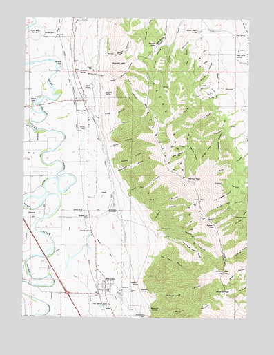
Honeyville, UT USGS Topographic Map
Click on map above to begin viewing in our Map Viewer.

This topographic map contains these locations and features:
Feature Name Type Latitude Longitude GNIS ID View Map
Baker CanyonValleyN41.6955°W112.0355°1425234View Map
Beaton SpringsSpringN41.7428°W112.1150°1425369View Map
Big CanyonValleyN41.6705°W112.0608°1425468View Map
Big HollowValleyN41.7366°W112.0216°1425507View Map
Bluerock SpringSpringN41.6367°W112.0598°1425840View Map
Bob Stewart PeakSummitN41.6491°W112.0066°1699874View Map
Box Elder PeakSummitN41.6358°W112.0144°1425931View Map
Chocolate PeakSummitN41.7308°W112.0733°1426602View Map
Chokecherry FlatFlatN41.7227°W112.0247°1426608View Map
City of HoneyvilleCivilN41.6361°W112.0857°2410786View Map
Cold SpringSpringN41.6299°W112.0780°1426792View Map
Cold Spring LakesLakeN41.6299°W112.0808°1426796View Map
Coldwater CanyonValleyN41.6619°W112.0527°1426798View Map
Coldwater LakeLakeN41.6676°W112.0011°1426799View Map
Coldwater SpringSpringN41.7367°W112.0080°1426800View Map
Cottonwood CanyonValleyN41.6305°W112.0552°1426906View Map
Crystal Spring ResortLocaleN41.6597°W112.0874°1435378View Map
Crystal SpringsPopulated PlaceN41.6602°W112.0874°1437538View Map
Deep Gorge SpringSpringN41.7352°W112.0077°1427299View Map
Dewey CanyonValleyN41.6891°W112.0772°1427381View Map
Dewey SpringSpringN41.7036°W112.0918°1427384View Map
DeweyvillePopulated PlaceN41.7105°W112.0902°1455092View Map
Deweyville CemeteryCemeteryN41.7144°W112.0913°1435425View Map
Dry HollowValleyN41.7333°W112.0194°1427555View Map
Fiddlers HollowValleyN41.7105°W112.0094°1427917View Map
Flat CanyonValleyN41.7008°W112.0808°1427986View Map
Fryer SpringSpringN41.7284°W112.0877°1428108View Map
Garland SpringSpringN41.7185°W112.0807°1428149View Map
Garland SpringsSpringN41.7302°W112.1063°1428150View Map
Glenn Mason SpringSpringN41.7437°W112.1185°1428208View Map
Glenn Orms SpringSpringN41.6256°W112.0570°1428209View Map
Hammond East Branch CanalCanalN41.6524°W112.0780°1441563View Map
Hammond West Branch CanalCanalN41.6313°W112.1088°1441565View Map
Hank Bell CanyonValleyN41.6774°W112.0683°1428506View Map
Hansen LakeLakeN41.7387°W112.0531°1428518View Map
Hawbush SpringSpringN41.7276°W112.0949°1428589View Map
Holdaway CanyonValleyN41.6847°W112.0738°1428761View Map
HoneyvillePopulated PlaceN41.6385°W112.0794°1428800View Map
Honeyville CemeteryCemeteryN41.6339°W112.0753°1435694View Map
Honeyville Fire DepartmentBuildingN41.6360°W112.0805°2627126View Map
Honeyville Post OfficePost OfficeN41.6362°W112.0801°2769062View Map
Honeyville SchoolSchoolN41.6363°W112.0777°1435695View Map
Honeyville SpringsSpringN41.6277°W112.0536°1428801View Map
Jensen SpringSpringN41.7207°W112.0922°1429149View Map
Jim May CanyonValleyN41.6583°W112.0511°1429166View Map
John Kidman FlatFlatN41.7174°W112.0291°1429199View Map
John Kidman HollowValleyN41.7185°W112.0186°1429200View Map
Kidman CanyonValleyN41.6966°W112.0349°1429341View Map
MadsenPopulated PlaceN41.6663°W112.0916°1437629View Map
Mendon PeakSummitN41.6824°W112.0311°1430226View Map
North Fork Hell CanyonValleyN41.6730°W112.0077°1430789View Map
North Maple CanyonValleyN41.7341°W112.0822°1430828View Map
Old Logway CanyonValleyN41.6794°W112.0074°1430980View Map
Pine CanyonValleyN41.6963°W112.0791°1431246View Map
Pleasant View PointCliffN41.6666°W112.0230°1431341View Map
Scout PeakSummitN41.6738°W112.0272°1432286View Map
Smith CanyonValleyN41.7255°W112.0702°1432566View Map
South Maple CanyonValleyN41.7219°W112.0838°1432737View Map
Spring HollowValleyN41.7385°W112.0455°1432855View Map
Spring LakeLakeN41.7155°W112.1183°1432861View Map
Stauffer CanyonValleyN41.6966°W112.0338°1432933View Map
Stewart PassGapN41.6641°W112.0202°1432981View Map
Straight HollowValleyN41.6983°W112.0186°1433004View Map
The Church of Jesus Christ of Latter Day SaintsChurchN41.6366°W112.0797°1436945View Map
The Church of Jesus Christ of Latter Day SaintsChurchN41.7055°W112.0897°1437042View Map
Three Drag Road CanyonValleyN41.6572°W112.0424°1433483View Map
Tolman SpringsSpringN41.6385°W112.0649°1433565View Map
Tom Muir SpringSpringN41.7186°W112.0222°1433568View Map
Town of DeweyvilleCivilN41.6930°W112.0883°2412425View Map
Tremonton SpringsSpringN41.7278°W112.1050°1433665View Map
Two Jump CanyonValleyN41.6488°W112.0552°1433760View Map
Walter Ahern SpringSpringN41.7445°W112.0299°1433938View Map
Wellsville ConeSummitN41.6444°W112.0136°1434041View Map
Wellsville Mountain WildernessReserveN41.6426°W112.0196°1450075View Map
Wide CanyonValleyN41.7085°W112.0847°1434231View Map
Willies HollowValleyN41.7324°W112.0122°1434303View Map
Willow SpringSpringN41.7261°W112.0858°1434358View Map
Yonk CanyonValleyN41.7385°W112.0358°1434512View Map
Yonk SpringSpringN41.7428°W112.0084°1434513View Map

Note: Coordinates in the location and feature list above are referenced to NAD83 datum.


Copyright (C) 2008-2025 Ryan Niemi / Sunset Dynamics ... All Rights Reserved