TopoQuest Logo
Do you find TopoQuest useful?
Help keep TopoQuest running and adding new maps/features by donating!
Bitcoin:  19c7KJd3qBynnjoSw5npx9KScwjBe4ifkT
Litecoin:  LXs6TkuXGGXo1vDsWCkWVdjQX94eUKd6ui
Home View Maps Find Maps Find Places Resources & Links


Mount Pleasant, Utah Topographic Map

USGS Map Title: Mount Pleasant, UT
USGS Map MRC: 39111E4
DRG (GeoTIFF) Download: o39111e4.tif


Neighboring USGS Topographic Map Quads:


  Big Hollow, UT  
39111F5
 

  Fairview, UT  
39111F4
 

  Fairview Lakes, UT  
39111F3
 

  Moroni, UT  
39111E5
 

  Mount Pleasant, UT  
39111E4
 

  Huntington Reservoir, UT  
39111E3
 

  Chester, UT  
39111D5
 

  Spring City, UT  
39111D4
 

  South Tent Mountain, UT  
39111D3


Map MRC Location:

N40°
W112°
N40°
W111°
H8 H7 H6 H5 H4 H3 H2 H1
G8 G7 G6 G5 G4 G3 G2 G1
F8 F7 F6 F5 F4 F3 F2 F1
E8 E7 E6 E5 E4 E3 E2 E1
D8 D7 D6 D5 D4 D3 D2 D1
C8 C7 C6 C5 C4 C3 C2 C1
B8 B7 B6 B5 B4 B3 B2 B1
A8 A7 A6 A5 A4 A3 A2 A1
N39°
W112°
N39°
W111°

Mount Pleasant, UT USGS 1:24K Topographic Map Preview:
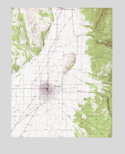
Mount Pleasant, UT USGS Topographic Map
Click on map above to begin viewing in our Map Viewer.

This topographic map contains these locations and features:
Feature Name Type Latitude Longitude GNIS ID View Map
A J Camper ParkLocaleN39.5686°W111.4552°1435041View Map
Basin Drive-InLocaleN39.5561°W111.4542°2559663View Map
Birch CreekStreamN39.5950°W111.4569°1425596View Map
City DitchCanalN39.5316°W111.4469°1426654View Map
City of Mount PleasantCivilN39.5407°W111.4559°2411180View Map
Coal ForkStreamN39.5419°W111.3799°1426758View Map
Cottonwood CanyonValleyN39.6233°W111.4513°1439998View Map
Cottonwood CreekStreamN39.6233°W111.4510°1451219View Map
Cove CreekStreamN39.5725°W111.4205°1426989View Map
Dublin WashValleyN39.5764°W111.4707°1427599View Map
First Southern Baptist ChurchChurchN39.5169°W111.4769°1455602View Map
KMTP-FM (Mt Pleasant)TowerN39.5555°W111.4605°1455784View Map
Little North CreekStreamN39.5727°W111.4549°1429776View Map
Lower Debris BasinBasinN39.5483°W111.4249°1429979View Map
Lower Mount Pleasant PowerplantLocaleN39.5402°W111.3752°1454470View Map
McArthur Frandsen CanalCanalN39.5655°W111.4899°1425015View Map
Moroni and Mount Pleasant CanalCanalN39.5730°W111.4802°1430499View Map
Mount PleasantPopulated PlaceN39.5469°W111.4555°1430522View Map
Mount Pleasant AirportAirportN39.5293°W111.4715°1434575View Map
Mount Pleasant Ambulance AssociationBuildingN39.5471°W111.4545°2665441View Map
Mount Pleasant City CemeteryCemeteryN39.5336°W111.4535°1436001View Map
Mount Pleasant Elementary SchoolSchoolN39.5387°W111.4470°1436002View Map
Mount Pleasant First Presbyterian ChurchChurchN39.5400°W111.4569°1436746View Map
Mount Pleasant Police DepartmentBuildingN39.5465°W111.4579°2730327View Map
Mount Pleasant Post OfficePost OfficeN39.5476°W111.4578°1455412View Map
Mount Pleasant Volunteer Fire DepartmentBuildingN39.5465°W111.4581°2627448View Map
Mount Pleasant-Moroni DivisionCivilN39.5941°W111.4768°1939395View Map
Mule CreekStreamN39.5661°W111.4552°1430594View Map
North CreekStreamN39.5602°W111.4377°1430766View Map
North Fork Birch CreekStreamN39.5916°W111.3849°1430780View Map
North Fork North CreekStreamN39.5536°W111.3807°1430797View Map
North Sanpete High SchoolSchoolN39.5356°W111.4479°1436047View Map
Quaking Hollow CreekStreamN39.5605°W111.3752°1431515View Map
Round HillsSummitN39.5697°W111.4263°1432019View Map
Sanpete Valley HospitalHospitalN39.5314°W111.4610°1436315View Map
Sanpete Valley Hospital HeliportAirportN39.5300°W111.4607°1436316View Map
Sect DitchCanalN39.5230°W111.4638°1432308View Map
South Fork Birch CreekStreamN39.5916°W111.3849°1432674View Map
South Fork North CreekStreamN39.5536°W111.3807°1432697View Map
Spring CreekStreamN39.6139°W111.4255°1446013View Map
The Church of Jesus Christ of Latter Day SaintsChurchN39.5458°W111.4546°1437008View Map
The Church of Jesus Christ of Latter Day SaintsChurchN39.5427°W111.4546°1437009View Map
Twin CreekStreamN39.5283°W111.4424°1446780View Map
Upper Debris BasinBasinN39.5458°W111.3894°1433804View Map
Woolf HollowValleyN39.5575°W111.3771°1434477View Map

Note: Coordinates in the location and feature list above are referenced to NAD83 datum.


Copyright (C) 2008-2025 Ryan Niemi / Sunset Dynamics ... All Rights Reserved