TopoQuest Logo
Do you find TopoQuest useful?
Help keep TopoQuest running and adding new maps/features by donating!
Bitcoin:  19c7KJd3qBynnjoSw5npx9KScwjBe4ifkT
Litecoin:  LXs6TkuXGGXo1vDsWCkWVdjQX94eUKd6ui
Home View Maps Find Maps Find Places Resources & Links


Fairview Lakes, Utah Topographic Map

USGS Map Title: Fairview Lakes, UT
USGS Map MRC: 39111F3
DRG (GeoTIFF) Download: o39111f3.tif


Neighboring USGS Topographic Map Quads:


  Indianola, UT  
39111G4
 

  C Canyon, UT  
39111G3
 

  Scofield Reservoir, UT  
39111G2
 

  Fairview, UT  
39111F4
 

  Fairview Lakes, UT  
39111F3
 

  Scofield, UT  
39111F2
 

  Mount Pleasant, UT  
39111E4
 

  Huntington Reservoir, UT  
39111E3
 

  Candland Mountain, UT  
39111E2


Map MRC Location:

N40°
W112°
N40°
W111°
H8 H7 H6 H5 H4 H3 H2 H1
G8 G7 G6 G5 G4 G3 G2 G1
F8 F7 F6 F5 F4 F3 F2 F1
E8 E7 E6 E5 E4 E3 E2 E1
D8 D7 D6 D5 D4 D3 D2 D1
C8 C7 C6 C5 C4 C3 C2 C1
B8 B7 B6 B5 B4 B3 B2 B1
A8 A7 A6 A5 A4 A3 A2 A1
N39°
W112°
N39°
W111°

Fairview Lakes, UT USGS 1:24K Topographic Map Preview:
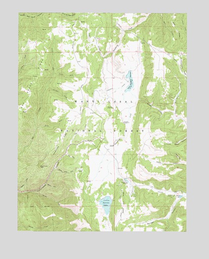
Fairview Lakes, UT USGS Topographic Map
Click on map above to begin viewing in our Map Viewer.

This topographic map contains these locations and features:
Feature Name Type Latitude Longitude GNIS ID View Map
Beaver DamDamN39.6550°W111.2957°1447804View Map
Beaver Dam ReservoirReservoirN39.6542°W111.2950°1438530View Map
Beaver Dams Summer Homes AreaPopulated PlaceN39.6458°W111.2905°1451187View Map
Beaver RidgeRidgeN39.6430°W111.2974°1438540View Map
Blind ForkStreamN39.6477°W111.3655°1438908View Map
Boulger CanyonValleyN39.6433°W111.2568°1439030View Map
Boulger ReservoirReservoirN39.6452°W111.2550°1439031View Map
Brooks CanyonValleyN39.7011°W111.2874°1439158View Map
Burnt ForkStreamN39.6522°W111.3549°1439348View Map
Cottonwood RidgeRidgeN39.6764°W111.3441°1440033View Map
Durphys ForkStreamN39.7072°W111.3546°1440730View Map
Fairview LakesReservoirN39.6406°W111.3101°1440985View Map
Fairview Lakes DamDamN39.6433°W111.3141°1447803View Map
Fairview Lakes OverlookLocaleN39.6297°W111.3205°1455841View Map
Flat Canyon CampgroundLocaleN39.6455°W111.2602°1441126View Map
Gooseberry CampgroundLocaleN39.6875°W111.2977°1441372View Map
Hys ForkStreamN39.6689°W111.3402°1441974View Map
Japanese CreekStreamN39.7127°W111.2952°1442104View Map
Left Fork Cottonwood CanyonValleyN39.6752°W111.3360°1442492View Map
Lower Gooseberry ReservoirReservoirN39.7109°W111.2925°1447806View Map
Lower Gooseberry Reservoir DamDamN39.7166°W111.2924°1447805View Map
Mammoth Ranger StationLocaleN39.6958°W111.3057°1443116View Map
Narrows TunnelTunnelN39.6725°W111.3174°1443763View Map
Neils ForkStreamN39.6839°W111.3621°1443790View Map
North Fork Swens CanyonValleyN39.6639°W111.2546°1443939View Map
Oak Creek RidgeRidgeN39.7114°W111.3644°1444019View Map
Pine Crown PeakSummitN39.6619°W111.3591°1444380View Map
Snowland Ski AreaLocaleN39.6561°W111.3368°1449015View Map
Spring Cabin HollowValleyN39.7272°W111.3055°1445978View Map
Swens ForkStreamN39.7150°W111.3496°1446296View Map
White Pine ForkStreamN39.6608°W111.3488°1447272View Map
Winterquarters RidgeRidgeN39.7189°W111.2535°1447488View Map

Note: Coordinates in the location and feature list above are referenced to NAD83 datum.


Copyright (C) 2008-2025 Ryan Niemi / Sunset Dynamics ... All Rights Reserved