TopoQuest Logo
Do you find TopoQuest useful?
Help keep TopoQuest running and adding new maps/features by donating!
Bitcoin:  19c7KJd3qBynnjoSw5npx9KScwjBe4ifkT
Litecoin:  LXs6TkuXGGXo1vDsWCkWVdjQX94eUKd6ui
Home View Maps Find Maps Find Places Resources & Links


Chrome Mountain, Montana Topographic Map

USGS Map Title: Chrome Mountain, MT
USGS Map MRC: 45110D2
DRG (GeoTIFF) Download: o45110d2.tif


Neighboring USGS Topographic Map Quads:


  Mount Rae, MT  
45110E3
 

  McLeod Basin, MT  
45110E2
 

  Enos Mountain, MT  
45110E1
 

  West Boulder Plateau, MT  
45110D3
 

  Chrome Mountain, MT  
45110D2
 

  Picket Pin Mountain, MT  
45110D1
 

  The Needles, MT  
45110C3
 

  Mount Douglas, MT  
45110C2
 

  Tumble Mountain, MT  
45110C1


Map MRC Location:

N46°
W111°
N46°
W110°
H8 H7 H6 H5 H4 H3 H2 H1
G8 G7 G6 G5 G4 G3 G2 G1
F8 F7 F6 F5 F4 F3 F2 F1
E8 E7 E6 E5 E4 E3 E2 E1
D8 D7 D6 D5 D4 D3 D2 D1
C8 C7 C6 C5 C4 C3 C2 C1
B8 B7 B6 B5 B4 B3 B2 B1
A8 A7 A6 A5 A4 A3 A2 A1
N45°
W111°
N45°
W110°

Chrome Mountain, MT USGS 1:24K Topographic Map Preview:
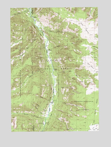
Chrome Mountain, MT USGS Topographic Map
Click on map above to begin viewing in our Map Viewer.

This topographic map contains these locations and features:
Feature Name Type Latitude Longitude GNIS ID View Map
04S12E25CBBD02 WellWellN45.4558°W110.1974°809568View Map
Aspen CampgroundLocaleN45.4569°W110.1971°798942View Map
Big Beaver CampgroundLocaleN45.4749°W110.2021°1743450View Map
Blakely CreekStreamN45.4597°W110.1935°780088View Map
Bonanza Number 3 MineMineN45.4797°W110.2396°804871View Map
Boulder River Number 1 MineMineN45.4763°W110.2030°805380View Map
Camp-on-the-BoulderLocaleN45.3833°W110.2046°806053View Map
Chippy Park CampgroundLocaleN45.4369°W110.1899°805897View Map
Chrome MountainSummitN45.4408°W110.1396°806924View Map
Clydehurst RanchLocaleN45.4616°W110.1999°781426View Map
Contact MountainSummitN45.4688°W110.1380°806939View Map
East Chippy CreekStreamN45.4349°W110.1910°780182View Map
Falls CreekStreamN45.4916°W110.2213°783296View Map
Falls Creek CampgroundLocaleN45.4902°W110.2185°805898View Map
Firewater CreekStreamN45.3960°W110.2021°783413View Map
Flemming BridgeBridgeN45.4038°W110.1921°806055View Map
Froze-to-Death CreekStreamN45.4991°W110.2227°806762View Map
Gish MineMineN45.4780°W110.2030°783959View Map
Graham CreekStreamN45.4785°W110.2096°784148View Map
Great Falls CreekStreamN45.4766°W110.2091°784257View Map
Hells Canyon RanchLocaleN45.3827°W110.2055°784748View Map
Lower Gish MineMineN45.4777°W110.2035°805381View Map
Middle Gish MineMineN45.4783°W110.2021°805383View Map
Miller CreekStreamN45.4038°W110.1921°787405View Map
Nicon Number 1 MineMineN45.4838°W110.2185°805379View Map
Raspberry CreekStreamN45.3927°W110.2032°789389View Map
Red Fox Claim MineMineN45.4572°W110.2327°804974View Map
Shorty CreekStreamN45.4227°W110.1882°790449View Map
Silvertip CreekStreamN45.4094°W110.1921°790536View Map
Skillman MineMineN45.4583°W110.2480°804975View Map
Speculator CreekStreamN45.3897°W110.1991°791144View Map
Twomile BridgeBridgeN45.4874°W110.2169°806054View Map
Upper Gish MineMineN45.4777°W110.2013°805382View Map
West Chippy CreekStreamN45.4369°W110.1919°792901View Map

Note: Coordinates in the location and feature list above are referenced to NAD83 datum.


Copyright (C) 2008-2025 Ryan Niemi / Sunset Dynamics ... All Rights Reserved