TopoQuest Logo
Do you find TopoQuest useful?
Help keep TopoQuest running and adding new maps/features by donating!
Bitcoin:  19c7KJd3qBynnjoSw5npx9KScwjBe4ifkT
Litecoin:  LXs6TkuXGGXo1vDsWCkWVdjQX94eUKd6ui
Home View Maps Find Maps Find Places Resources & Links


Six Corners, Oregon Topographic Map

USGS Map Title: Six Corners, OR
USGS Map MRC: 44119C7
DRG (GeoTIFF) Download: o44119c7.tif


Neighboring USGS Topographic Map Quads:


  Derr Meadows, OR  
44119D8
 

  Antone, OR  
44119D7
 

  Day Basin, OR  
44119D6
 

  Little Summit Prairie, OR  
44119C8
 

  Six Corners, OR  
44119C7
 

  Wolf Mountain, OR  
44119C6
 

  Paulina, OR  
44119B8
 

  Mud Spring, OR  
44119B7
 

  Powell Mountain, OR  
44119B6


Map MRC Location:

N45°
W120°
N45°
W119°
H8 H7 H6 H5 H4 H3 H2 H1
G8 G7 G6 G5 G4 G3 G2 G1
F8 F7 F6 F5 F4 F3 F2 F1
E8 E7 E6 E5 E4 E3 E2 E1
D8 D7 D6 D5 D4 D3 D2 D1
C8 C7 C6 C5 C4 C3 C2 C1
B8 B7 B6 B5 B4 B3 B2 B1
A8 A7 A6 A5 A4 A3 A2 A1
N44°
W120°
N44°
W119°

Six Corners, OR USGS 1:24K Topographic Map Preview:
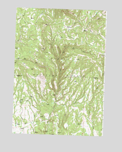
Six Corners, OR USGS Topographic Map
Click on map above to begin viewing in our Map Viewer.

This topographic map contains these locations and features:
Feature Name Type Latitude Longitude GNIS ID View Map
Antelope ReservoirReservoirN44.2551°W119.8595°1137245View Map
Aqua SpringSpringN44.3036°W119.7886°1137281View Map
Baldy CreekStreamN44.3568°W119.7766°1137472View Map
Bear MeadowsFlatN44.3672°W119.8556°1137726View Map
Bear MountainSummitN44.3591°W119.8351°1137729View Map
Board Tree SpringSpringN44.2797°W119.8245°1138356View Map
Bull SpringSpringN44.2870°W119.8514°1138925View Map
Clayton ReservoirReservoirN44.2588°W119.8648°1139773View Map
Clear SpringSpringN44.3143°W119.8489°1139808View Map
Connally SpringSpringN44.3347°W119.8749°1140042View Map
Dean SpringSpringN44.3243°W119.8625°1140766View Map
East Wolf CreekStreamN44.3246°W119.8147°1141652View Map
Frog ReservoirReservoirN44.2826°W119.8537°1142507View Map
Frog SpringSpringN44.2826°W119.8538°1156306View Map
Grass SpringSpringN44.3343°W119.8354°1142958View Map
Hornet ReservoirReservoirN44.2836°W119.8612°1143737View Map
Little Windy CreekStreamN44.3665°W119.7697°1145289View Map
Mascall TrailTrailN44.3610°W119.7766°1158348View Map
Miles ReservoirReservoirN44.2518°W119.8440°1146207View Map
Nichol SpringSpringN44.3305°W119.7533°1146821View Map
Noble Garden SpringSpringN44.2612°W119.7853°1146862View Map
Podo CreekStreamN44.3638°W119.7889°1150233View Map
Podo MeadowsFlatN44.3571°W119.8033°1150285View Map
Porcupine ReservoirReservoirN44.2678°W119.8321°1147896View Map
Potter MeadowsFlatN44.3546°W119.7814°1147947View Map
Reed ReservoirReservoirN44.3257°W119.7855°1148357View Map
Scab ReservoirReservoirN44.2695°W119.8126°1149109View Map
Scab SpringSpringN44.2693°W119.8125°1156305View Map
Six CornersLocaleN44.3238°W119.8686°1149560View Map
Sugar Creek ReservoirReservoirN44.2520°W119.8126°1150532View Map
Survey SpringSpringN44.3208°W119.8466°1150702View Map
Windy CreekStreamN44.3638°W119.7714°1152507View Map
Wolf Creek Recreation SiteLocaleN44.2529°W119.8258°1152584View Map
Wolf RidgeRidgeN44.3468°W119.7825°1152600View Map
Wolf SpringSpringN44.3471°W119.8127°1129288View Map
Yu-ma SpringSpringN44.2894°W119.8174°1152764View Map

Note: Coordinates in the location and feature list above are referenced to NAD83 datum.


Copyright (C) 2008-2024 Ryan Niemi / Sunset Dynamics ... All Rights Reserved