TopoQuest Logo
Do you find TopoQuest useful?
Help keep TopoQuest running and adding new maps/features by donating!
Bitcoin:  19c7KJd3qBynnjoSw5npx9KScwjBe4ifkT
Litecoin:  LXs6TkuXGGXo1vDsWCkWVdjQX94eUKd6ui
Home View Maps Find Maps Find Places Resources & Links


Murray, Kentucky Topographic Map

USGS Map Title: Murray, KY
USGS Map MRC: 36088E3
DRG (GeoTIFF) Download: o36088e3.tif


Neighboring USGS Topographic Map Quads:


  Kirksey, KY  
36088F4
 

  Dexter, KY  
36088F3
 

  Hico, KY  
36088F2
 

  Lynn Grove, KY  
36088E4
 

  Murray, KY  
36088E3
 

  New Concord, KY  
36088E2
 

  Cottage Grove, TN  
36088D4
 

  Puryear, TN  
36088D3
 

  Buchanan, TN  
36088D2


Map MRC Location:

N37°
W89°
N37°
W88°
H8 H7 H6 H5 H4 H3 H2 H1
G8 G7 G6 G5 G4 G3 G2 G1
F8 F7 F6 F5 F4 F3 F2 F1
E8 E7 E6 E5 E4 E3 E2 E1
D8 D7 D6 D5 D4 D3 D2 D1
C8 C7 C6 C5 C4 C3 C2 C1
B8 B7 B6 B5 B4 B3 B2 B1
A8 A7 A6 A5 A4 A3 A2 A1
N36°
W89°
N36°
W88°

Murray, KY USGS 1:24K Topographic Map Preview:
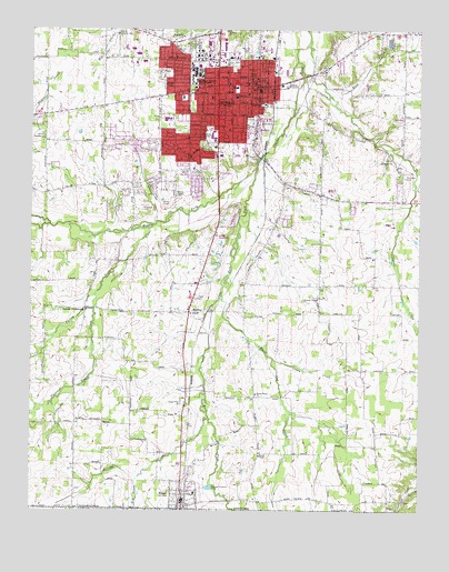
Murray, KY USGS Topographic Map
Click on map above to begin viewing in our Map Viewer.

This topographic map contains these locations and features:
Feature Name Type Latitude Longitude GNIS ID View Map
Austin SchoolSchoolN36.6098°W88.3100°486152View Map
Bakers CrossroadsPopulated PlaceN36.5523°W88.3570°507438View Map
Brandon AirdromeAirportN36.5750°W88.3117°517449View Map
Brushy CreekStreamN36.5239°W88.3178°488108View Map
Calloway CountyCivilN36.6211°W88.2722°516864View Map
Calloway County Fire and RescueBuildingN36.6018°W88.2987°2637189View Map
Calloway County Sheriff's OfficeBuildingN36.6125°W88.3061°2767656View Map
Carter SchoolSchoolN36.6073°W88.3167°489015View Map
City of HazelCivilN36.5055°W88.3253°2404668View Map
City of MurrayCivilN36.6146°W88.3207°2404343View Map
Clayton CreekStreamN36.6142°W88.2878°489601View Map
Cleanth Brooks Historical MarkerParkN36.6129°W88.3243°2744785View Map
Craigtown (historical)Populated PlaceN36.5078°W88.2813°2743619View Map
Dry CreekStreamN36.5089°W88.3400°491169View Map
East Fork Clarks RiverStreamN36.5894°W88.3026°491450View Map
East Fork Clayton CreekStreamN36.6070°W88.2792°491452View Map
East Murray (historical)Populated PlaceN36.6149°W88.2813°2743625View Map
Emmanuel ChurchChurchN36.6231°W88.3262°491766View Map
England CemeteryCemeteryN36.5781°W88.3392°491779View Map
Farley BranchStreamN36.5731°W88.3370°491983View Map
Five PointsPopulated PlaceN36.6167°W88.3292°492153View Map
Forrester CemeteryCemeteryN36.5867°W88.2546°492348View Map
Green CreekStreamN36.5395°W88.2970°493266View Map
Green Plains CemeteryCemeteryN36.5279°W88.3255°493280View Map
Green Plains ChurchChurchN36.5303°W88.3023°493281View Map
Halfway (historical)Populated PlaceN36.5661°W88.3309°2743627View Map
HazelPopulated PlaceN36.5023°W88.3259°493943View Map
Hazel CemeteryCemeteryN36.5072°W88.3230°2745825View Map
Hazel Volunteer Fire DepartmentBuildingN36.5021°W88.3256°2636370View Map
Hickory Grove (historical)Populated PlaceN36.5707°W88.2818°2743628View Map
Hoke HeliportAirportN36.5889°W88.3417°517450View Map
Hutson HeliportAirportN36.5889°W88.3345°517451View Map
Locust Grove (historical)Populated PlaceN36.5549°W88.2823°2743631View Map
Locust Grove CemeteryCemeteryN36.5555°W88.2827°2775692View Map
Locust Grove ChurchChurchN36.5551°W88.2825°496946View Map
Martin ChapelChurchN36.5817°W88.3284°497612View Map
Martin Chapel CemeteryCemeteryN36.5816°W88.3282°2775661View Map
Mason ChapelChurchN36.5145°W88.3012°497657View Map
Middle Fork Clarks RiverStreamN36.5895°W88.3025°498115View Map
MidwayPopulated PlaceN36.5514°W88.3239°508600View Map
MurrayPopulated PlaceN36.6103°W88.3148°499118View Map
Murray - Calloway County HospitalHospitalN36.6077°W88.3092°2660389View Map
Murray - Calloway County Hospital Ambulance ServiceBuildingN36.6084°W88.3089°2719093View Map
Murray CemeteryCemeteryN36.6206°W88.3061°499120View Map
Murray DivisionCivilN36.6172°W88.3136°1937165View Map
Murray Fire Department Station 1BuildingN36.6089°W88.3026°2636604View Map
Murray Fire Department Station 2BuildingN36.6064°W88.3241°2637201View Map
Murray Police DepartmentBuildingN36.6085°W88.3028°2767445View Map
Murray State UniversitySchoolN36.6155°W88.3214°499125View Map
North MurrayPopulated PlaceN36.6245°W88.3377°2743636View Map
Old Salem (historical)Populated PlaceN36.5911°W88.2591°2743637View Map
Old Salem CemeteryCemeteryN36.5926°W88.2597°2775691View Map
Old Salem ChurchChurchN36.5914°W88.2595°499879View Map
Outland (historical)Populated PlaceN36.6103°W88.2554°2743638View Map
Pleasant Grove CreekStreamN36.5523°W88.3547°500833View Map
Providence Fire StationBuildingN36.5345°W88.2734°2637191View Map
Robertson SchoolSchoolN36.6073°W88.3262°502077View Map
South MurrayPopulated PlaceN36.5848°W88.3216°2743644View Map
Steeleville (historical)Populated PlaceN36.5412°W88.2952°2743645View Map
Stone (historical)Populated PlaceN36.5656°W88.2656°2743646View Map
The Oaks Country ClubLocaleN36.6003°W88.3731°517295View Map
University High SchoolSchoolN36.6137°W88.3234°505845View Map
WBLN-FM (Murray)TowerN36.5495°W88.3312°517727View Map
West MurrayPopulated PlaceN36.5949°W88.3408°2743650View Map
White Oak CreekStreamN36.5570°W88.3137°506616View Map

Note: Coordinates in the location and feature list above are referenced to NAD83 datum.


Copyright (C) 2008-2024 Ryan Niemi / Sunset Dynamics ... All Rights Reserved