TopoQuest Logo
Do you find TopoQuest useful?
Help keep TopoQuest running and adding new maps/features by donating!
Bitcoin:  19c7KJd3qBynnjoSw5npx9KScwjBe4ifkT
Litecoin:  LXs6TkuXGGXo1vDsWCkWVdjQX94eUKd6ui
Home View Maps Find Maps Find Places Resources & Links


New Concord, Kentucky Topographic Map

USGS Map Title: New Concord, KY
USGS Map MRC: 36088E2
DRG (GeoTIFF) Download: o36088e2.tif


Neighboring USGS Topographic Map Quads:


  Dexter, KY  
36088F3
 

  Hico, KY  
36088F2
 

  Rushing Bay, TN  
36088F1
 

  Murray, KY  
36088E3
 

  New Concord, KY  
36088E2
 

  Hamlin, KY  
36088E1
 

  Puryear, TN  
36088D3
 

  Buchanan, TN  
36088D2
 

  Paris Landing, TN  
36088D1


Map MRC Location:

N37°
W89°
N37°
W88°
H8 H7 H6 H5 H4 H3 H2 H1
G8 G7 G6 G5 G4 G3 G2 G1
F8 F7 F6 F5 F4 F3 F2 F1
E8 E7 E6 E5 E4 E3 E2 E1
D8 D7 D6 D5 D4 D3 D2 D1
C8 C7 C6 C5 C4 C3 C2 C1
B8 B7 B6 B5 B4 B3 B2 B1
A8 A7 A6 A5 A4 A3 A2 A1
N36°
W89°
N36°
W88°

New Concord, KY USGS 1:24K Topographic Map Preview:
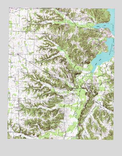
New Concord, KY USGS Topographic Map
Click on map above to begin viewing in our Map Viewer.

This topographic map contains these locations and features:
Feature Name Type Latitude Longitude GNIS ID View Map
Barnett CemeteryCemeteryN36.6156°W88.1728°486395View Map
Beechy CreekStreamN36.5712°W88.1417°486757View Map
Blood River BottomsFlatN36.5513°W88.1659°2743612View Map
Bullfrog BranchStreamN36.5039°W88.2073°488369View Map
Bullfrog HollowValleyN36.5056°W88.2091°2743613View Map
Cherry Corner (historical)Populated PlaceN36.5807°W88.2241°2743615View Map
Cherry Corner ChurchChurchN36.5809°W88.2239°489401View Map
Coleman BranchStreamN36.5009°W88.2161°489818View Map
Coleman CemeteryCemeteryN36.6049°W88.1571°489819View Map
Culpepper HollowValleyN36.5823°W88.1869°490468View Map
Devils PulpitCliffN36.5497°W88.1591°2743623View Map
Dog CreekStreamN36.5523°W88.1656°490974View Map
East Prong Beechy CreekStreamN36.5381°W88.1445°491496View Map
Egypt HollowValleyN36.5334°W88.1401°491591View Map
Fitts - Dalton CemeteryCemeteryN36.5984°W88.1959°2775694View Map
Good Shephard ChurchChurchN36.5809°W88.2373°492961View Map
Goose CreekStreamN36.5484°W88.1667°492991View Map
Hicks CemeteryCemeteryN36.5757°W88.2199°494161View Map
Knight BranchStreamN36.5528°W88.1395°495831View Map
Lassiter CemeteryCemeteryN36.6019°W88.2301°2775693View Map
Lawrence BranchStreamN36.5028°W88.2423°496071View Map
Lawson CemeteryCemeteryN36.5494°W88.1929°496085View Map
Lax CreekStreamN36.5270°W88.1706°496095View Map
Macedonia (historical)Populated PlaceN36.5093°W88.1987°2743633View Map
Macedonia ChurchChurchN36.5106°W88.1931°497406View Map
McCruiston (historical)Populated PlaceN36.5866°W88.1719°2743634View Map
McCullough ForkStreamN36.5253°W88.1709°497828View Map
New ConcordPopulated PlaceN36.5484°W88.1548°499305View Map
New Concord CemeteryCemeteryN36.5521°W88.1587°2775699View Map
New Concord DivisionCivilN36.5554°W88.1603°1937169View Map
New Concord Fire StationBuildingN36.5514°W88.1532°2637192View Map
New Hope ChurchChurchN36.5801°W88.2450°499339View Map
New ProvidencePopulated PlaceN36.5289°W88.2370°499380View Map
Outland CemeteryCemeteryN36.5623°W88.2325°500045View Map
Panther CreekStreamN36.5653°W88.1520°500152View Map
Parker CemeteryCemeteryN36.5921°W88.1503°500187View Map
Pleasant Valley ChurchChurchN36.6245°W88.2178°500923View Map
Poplar Spring (historical)Populated PlaceN36.6160°W88.1620°2743640View Map
Poplar Springs ChurchChurchN36.6148°W88.1631°501132View Map
PottertownPopulated PlaceN36.6214°W88.1911°508863View Map
Pottertown Fire StationBuildingN36.6141°W88.1767°2637190View Map
Stubblefield CemeteryCemeteryN36.5430°W88.1737°504604View Map
Sulphur Springs ChurchChurchN36.5526°W88.1567°504769View Map
Tan BranchStreamN36.5745°W88.1353°504932View Map
Wildcat CreekStreamN36.6092°W88.1317°506731View Map

Note: Coordinates in the location and feature list above are referenced to NAD83 datum.


Copyright (C) 2008-2024 Ryan Niemi / Sunset Dynamics ... All Rights Reserved