TopoQuest Logo
Do you find TopoQuest useful?
Help keep TopoQuest running and adding new maps/features by donating!
Bitcoin:  19c7KJd3qBynnjoSw5npx9KScwjBe4ifkT
Litecoin:  LXs6TkuXGGXo1vDsWCkWVdjQX94eUKd6ui
Home View Maps Find Maps Find Places Resources & Links


Nebo, Louisiana Topographic Map

USGS Map Title: Nebo, LA
USGS Map MRC: 31092E2
DRG (GeoTIFF) Download: o31092e2.tif


Neighboring USGS Topographic Map Quads:


  Little Creek, LA  
31092F3
 

  Jena West, LA  
31092F2
 

  Jena East, LA  
31092F1
 

  Fishville, LA  
31092E3
 

  Nebo, LA  
31092E2
 

  Bird Island Point, LA  
31092E1
 

  Green Gables, LA  
31092D3
 

  Holloway, LA  
31092D2
 

  Buckeye NE, LA  
31092D1


Map MRC Location:

N32°
W93°
N32°
W92°
H8 H7 H6 H5 H4 H3 H2 H1
G8 G7 G6 G5 G4 G3 G2 G1
F8 F7 F6 F5 F4 F3 F2 F1
E8 E7 E6 E5 E4 E3 E2 E1
D8 D7 D6 D5 D4 D3 D2 D1
C8 C7 C6 C5 C4 C3 C2 C1
B8 B7 B6 B5 B4 B3 B2 B1
A8 A7 A6 A5 A4 A3 A2 A1
N31°
W93°
N31°
W92°

Nebo, LA USGS 1:24K Topographic Map Preview:
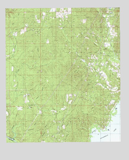
Nebo, LA USGS Topographic Map
Click on map above to begin viewing in our Map Viewer.

This topographic map contains these locations and features:
Feature Name Type Latitude Longitude GNIS ID View Map
Alligator BranchStreamN31.5349°W92.2199°532132View Map
Bacon RunStreamN31.5116°W92.1596°532267View Map
Beulah School (historical)SchoolN31.6141°W92.1843°545899View Map
Big PointCapeN31.5121°W92.1418°533099View Map
Black BranchStreamN31.6021°W92.2412°533178View Map
Boggy BendBendN31.5138°W92.1557°533291View Map
Clear BranchStreamN31.5460°W92.2340°533976View Map
Constantine BranchStreamN31.5035°W92.2432°534089View Map
Coon CemeteryCemeteryN31.5985°W92.1460°534106View Map
Frazier CemeteryCemeteryN31.5443°W92.2290°535089View Map
Gray School (historical)SchoolN31.5663°W92.2343°545923View Map
Hailey CemeteryCemeteryN31.6191°W92.1415°535485View Map
Horsepen CreekStreamN31.5421°W92.2376°535809View Map
Hurricane CemeteryCemeteryN31.5991°W92.2460°1952103View Map
Hurricane Creek Baptist ChurchChurchN31.5996°W92.2454°554813View Map
Indian BluffCliffN31.5313°W92.1326°535912View Map
Indian CreekStreamN31.5277°W92.1360°535919View Map
Little Jordan BranchStreamN31.5824°W92.1410°536568View Map
MagnoliaPopulated PlaceN31.5077°W92.2043°545942View Map
Magnolia Baptist ChurchChurchN31.5057°W92.2007°555217View Map
Magnolia CemeteryCemeteryN31.5052°W92.2004°545943View Map
Magnolia School (historical)SchoolN31.5088°W92.2046°545944View Map
Mason BranchStreamN31.5685°W92.1265°555248View Map
Mayhew HollowValleyN31.5047°W92.2419°536953View Map
Mill CreekStreamN31.6124°W92.1393°537114View Map
NeboPopulated PlaceN31.5888°W92.1418°543512View Map
Nebo Baptist ChurchChurchN31.5630°W92.1465°545949View Map
Nebo CemeteryCemeteryN31.5677°W92.1593°537535View Map
Nebo Elementary SchoolSchoolN31.5631°W92.1473°1629731View Map
Nebo-Hemphill Oil FieldOilfieldN31.5891°W92.1529°555462View Map
Norris CemeteryCemeteryN31.5127°W92.1862°537707View Map
Pound BranchStreamN31.5718°W92.1607°555717View Map
RogersPopulated PlaceN31.5324°W92.2251°555826View Map
Rogers Nebo Volunteer Fire DepartmentBuildingN31.5840°W92.1415°2672889View Map
Rogers Nebo Volunteer Fire Department Station 2BuildingN31.5260°W92.1985°2672974View Map
Rogers Oil FieldOilfieldN31.5182°W92.1821°538691View Map
Thompson BranchStreamN31.5707°W92.2176°556234View Map
Thompson CemeteryCemeteryN31.5741°W92.2179°539892View Map
United ChurchChurchN31.5957°W92.1437°540118View Map
Ward EightCivilN31.6132°W92.2171°545110View Map
West Catahoula Lake Oil FieldOilfieldN31.5482°W92.1501°540304View Map
Whatley CemeteryCemeteryN31.5171°W92.1921°540348View Map
Whiskey RunStreamN31.5146°W92.1543°545992View Map

Note: Coordinates in the location and feature list above are referenced to NAD83 datum.


Copyright (C) 2008-2024 Ryan Niemi / Sunset Dynamics ... All Rights Reserved