TopoQuest Logo
Do you find TopoQuest useful?
Help keep TopoQuest running and adding new maps/features by donating!
Bitcoin:  19c7KJd3qBynnjoSw5npx9KScwjBe4ifkT
Litecoin:  LXs6TkuXGGXo1vDsWCkWVdjQX94eUKd6ui
Home View Maps Find Maps Find Places Resources & Links


Buckeye NE, Louisiana Topographic Map

USGS Map Title: Buckeye NE, LA
USGS Map MRC: 31092D1
DRG (GeoTIFF) Download: o31092d1.tif


Neighboring USGS Topographic Map Quads:


  Nebo, LA  
31092E2
 

  Bird Island Point, LA  
31092E1
 

  Walters, LA  
31091E8
 

  Holloway, LA  
31092D2
 

  Buckeye NE, LA  
31092D1
 

  Larto Lake North, LA  
31091D8
 

  Buckeye, LA  
31092C2
 

  Powell Point, LA  
31092C1
 

  Larto Lake South, LA  
31091C8


Map MRC Location:

N32°
W93°
N32°
W92°
H8 H7 H6 H5 H4 H3 H2 H1
G8 G7 G6 G5 G4 G3 G2 G1
F8 F7 F6 F5 F4 F3 F2 F1
E8 E7 E6 E5 E4 E3 E2 E1
D8 D7 D6 D5 D4 D3 D2 D1
C8 C7 C6 C5 C4 C3 C2 C1
B8 B7 B6 B5 B4 B3 B2 B1
A8 A7 A6 A5 A4 A3 A2 A1
N31°
W93°
N31°
W92°

Buckeye NE, LA USGS 1:24K Topographic Map Preview:
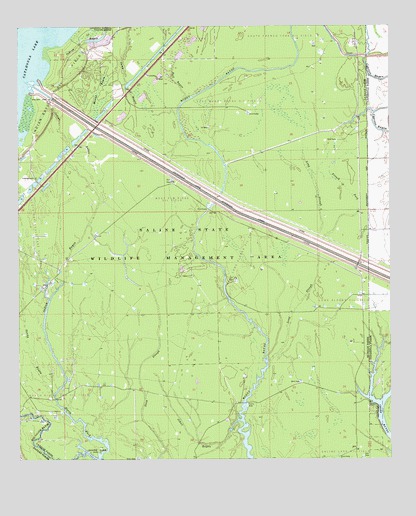
Buckeye NE, LA USGS Topographic Map
Click on map above to begin viewing in our Map Viewer.

This topographic map contains these locations and features:
Feature Name Type Latitude Longitude GNIS ID View Map
Bull BayouStreamN31.4788°W92.0690°533525View Map
Catahoula Lake Diversion CanalCanalN31.4446°W92.0471°533819View Map
Cross BayouStreamN31.3813°W92.0001°534279View Map
Cypress Bayou Oil FieldOilfieldN31.4207°W92.0146°554160View Map
Dewey W Wills State Wildlife Management AreaParkN31.4377°W92.0696°539105View Map
Duck SloughGutN31.3996°W92.0849°534638View Map
East Muddy Bayou Oil FieldOilfieldN31.4785°W92.0554°1959409View Map
French ForkGutN31.4527°W92.0143°535101View Map
French Fork Oil FieldOilfieldN31.4952°W92.0232°554480View Map
Indian BayouStreamN31.3932°W92.1135°535905View Map
Indian Bayou Oil FieldOilfieldN31.4816°W92.1124°535911View Map
Johns BayouStreamN31.3863°W92.0507°536074View Map
Long SloughStreamN31.4330°W92.0243°536716View Map
Long Slough Oil FieldOilfieldN31.4205°W92.0146°1959412View Map
Mound BayouGutN31.4818°W92.0985°537272View Map
Muddy Bayou Oil FieldOilfieldN31.4780°W92.0571°545947View Map
North Big Island Oil FieldOilfieldN31.3918°W92.1126°1959389View Map
North Fork Big Saline BayouStreamN31.3755°W92.0976°537728View Map
Sandy BayouStreamN31.3932°W92.1135°539156View Map
Sandy Bayou Oil FieldOilfieldN31.4318°W92.1132°539157View Map
South Catahoula Lake Oil FieldOilfieldN31.4405°W92.1204°1959408View Map
South Frence Fork Oil FieldOilfieldN31.4971°W92.0379°1959410View Map
West Elm Ridge Oil FieldOilfieldN31.4535°W92.0837°545989View Map
West Long Slough Oil FieldOilfieldN31.4349°W92.0490°545990View Map
West Saline Lake Oil FieldOilfieldN31.3957°W92.1085°556395View Map

Note: Coordinates in the location and feature list above are referenced to NAD83 datum.


Copyright (C) 2008-2025 Ryan Niemi / Sunset Dynamics ... All Rights Reserved