TopoQuest Logo
Do you find TopoQuest useful?
Help keep TopoQuest running and adding new maps/features by donating!
Bitcoin:  19c7KJd3qBynnjoSw5npx9KScwjBe4ifkT
Litecoin:  LXs6TkuXGGXo1vDsWCkWVdjQX94eUKd6ui
Home View Maps Find Maps Find Places Resources & Links


Neches, Texas Topographic Map

USGS Map Title: Neches, TX
USGS Map MRC: 31095G4
DRG (GeoTIFF) Download: o31095g4.tif


Neighboring USGS Topographic Map Quads:


  Pert, TX  
31095H5
 

  Todd City, TX  
31095H4
 

  Jacksonville West, TX  
31095H3
 

  Northeast Palestine, TX  
31095G5
 

  Neches, TX  
31095G4
 

  Maydelle, TX  
31095G3
 

  Southeast Palestine, TX  
31095F5
 

  Slocum, TX  
31095F4
 

  Denson Springs, TX  
31095F3


Map MRC Location:

N32°
W96°
N32°
W95°
H8 H7 H6 H5 H4 H3 H2 H1
G8 G7 G6 G5 G4 G3 G2 G1
F8 F7 F6 F5 F4 F3 F2 F1
E8 E7 E6 E5 E4 E3 E2 E1
D8 D7 D6 D5 D4 D3 D2 D1
C8 C7 C6 C5 C4 C3 C2 C1
B8 B7 B6 B5 B4 B3 B2 B1
A8 A7 A6 A5 A4 A3 A2 A1
N31°
W96°
N31°
W95°

Neches, TX USGS 1:24K Topographic Map Preview:
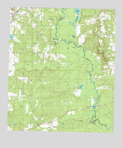
Neches, TX USGS Topographic Map
Click on map above to begin viewing in our Map Viewer.

This topographic map contains these locations and features:
Feature Name Type Latitude Longitude GNIS ID View Map
Alligator LakeLakeN31.8354°W95.4225°1889585View Map
Antioch ChurchChurchN31.7568°W95.4644°1351201View Map
Beech CreekStreamN31.7921°W95.4036°1351777View Map
Black LakeLakeN31.8346°W95.4298°1889584View Map
Buzzard SloughLakeN31.8649°W95.4209°1890041View Map
Caldwell CemeteryCemeteryN31.8638°W95.4519°1889580View Map
Daly MountainSummitN31.8735°W95.4969°1890019View Map
Dead Water LakeLakeN31.8738°W95.4200°1889586View Map
Fields ChapelChurchN31.7588°W95.4500°1357316View Map
Flint HillSummitN31.8452°W95.4672°1889579View Map
Flint Hill ChurchChurchN31.8510°W95.4683°1357484View Map
Flint Hill SchoolSchoolN31.8471°W95.4647°1357485View Map
HerringPopulated PlaceN31.7591°W95.4011°1379922View Map
Horseshoe LakeLakeN31.8426°W95.4324°1889588View Map
Hurricane CreekStreamN31.8254°W95.4116°1359852View Map
Indian PondLakeN31.7961°W95.4148°1359980View Map
JarvisPopulated PlaceN31.7552°W95.4450°1379998View Map
Killion LakeReservoirN31.7573°W95.4936°1854564View Map
Killon Lake DamDamN31.7552°W95.4936°1854563View Map
Lake DogwoodReservoirN31.8460°W95.4991°1854566View Map
Lake Dogwood DamDamN31.8452°W95.4952°1854565View Map
NechesPopulated PlaceN31.8668°W95.4958°1363629View Map
Neches Post OfficePost OfficeN31.8675°W95.4957°2731678View Map
Neches River National Wildlife RefugeParkN31.8634°W95.4182°2765422View Map
Neches Volunteer Fire DepartmentBuildingN31.8707°W95.4937°2655711View Map
Phillips LakeLakeN31.8114°W95.4075°1365147View Map
Rocky PointSummitN31.8407°W95.4430°1889583View Map
Saint Johns ChurchChurchN31.8307°W95.4616°1367188View Map
Stills CreekStreamN31.7671°W95.4063°1376310View Map
Sumac BranchStreamN31.7635°W95.4291°1369381View Map
Turtle SloughGutN31.8438°W95.4483°1889582View Map
Twin LakesLakeN31.8600°W95.4247°1889587View Map
Watts SchoolSchoolN31.7716°W95.4713°1370949View Map
White MountainSummitN31.8399°W95.3925°1889952View Map
White Oak CemeteryCemeteryN31.8635°W95.4511°1889581View Map
White Oak CreekStreamN31.8488°W95.4441°1371395View Map

Note: Coordinates in the location and feature list above are referenced to NAD83 datum.


Copyright (C) 2008-2025 Ryan Niemi / Sunset Dynamics ... All Rights Reserved