TopoQuest Logo
Do you find TopoQuest useful?
Help keep TopoQuest running and adding new maps/features by donating!
Bitcoin:  19c7KJd3qBynnjoSw5npx9KScwjBe4ifkT
Litecoin:  LXs6TkuXGGXo1vDsWCkWVdjQX94eUKd6ui
Home View Maps Find Maps Find Places Resources & Links


Slocum, Texas Topographic Map

USGS Map Title: Slocum, TX
USGS Map MRC: 31095F4
DRG (GeoTIFF) Download: o31095f4.tif


Neighboring USGS Topographic Map Quads:


  Northeast Palestine, TX  
31095G5
 

  Neches, TX  
31095G4
 

  Maydelle, TX  
31095G3
 

  Southeast Palestine, TX  
31095F5
 

  Slocum, TX  
31095F4
 

  Denson Springs, TX  
31095F3
 

  Elkhart Creek, TX  
31095E5
 

  Percilla, TX  
31095E4
 

  Augusta, TX  
31095E3


Map MRC Location:

N32°
W96°
N32°
W95°
H8 H7 H6 H5 H4 H3 H2 H1
G8 G7 G6 G5 G4 G3 G2 G1
F8 F7 F6 F5 F4 F3 F2 F1
E8 E7 E6 E5 E4 E3 E2 E1
D8 D7 D6 D5 D4 D3 D2 D1
C8 C7 C6 C5 C4 C3 C2 C1
B8 B7 B6 B5 B4 B3 B2 B1
A8 A7 A6 A5 A4 A3 A2 A1
N31°
W96°
N31°
W95°

Slocum, TX USGS 1:24K Topographic Map Preview:
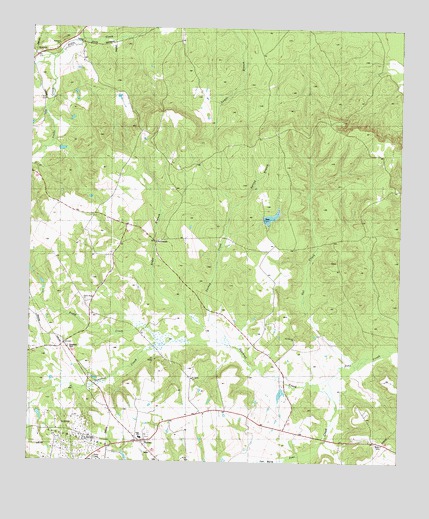
Slocum, TX USGS Topographic Map
Click on map above to begin viewing in our Map Viewer.

This topographic map contains these locations and features:
Feature Name Type Latitude Longitude GNIS ID View Map
Alder BranchStreamN31.6596°W95.4361°1889605View Map
AlderbranchPopulated PlaceN31.6888°W95.4580°1379330View Map
Asberry ChurchChurchN31.7455°W95.4913°1890043View Map
Crawford CemeteryCemeteryN31.6582°W95.4869°1355325View Map
Gal CreekStreamN31.6538°W95.3908°1357821View Map
Ioni MarshSwampN31.6255°W95.4191°1889607View Map
KossuthPopulated PlaceN31.7424°W95.4988°1380039View Map
Mays LakeReservoirN31.6468°W95.4852°1854506View Map
Mays Lake DamDamN31.6468°W95.4852°1854505View Map
Providence ChurchChurchN31.6613°W95.4099°1365821View Map
Saint James ChurchChurchN31.6493°W95.4450°1367159View Map
Sand Springs ChurchChurchN31.6871°W95.4116°1367645View Map
SlocumPopulated PlaceN31.6313°W95.4622°1368437View Map
Slocum Volunteer Fire DepartmentBuildingN31.6307°W95.4625°2655361View Map
Snake CreekStreamN31.7418°W95.4919°1368541View Map
Solcum Oil FieldOilfieldN31.6319°W95.4842°1889606View Map
Spring BranchStreamN31.6993°W95.4311°1368937View Map
Squirrel CreekStreamN31.6477°W95.4113°1369079View Map
Turkey CreekStreamN31.6549°W95.4272°1370226View Map
Union Hope ChurchChurchN31.6713°W95.4811°1889604View Map
Union Hope SchoolSchoolN31.6718°W95.4808°1370464View Map
Yellow BranchStreamN31.6407°W95.4988°1372034View Map

Note: Coordinates in the location and feature list above are referenced to NAD83 datum.


Copyright (C) 2008-2025 Ryan Niemi / Sunset Dynamics ... All Rights Reserved