TopoQuest Logo
Do you find TopoQuest useful?
Help keep TopoQuest running and adding new maps/features by donating!
Bitcoin:  19c7KJd3qBynnjoSw5npx9KScwjBe4ifkT
Litecoin:  LXs6TkuXGGXo1vDsWCkWVdjQX94eUKd6ui
Home View Maps Find Maps Find Places Resources & Links


Neosho East, Missouri Topographic Map

USGS Map Title: Neosho East, MO
USGS Map MRC: 36094G3
DRG (GeoTIFF) Download: o36094g3.tif


Neighboring USGS Topographic Map Quads:


  Tipton Ford, MO  
36094H4
 

  Granby, MO  
36094H3
 

  Newtonia, MO  
36094H2
 

  Neosho West, MO  
36094G4
 

  Neosho East, MO  
36094G3
 

  Stella, MO  
36094G2
 

  Anderson, MO  
36094F4
 

  McNatt, MO  
36094F3
 

  Bethpage, MO  
36094F2


Map MRC Location:

N37°
W95°
N37°
W94°
H8 H7 H6 H5 H4 H3 H2 H1
G8 G7 G6 G5 G4 G3 G2 G1
F8 F7 F6 F5 F4 F3 F2 F1
E8 E7 E6 E5 E4 E3 E2 E1
D8 D7 D6 D5 D4 D3 D2 D1
C8 C7 C6 C5 C4 C3 C2 C1
B8 B7 B6 B5 B4 B3 B2 B1
A8 A7 A6 A5 A4 A3 A2 A1
N36°
W95°
N36°
W94°

Neosho East, MO USGS 1:24K Topographic Map Preview:
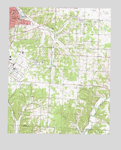
Neosho East, MO USGS Topographic Map
Click on map above to begin viewing in our Map Viewer.

This topographic map contains these locations and features:
Feature Name Type Latitude Longitude GNIS ID View Map
AromaPopulated PlaceN36.8637°W94.2647°713398View Map
Benton Elementary SchoolSchoolN36.8588°W94.3508°2709521View Map
Benton School (historical)SchoolN36.8631°W94.3638°713968View Map
Big SpringSpringN36.8696°W94.3722°714216View Map
Big Spring ParkParkN36.8692°W94.3719°714229View Map
Camp CrowderMilitaryN36.8040°W94.3583°2512055View Map
Central Elementary SchoolSchoolN36.8676°W94.3720°715683View Map
ChristopherPopulated PlaceN36.7987°W94.2897°740741View Map
Christopher School (historical)SchoolN36.7951°W94.2895°746355View Map
City of NeoshoCivilN36.8229°W94.3624°2395172View Map
Cloverleaf School (historical)SchoolN36.8309°W94.2886°746354View Map
Crowder CollegeSchoolN36.8140°W94.3680°716549View Map
Elm SpringSpringN36.8151°W94.3238°717532View Map
Elm Spring BranchStreamN36.8526°W94.3261°717537View Map
Elm Spring CemeteryCemeteryN36.8167°W94.3219°717539View Map
Five Points School (historical)SchoolN36.7670°W94.3269°746352View Map
Freeman Neosho HospitalHospitalN36.8666°W94.3696°2655020View Map
Hearrell SpringSpringN36.8623°W94.3631°719317View Map
JunePopulated PlaceN36.8012°W94.3602°739496View Map
KBTN-AM (Neosho)TowerN36.8478°W94.3202°754298View Map
Maness CemeteryCemeteryN36.7731°W94.3549°721790View Map
McMahan SpringSpringN36.8548°W94.3252°722155View Map
Monark ChurchChurchN36.8715°W94.2922°722518View Map
Monark School (historical)SchoolN36.8673°W94.2913°746353View Map
Monark SpringsPopulated PlaceN36.8645°W94.2916°722519View Map
Monark SpringsSpringN36.8630°W94.2894°722520View Map
Morse ParkParkN36.8737°W94.3574°722664View Map
NeoshoPopulated PlaceN36.8690°W94.3680°723172View Map
Neosho Fire Department Station 1BuildingN36.8706°W94.3705°2621249View Map
Neosho National Fish HatcheryParkN36.8254°W94.3236°2765424View Map
Neosho Police DepartmentBuildingN36.8710°W94.3707°2752447View Map
Neosho Post OfficePost OfficeN36.8673°W94.3684°2782900View Map
Newton County Sheriff's OfficeBuildingN36.8733°W94.3689°2752570View Map
Oak Grove ChurchChurchN36.7520°W94.2841°723577View Map
Oakgrove School (historical)SchoolN36.7523°W94.2831°2709520View Map
Pleasant Valley School (historical)SchoolN36.8523°W94.3274°746350View Map
Pottershop HollowValleyN36.7503°W94.2849°724797View Map
School Number 93 (historical)SchoolN36.7682°W94.3585°2709549View Map
Spring School (historical)SchoolN36.8170°W94.3227°746351View Map
Stuffle DamDamN36.8584°W94.2602°762974View Map
SweetwaterPopulated PlaceN36.8267°W94.2658°727384View Map
Township of BentonCivilN36.7946°W94.2710°767070View Map

Note: Coordinates in the location and feature list above are referenced to NAD83 datum.


Copyright (C) 2008-2025 Ryan Niemi / Sunset Dynamics ... All Rights Reserved