TopoQuest Logo
Do you find TopoQuest useful?
Help keep TopoQuest running and adding new maps/features by donating!
Bitcoin:  19c7KJd3qBynnjoSw5npx9KScwjBe4ifkT
Litecoin:  LXs6TkuXGGXo1vDsWCkWVdjQX94eUKd6ui
Home View Maps Find Maps Find Places Resources & Links


Neskowin, Oregon Topographic Map

USGS Map Title: Neskowin, OR
USGS Map MRC: 45123A8
DRG (GeoTIFF) Download: o45123a8.tif


Neighboring USGS Topographic Map Quads:


  Nestucca Bay, OR  
45123B8
 

  Hebo, OR  
45123B7


  Neskowin, OR  
45123A8
 

  Dolph, OR  
45123A7
 

  Lincoln City, OR  
44124H1
 

  Devils Lake, OR  
44123H8
 

  Stott Mountain, OR  
44123H7


Map MRC Location:

N46°
W124°
N46°
W123°
H8 H7 H6 H5 H4 H3 H2 H1
G8 G7 G6 G5 G4 G3 G2 G1
F8 F7 F6 F5 F4 F3 F2 F1
E8 E7 E6 E5 E4 E3 E2 E1
D8 D7 D6 D5 D4 D3 D2 D1
C8 C7 C6 C5 C4 C3 C2 C1
B8 B7 B6 B5 B4 B3 B2 B1
A8 A7 A6 A5 A4 A3 A2 A1
N45°
W124°
N45°
W123°

Neskowin, OR USGS 1:24K Topographic Map Preview:
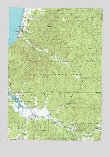
Neskowin, OR USGS Topographic Map
Click on map above to begin viewing in our Map Viewer.

This topographic map contains these locations and features:
Feature Name Type Latitude Longitude GNIS ID View Map
Baxter CreekStreamN45.0215°W123.9609°1153484View Map
Bear CreekStreamN45.0033°W123.9036°1137690View Map
Butte CreekStreamN45.1065°W123.9801°1139054View Map
Calkins CreekStreamN45.0409°W123.9484°1139472View Map
Cascade Experimental Forest HeadquartersLocaleN45.0340°W123.9234°1135106View Map
Cascade Head Experimental ForestForestN45.0623°W123.9540°1851761View Map
Cascade Head Scenic Research AreaParkN45.0509°W123.9801°1155906View Map
Chinook Winds Golf ResortLocaleN45.0040°W123.9859°1163808View Map
Chitwood FallsFallsN45.0740°W123.9937°1153478View Map
Crowley CreekStreamN45.0407°W123.9923°1140490View Map
Curl CreekStreamN45.0123°W123.9234°1153479View Map
Deer CreekStreamN45.0233°W123.9503°1140830View Map
Deer Creek LakeReservoirN45.0320°W123.9258°1153487View Map
Devils Lake Post Office (historical)Post OfficeN45.0015°W123.9790°1164315View Map
Emma Post Office (historical)Post OfficeN45.0609°W123.9034°1165217View Map
Fall CreekStreamN45.0859°W123.9615°1158227View Map
Fox CreekStreamN45.1193°W123.8776°1153473View Map
Frazer CreekStreamN45.0301°W123.9776°1120960View Map
Gardner CreekStreamN45.0332°W123.9254°1158875View Map
George R Vogel Group CampLocaleN45.0598°W123.9009°1146785View Map
Green PointCapeN45.0418°W123.8882°1143050View Map
Hawk CreekStreamN45.1062°W123.9804°1143372View Map
Hawk Creek Golf CourseLocaleN45.1030°W123.9759°2554106View Map
Jim CreekStreamN45.0740°W123.9296°1144272View Map
Kingston CreekStreamN45.0587°W123.9029°1144626View Map
Kiwanda CreekStreamN45.1012°W123.9832°1153468View Map
Knight County ParkParkN45.0415°W123.9915°1153526View Map
Knight ParkLocaleN45.0406°W123.9934°2668382View Map
Lake NeskowinLakeN45.1208°W123.9724°1158674View Map
Lewis CreekStreamN45.0712°W123.9234°1144968View Map
Marx Post Office (historical)Post OfficeN45.0848°W123.9515°1165591View Map
McMillin CreekStreamN45.0053°W123.8900°1153480View Map
Mink CreekStreamN45.0304°W123.9771°1153525View Map
Morton CreekStreamN45.0040°W123.9043°1153482View Map
NeotsuPopulated PlaceN45.0012°W123.9812°1146779View Map
Neotsu Post OfficePost OfficeN45.0012°W123.9869°1165695View Map
NeskowinPopulated PlaceN45.1068°W123.9843°1146783View Map
Neskowin BeachBeachN45.1012°W123.9859°1153469View Map
Neskowin Beach State Recreation SiteParkN45.1021°W123.9854°1135107View Map
Neskowin Census Designated PlaceCensusN45.1208°W123.9763°2408914View Map
Neskowin CreekStreamN45.0998°W123.9871°1146784View Map
Neskowin CrestSummitN45.1141°W123.9729°1146786View Map
Neskowin Marsh Golf CourseLocaleN45.1068°W123.9790°1163809View Map
Neskowin Natural AreaParkN45.0812°W123.9901°1146787View Map
Neskowin Post OfficePost OfficeN45.1068°W123.9843°1165696View Map
Neskowin Regional Sanitary AuthorityLocaleN45.0978°W123.9776°2660733View Map
Neskowin Valley SchoolSchoolN45.0736°W123.9254°2487508View Map
Nestucca Rural Fire Protection District Station 84 NeskowinBuildingN45.1073°W123.9775°2577012View Map
North Fork Panther CreekStreamN45.0184°W123.8929°1153481View Map
North Lincoln Fire and Rescue District 1 Station 1200 Rose LodgeBuildingN45.0100°W123.8807°2576897View Map
North Lincoln Fire and Rescue District 1 Station 1300 OtisBuildingN45.0245°W123.9471°2576804View Map
OtisPopulated PlaceN45.0243°W123.9465°1147282View Map
Otis JunctionLocaleN45.0193°W123.9484°1147285View Map
Otis Post OfficePost OfficeN45.0243°W123.9465°1165751View Map
Otis School (historical)SchoolN45.0248°W123.9471°1162234View Map
Panther CreekStreamN45.0087°W123.9173°1147393View Map
Panther CreekLocaleN45.0096°W123.9151°1153483View Map
Proposal RockIslandN45.1015°W123.9871°1148013View Map
Prospect CreekStreamN45.0798°W123.9440°1148015View Map
Rose LodgePopulated PlaceN45.0104°W123.8804°1148732View Map
Rose Lodge Census Designated PlaceCensusN45.0187°W123.8882°2409209View Map
Rose Lodge Post OfficePost OfficeN45.0104°W123.8804°1165883View Map
Rose Lodge School (historical)SchoolN45.0104°W123.8846°1162235View Map
Rowdy CreekStreamN45.0315°W123.9865°1148811View Map
Salmon CreekStreamN45.0309°W123.9701°1148971View Map
Salmon River HatcheryLocaleN45.0172°W123.9383°2554107View Map
Slick Rock CreekStreamN45.0121°W123.8851°1149686View Map
Sloan CreekStreamN45.0693°W123.9187°1149726View Map
Sutton CreekStreamN45.0582°W123.8990°1153466View Map
Telephone CreekStreamN45.0448°W123.9465°1153524View Map
Three RocksPopulated PlaceN45.0446°W123.9993°1151175View Map
Toketa CreekStreamN45.0373°W123.9179°1151297View Map
Tooze CreekStreamN45.0448°W123.9879°1130670View Map
West Fork Austin CreekStreamN45.1159°W123.8832°1152050View Map
Willis CreekStreamN45.0146°W123.9348°1152400View Map
Yach Post Office (historical)Post OfficeN45.1212°W123.8790°1166217View Map

Note: Coordinates in the location and feature list above are referenced to NAD83 datum.


Copyright (C) 2008-2024 Ryan Niemi / Sunset Dynamics ... All Rights Reserved