TopoQuest Logo
Do you find TopoQuest useful?
Help keep TopoQuest running and adding new maps/features by donating!
Bitcoin:  19c7KJd3qBynnjoSw5npx9KScwjBe4ifkT
Litecoin:  LXs6TkuXGGXo1vDsWCkWVdjQX94eUKd6ui
Home View Maps Find Maps Find Places Resources & Links


Dolph, Oregon Topographic Map

USGS Map Title: Dolph, OR
USGS Map MRC: 45123A7
DRG (GeoTIFF) Download: o45123a7.tif


Neighboring USGS Topographic Map Quads:


  Nestucca Bay, OR  
45123B8
 

  Hebo, OR  
45123B7
 

  Niagara Creek, OR  
45123B6
 

  Neskowin, OR  
45123A8
 

  Dolph, OR  
45123A7
 

  Midway, OR  
45123A6
 

  Devils Lake, OR  
44123H8
 

  Stott Mountain, OR  
44123H7
 

  Warnicke Creek, OR  
44123H6


Map MRC Location:

N46°
W124°
N46°
W123°
H8 H7 H6 H5 H4 H3 H2 H1
G8 G7 G6 G5 G4 G3 G2 G1
F8 F7 F6 F5 F4 F3 F2 F1
E8 E7 E6 E5 E4 E3 E2 E1
D8 D7 D6 D5 D4 D3 D2 D1
C8 C7 C6 C5 C4 C3 C2 C1
B8 B7 B6 B5 B4 B3 B2 B1
A8 A7 A6 A5 A4 A3 A2 A1
N45°
W124°
N45°
W123°

Dolph, OR USGS 1:24K Topographic Map Preview:
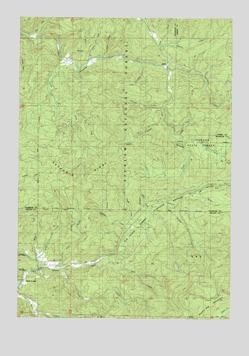
Dolph, OR USGS Topographic Map
Click on map above to begin viewing in our Map Viewer.

This topographic map contains these locations and features:
Feature Name Type Latitude Longitude GNIS ID View Map
Alder BrookStreamN45.0201°W123.8551°1137057View Map
Baxter CreekStreamN45.1112°W123.7940°1137606View Map
Bear CreekStreamN45.1171°W123.8746°1137691View Map
Bear CreekStreamN45.0690°W123.7629°1158119View Map
Boulder CreekStreamN45.0462°W123.7879°1138468View Map
Boyer Post Office (historical)Post OfficeN45.0415°W123.8096°1164232View Map
Cedar CreekStreamN45.1062°W123.8032°1139507View Map
Conklin CreekStreamN45.0771°W123.7859°1140036View Map
Deer CreekStreamN45.0257°W123.8221°1140831View Map
DolphLocaleN45.1057°W123.7898°1158211View Map
Dolph Post Office (historical)Post OfficeN45.1057°W123.7898°1165169View Map
Fall CreekStreamN45.0721°W123.7834°1141972View Map
Gunaldo FallsFallsN45.1040°W123.7740°1638893View Map
H B Van Duzer Forest State Scenic CorridorParkN45.0443°W123.8026°1151724View Map
Hiack CreekStreamN45.0832°W123.7921°1143525View Map
Indian CreekStreamN45.0459°W123.7990°1144028View Map
Judson CreekStreamN45.1076°W123.8346°1154251View Map
Kautz CreekStreamN45.0840°W123.8443°1144495View Map
Little CreekStreamN45.0201°W123.8582°1153523View Map
Little Nestucca Camp (historical)LocaleN45.1171°W123.8604°1153471View Map
Little Salmon RiverStreamN45.0518°W123.7762°1145248View Map
Louie CreekStreamN45.1129°W123.7946°1145573View Map
McAllister CreekStreamN45.0234°W123.8290°1153521View Map
McKnight CreekStreamN45.1082°W123.8521°1146013View Map
Muscott BridgeBridgeN45.1109°W123.8534°1162232View Map
Muscott CreekStreamN45.1109°W123.8437°1153474View Map
Neskowin RidgeRidgeN45.0546°W123.8368°1146788View Map
Pitner Post Office (historical)Post OfficeN45.0529°W123.7712°1164601View Map
Prairie CreekStreamN45.0393°W123.8084°1147978View Map
Salmon River Guard StationLocaleN45.0559°W123.7659°1148985View Map
Salmon River State Forest Service StationLocaleN45.0562°W123.7657°1167201View Map
Small CreekStreamN45.1087°W123.8273°1149742View Map
Sourgrass CreekStreamN45.1029°W123.7876°1149893View Map
South Fork Little Nestucca RiverStreamN45.1068°W123.8504°1149986View Map
Stillwell CreekStreamN45.0878°W123.7894°1150434View Map
Sulphur CreekStreamN45.0365°W123.8123°1150579View Map
Swampy CreekStreamN45.0248°W123.8262°1153522View Map
Treat RiverStreamN45.0201°W123.8504°1151409View Map
Trout CreekStreamN45.0009°W123.8643°1151445View Map
Weed BridgeBridgeN45.1085°W123.8240°1162233View Map
West Fork Salmon RiverStreamN45.0204°W123.8634°1152110View Map
Widow CreekStreamN45.0248°W123.8654°1163350View Map
Yach BridgeBridgeN45.1165°W123.8657°1162231View Map

Note: Coordinates in the location and feature list above are referenced to NAD83 datum.


Copyright (C) 2008-2025 Ryan Niemi / Sunset Dynamics ... All Rights Reserved