TopoQuest Logo
Do you find TopoQuest useful?
Help keep TopoQuest running and adding new maps/features by donating!
Bitcoin:  19c7KJd3qBynnjoSw5npx9KScwjBe4ifkT
Litecoin:  LXs6TkuXGGXo1vDsWCkWVdjQX94eUKd6ui
Home View Maps Find Maps Find Places Resources & Links


Stott Mountain, Oregon Topographic Map

USGS Map Title: Stott Mountain, OR
USGS Map MRC: 44123H7
DRG (GeoTIFF) Download: o44123h7.tif


Neighboring USGS Topographic Map Quads:


  Neskowin, OR  
45123A8
 

  Dolph, OR  
45123A7
 

  Midway, OR  
45123A6
 

  Devils Lake, OR  
44123H8
 

  Stott Mountain, OR  
44123H7
 

  Warnicke Creek, OR  
44123H6
 

  Mowrey Landing, OR  
44123G8
 

  Euchre Mountain, OR  
44123G7
 

  Valsetz, OR  
44123G6


Map MRC Location:

N45°
W124°
N45°
W123°
H8 H7 H6 H5 H4 H3 H2 H1
G8 G7 G6 G5 G4 G3 G2 G1
F8 F7 F6 F5 F4 F3 F2 F1
E8 E7 E6 E5 E4 E3 E2 E1
D8 D7 D6 D5 D4 D3 D2 D1
C8 C7 C6 C5 C4 C3 C2 C1
B8 B7 B6 B5 B4 B3 B2 B1
A8 A7 A6 A5 A4 A3 A2 A1
N44°
W124°
N44°
W123°

Stott Mountain, OR USGS 1:24K Topographic Map Preview:
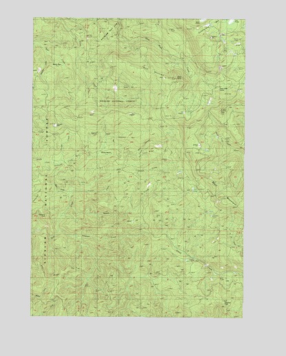
Stott Mountain, OR USGS Topographic Map
Click on map above to begin viewing in our Map Viewer.

This topographic map contains these locations and features:
Feature Name Type Latitude Longitude GNIS ID View Map
Bald MountainRidgeN44.9771°W123.8087°1137446View Map
Barn CreekStreamN44.9248°W123.8529°1137528View Map
Box CanyonValleyN44.9393°W123.8198°1138527View Map
Cougar MountainSummitN44.9554°W123.8626°1140237View Map
Diamond PeakSummitN44.9171°W123.8668°1141005View Map
Elk RidgeRidgeN44.9432°W123.8073°1141794View Map
Elk WallowBasinN44.9629°W123.7901°1141801View Map
Four Cabin CornerPopulated PlaceN44.9646°W123.7676°1142353View Map
Fowler CreekStreamN44.9271°W123.8509°1142380View Map
Hogback MountainRidgeN44.9490°W123.8157°1143647View Map
Horner CreekStreamN44.9390°W123.8679°1143735View Map
Horner RanchLocaleN44.9443°W123.8287°1143736View Map
Jeeter PrairieSwampN44.9999°W123.7754°1144236View Map
Lost PrairieSwampN44.9986°W123.7589°1145557View Map
McMullen CreekStreamN44.9804°W123.8596°1153650View Map
Minski PlaceLocaleN44.9798°W123.8587°1146345View Map
Nelson CreekStreamN44.9382°W123.8215°1146769View Map
Pea RidgeRidgeN44.8915°W123.8673°1147518View Map
Rocky PointSummitN44.9746°W123.7912°1148671View Map
Saddle Bag MountainSummitN44.9916°W123.7784°1148917View Map
Sampson CreekStreamN44.9098°W123.8593°1149014View Map
Seven-Nine TrailTrailN44.9668°W123.7659°1149254View Map
Side Camp (historical)LocaleN44.8832°W123.7734°1153649View Map
Smith CreekStreamN44.9204°W123.8534°1149748View Map
Stott MountainRidgeN44.9248°W123.7643°1150461View Map
Suncrest PointSummitN44.8821°W123.7634°1134924View Map
Suncrest Point LookoutLocaleN44.8809°W123.7623°1150655View Map

Note: Coordinates in the location and feature list above are referenced to NAD83 datum.


Copyright (C) 2008-2024 Ryan Niemi / Sunset Dynamics ... All Rights Reserved