TopoQuest Logo
Do you find TopoQuest useful?
Help keep TopoQuest running and adding new maps/features by donating!
Bitcoin:  19c7KJd3qBynnjoSw5npx9KScwjBe4ifkT
Litecoin:  LXs6TkuXGGXo1vDsWCkWVdjQX94eUKd6ui
Home View Maps Find Maps Find Places Resources & Links


New Harmony, Utah Topographic Map

USGS Map Title: New Harmony, UT
USGS Map MRC: 37113D3
DRG (GeoTIFF) Download: o37113d3.tif


Neighboring USGS Topographic Map Quads:


  Page Ranch, UT  
37113E4
 

  Stoddard Mountain, UT  
37113E3
 

  Kanarraville, UT  
37113E2
 

  Grass Valley, UT  
37113D4
 

  New Harmony, UT  
37113D3
 

  Kolob Arch, UT  
37113D2
 

  Signal Peak, UT  
37113C4
 

  Pintura, UT  
37113C3
 

  Smith Mesa, UT  
37113C2


Map MRC Location:

N38°
W114°
N38°
W113°
H8 H7 H6 H5 H4 H3 H2 H1
G8 G7 G6 G5 G4 G3 G2 G1
F8 F7 F6 F5 F4 F3 F2 F1
E8 E7 E6 E5 E4 E3 E2 E1
D8 D7 D6 D5 D4 D3 D2 D1
C8 C7 C6 C5 C4 C3 C2 C1
B8 B7 B6 B5 B4 B3 B2 B1
A8 A7 A6 A5 A4 A3 A2 A1
N37°
W114°
N37°
W113°

New Harmony, UT USGS 1:24K Topographic Map Preview:
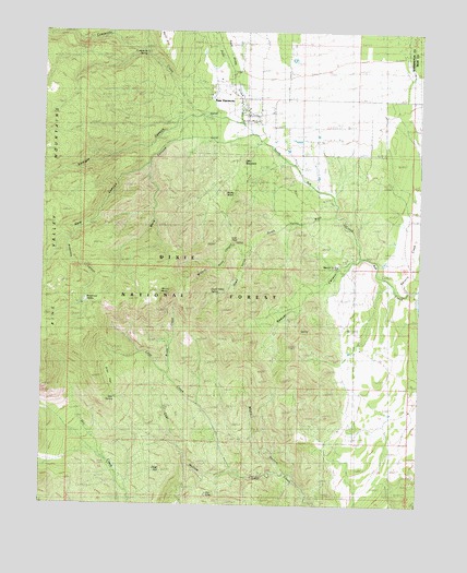
New Harmony, UT USGS Topographic Map
Click on map above to begin viewing in our Map Viewer.

This topographic map contains these locations and features:
Feature Name Type Latitude Longitude GNIS ID View Map
Anderson CanyonValleyN37.4444°W113.3669°1438208View Map
Anderson ValleyBasinN37.4314°W113.3552°1438220View Map
Anderson Valley TrailTrailN37.4378°W113.3425°1450051View Map
Browse Area Guard StationLocaleN37.3855°W113.3536°1439179View Map
Brush CreekStreamN37.4094°W113.3338°1439188View Map
Bumblebee CanyonValleyN37.4916°W113.2966°1439319View Map
Burnt RidgeRidgeN37.4572°W113.3591°1451201View Map
Coal HillSummitN37.3825°W113.3352°1439836View Map
Coal Hill RidgeRidgeN37.3916°W113.3263°1451216View Map
Coal HollowValleyN37.3830°W113.2966°1439837View Map
Comanche CanyonValleyN37.4994°W113.3661°1439904View Map
Comanche CreekStreamN37.4789°W113.3255°1439905View Map
Comanche SpringSpringN37.4950°W113.3432°1439906View Map
Comanche TrailTrailN37.4816°W113.3597°1450049View Map
Dam CanyonValleyN37.4647°W113.3419°1440242View Map
Death ValleyValleyN37.4433°W113.3063°1440331View Map
Death Valley SpringSpringN37.4308°W113.3197°1448331View Map
Death Valley WashValleyN37.4508°W113.2850°1444232View Map
Dry LakeLakeN37.3775°W113.3208°1440659View Map
Flat Top MountainSummitN37.4519°W113.3694°1441140View Map
Harmony Valley Fire DistrictBuildingN37.4783°W113.3051°2627321View Map
Kanarra CreekStreamN37.4319°W113.2541°1442268View Map
Leep Creek TrailTrailN37.4130°W113.3555°1449970View Map
Little MountainSummitN37.4658°W113.3100°1448607View Map
Low PassGapN37.4453°W113.3138°1442991View Map
Main CanyonValleyN37.4714°W113.3316°1443099View Map
Maple HollowValleyN37.3847°W113.2947°1443169View Map
Mount BaldySummitN37.4314°W113.3363°1438369View Map
New HarmonyPopulated PlaceN37.4794°W113.3097°1443808View Map
New Harmony CemeteryCemeteryN37.4794°W113.3002°1448738View Map
New Harmony Post OfficePost OfficeN37.4797°W113.3081°1455425View Map
New Harmony TrailheadTrailN37.4825°W113.3041°1449969View Map
North Ash CreekStreamN37.4403°W113.2697°1443844View Map
Pace DrawValleyN37.4875°W113.3113°1444145View Map
Pass CanyonValleyN37.4494°W113.2900°1455688View Map
Pinto CreekStreamN37.4758°W113.3097°1444430View Map
Red Butte CanyonValleyN37.4897°W113.2652°1444766View Map
Rocky KnollSummitN37.4575°W113.3158°1448935View Map
Sawyer CanyonValleyN37.4405°W113.2700°1445360View Map
Sawyer SpringSpringN37.4380°W113.2772°1445362View Map
Straight CanyonValleyN37.4769°W113.3297°1446171View Map
Syler FlatFlatN37.4086°W113.3530°1445363View Map
Syler SpringSpringN37.4036°W113.3525°1445364View Map
The Church of Jesus Christ of Latter Day SaintsChurchN37.4778°W113.3086°1455657View Map
Town of New HarmonyCivilN37.4803°W113.3097°2413044View Map
Willard Road CanyonValleyN37.4436°W113.3036°1449198View Map

Note: Coordinates in the location and feature list above are referenced to NAD83 datum.


Copyright (C) 2008-2025 Ryan Niemi / Sunset Dynamics ... All Rights Reserved