TopoQuest Logo
Do you find TopoQuest useful?
Help keep TopoQuest running and adding new maps/features by donating!
Bitcoin:  19c7KJd3qBynnjoSw5npx9KScwjBe4ifkT
Litecoin:  LXs6TkuXGGXo1vDsWCkWVdjQX94eUKd6ui
Home View Maps Find Maps Find Places Resources & Links


Stoddard Mountain, Utah Topographic Map

USGS Map Title: Stoddard Mountain, UT
USGS Map MRC: 37113E3
DRG (GeoTIFF) Download: o37113e3.tif


Neighboring USGS Topographic Map Quads:


  Silver Peak, UT  
37113F4
 

  Desert Mound, UT  
37113F3
 

  Cedar City NW, UT  
37113F2
 

  Page Ranch, UT  
37113E4
 

  Stoddard Mountain, UT  
37113E3
 

  Kanarraville, UT  
37113E2
 

  Grass Valley, UT  
37113D4
 

  New Harmony, UT  
37113D3
 

  Kolob Arch, UT  
37113D2


Map MRC Location:

N38°
W114°
N38°
W113°
H8 H7 H6 H5 H4 H3 H2 H1
G8 G7 G6 G5 G4 G3 G2 G1
F8 F7 F6 F5 F4 F3 F2 F1
E8 E7 E6 E5 E4 E3 E2 E1
D8 D7 D6 D5 D4 D3 D2 D1
C8 C7 C6 C5 C4 C3 C2 C1
B8 B7 B6 B5 B4 B3 B2 B1
A8 A7 A6 A5 A4 A3 A2 A1
N37°
W114°
N37°
W113°

Stoddard Mountain, UT USGS 1:24K Topographic Map Preview:
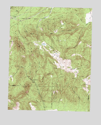
Stoddard Mountain, UT USGS Topographic Map
Click on map above to begin viewing in our Map Viewer.

This topographic map contains these locations and features:
Feature Name Type Latitude Longitude GNIS ID View Map
Aspen SpringSpringN37.5946°W113.3498°1438293View Map
Bald HillSummitN37.5089°W113.3438°1438346View Map
Broad HollowValleyN37.5025°W113.3038°1439134View Map
Bumblebee LakeLakeN37.5512°W113.2720°1439320View Map
Bumblebee SpringSpringN37.5512°W113.2772°1439321View Map
Cottonwood CanyonValleyN37.6119°W113.3155°1439987View Map
Cottonwood SpringSpringN37.5934°W113.3141°1440039View Map
Crystal SpringsSpringN37.6192°W113.3675°1440183View Map
Culbert CanyonValleyN37.5386°W113.3427°1440189View Map
Dry LakeLakeN37.5799°W113.3230°1440660View Map
Dry Lakes TrailTrailN37.5716°W113.3347°1449990View Map
Duncan CanyonValleyN37.6139°W113.3175°1440712View Map
Duncan Canyon TrailTrailN37.5844°W113.3591°1440714View Map
Duncan MountainSummitN37.5916°W113.3427°1440718View Map
Duncan SpringSpringN37.5798°W113.3516°1440720View Map
Five Pines CanyonValleyN37.5286°W113.3308°1441097View Map
Flat Top MountainSummitN37.6016°W113.2966°1441136View Map
Granite MountainSummitN37.5286°W113.3475°1441413View Map
Harmony MountainsRangeN37.5615°W113.3042°1441604View Map
Hidden SpringSpringN37.5512°W113.3021°1441745View Map
Horse HollowValleyN37.6069°W113.2613°1441876View Map
Iron Mountain WyeLocaleN37.6114°W113.3675°1442052View Map
Kelsey Deer CampLocaleN37.5364°W113.3391°1442297View Map
Kelsey Mare HollowValleyN37.5222°W113.2938°1442298View Map
Left Quichapa CanyonValleyN37.6008°W113.2627°1442552View Map
Lime SpringSpringN37.5417°W113.2967°1442607View Map
Lower Water SpringSpringN37.5327°W113.2612°1443031View Map
Maple SpringSpringN37.5395°W113.2738°1443179View Map
Pace CanyonValleyN37.5353°W113.3352°1444144View Map
Pole CanyonValleyN37.6089°W113.3522°1444512View Map
Right Quichapa CanyonValleyN37.6014°W113.2633°1444979View Map
Rock SpringSpringN37.5575°W113.3105°1445087View Map
Stoddard CanyonValleyN37.6075°W113.3608°1446154View Map
Stoddard MountainSummitN37.5764°W113.3597°1446158View Map
Willow SpringSpringN37.5849°W113.2988°1447430View Map

Note: Coordinates in the location and feature list above are referenced to NAD83 datum.


Copyright (C) 2008-2024 Ryan Niemi / Sunset Dynamics ... All Rights Reserved