TopoQuest Logo
Do you find TopoQuest useful?
Help keep TopoQuest running and adding new maps/features by donating!
Bitcoin:  19c7KJd3qBynnjoSw5npx9KScwjBe4ifkT
Litecoin:  LXs6TkuXGGXo1vDsWCkWVdjQX94eUKd6ui
Home View Maps Find Maps Find Places Resources & Links


Grass Valley, Utah Topographic Map

USGS Map Title: Grass Valley, UT
USGS Map MRC: 37113D4
DRG (GeoTIFF) Download: o37113d4.tif


Neighboring USGS Topographic Map Quads:


  Pinto, UT  
37113E5
 

  Page Ranch, UT  
37113E4
 

  Stoddard Mountain, UT  
37113E3
 

  Central East, UT  
37113D5
 

  Grass Valley, UT  
37113D4
 

  New Harmony, UT  
37113D3
 

  Saddle Mountain, UT  
37113C5
 

  Signal Peak, UT  
37113C4
 

  Pintura, UT  
37113C3


Map MRC Location:

N38°
W114°
N38°
W113°
H8 H7 H6 H5 H4 H3 H2 H1
G8 G7 G6 G5 G4 G3 G2 G1
F8 F7 F6 F5 F4 F3 F2 F1
E8 E7 E6 E5 E4 E3 E2 E1
D8 D7 D6 D5 D4 D3 D2 D1
C8 C7 C6 C5 C4 C3 C2 C1
B8 B7 B6 B5 B4 B3 B2 B1
A8 A7 A6 A5 A4 A3 A2 A1
N37°
W114°
N37°
W113°

Grass Valley, UT USGS 1:24K Topographic Map Preview:
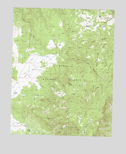
Grass Valley, UT USGS Topographic Map
Click on map above to begin viewing in our Map Viewer.

This topographic map contains these locations and features:
Feature Name Type Latitude Longitude GNIS ID View Map
Bare ValleyBasinN37.4278°W113.4088°1425284View Map
Bark HollowValleyN37.4194°W113.4619°1437305View Map
Bench SpringSpringN37.4620°W113.4446°1425422View Map
Bens PastureFlatN37.4844°W113.3880°1449959View Map
Big PointSummitN37.4141°W113.3808°1438717View Map
Big WaterLakeN37.4934°W113.3956°1425572View Map
Burnt CanyonValleyN37.4614°W113.3758°1439185View Map
Cougar CanyonValleyN37.4555°W113.4430°1426969View Map
Dry FlatFlatN37.4839°W113.4419°1449961View Map
First WaterLakeN37.4128°W113.4383°1427953View Map
First Water SpringSpringN37.4128°W113.4381°1455686View Map
Gardner PeakSummitN37.3911°W113.4522°1428143View Map
Gardner Peak TrailTrailN37.3922°W113.4825°1449956View Map
Gardner RanchLocaleN37.4453°W113.4513°1428144View Map
Grass Valley DamDamN37.4194°W113.4947°1434623View Map
Grass Valley ReservoirReservoirN37.4173°W113.4963°1430698View Map
Grass Valley TrailTrailN37.4791°W113.4138°1441434View Map
Grassy Flat CanyonValleyN37.4978°W113.4891°1441443View Map
Hop CanyonValleyN37.3791°W113.4447°1441841View Map
Jodes FlatFlatN37.3978°W113.4608°1429177View Map
Jodes FlatFlatN37.4422°W113.4266°1435773View Map
Juniper Park CampgroundLocaleN37.3755°W113.4627°1454781View Map
Left Fork Santa Clara RiverStreamN37.3764°W113.4625°1429547View Map
Lower Pines CampgroundLocaleN37.3778°W113.4661°1454807View Map
Mahogany PointCapeN37.4914°W113.4063°1430046View Map
Main CanyonValleyN37.4450°W113.4458°1430058View Map
Middle Fork Santa Clara RiverStreamN37.3755°W113.4633°1443353View Map
Middle Fork Water CanyonValleyN37.4122°W113.4677°1430284View Map
Mill CanyonValleyN37.4522°W113.4436°1430322View Map
Mill Canyon TrailheadLocaleN37.4553°W113.4566°1449963View Map
Mill FlatFlatN37.4325°W113.3841°1430327View Map
Nay CanyonValleyN37.3791°W113.4780°1443769View Map
North ValleyValleyN37.3878°W113.4027°1430873View Map
Pine RidgeRidgeN37.3930°W113.4408°1431266View Map
Pine Valley Forest Service FacilityLocaleN37.3800°W113.4730°1450026View Map
Pine Valley Mountain WildernessReserveN37.3865°W113.4237°1450050View Map
Pine Valley MountainsRangeN37.4025°W113.3911°1444416View Map
Pine Valley Recreation AreaParkN37.3833°W113.4794°1454862View Map
Pine Valley ReservoirReservoirN37.3787°W113.4745°1434617View Map
Pine Valley Reservoir DamDamN37.3786°W113.4763°1434618View Map
Pines CampgroundLocaleN37.3769°W113.4611°1449957View Map
Ponderosa CampgroundLocaleN37.3786°W113.4711°1454865View Map
Rencher RanchLocaleN37.4528°W113.4550°1431749View Map
Reservoir CanyonValleyN37.4291°W113.4380°1431754View Map
Reservoir Canyon TrailTrailN37.4350°W113.4361°1449964View Map
Right Fork Water CanyonValleyN37.4119°W113.4738°1431819View Map
Second WaterLakeN37.4193°W113.4240°1432304View Map
Second Water SpringSpringN37.4164°W113.4247°1455685View Map
Sheep Pen SpringSpringN37.4653°W113.3850°1454892View Map
Sheep PensBasinN37.4636°W113.3894°1432382View Map
Slew SpringSpringN37.4961°W113.4170°1432538View Map
Spring HollowValleyN37.4439°W113.4505°1432852View Map
Squaw CanyonValleyN37.3816°W113.4786°1446069View Map
Teds PastureFlatN37.4230°W113.3930°1433212View Map
The BenchBenchN37.4155°W113.4441°1433262View Map
Timber MountainSummitN37.4708°W113.3961°1433528View Map
Upper Pines CampgroundLocaleN37.3786°W113.4716°1449958View Map
Water CanyonValleyN37.4147°W113.4886°1433994View Map
Water Canyon TrailTrailN37.4289°W113.4044°1449960View Map
West ValleyValleyN37.3875°W113.4158°1434126View Map
Whipple ValleyBasinN37.3780°W113.4108°1434146View Map
White Rocks DrawValleyN37.4558°W113.4452°1434199View Map
White Rocks ReservoirReservoirN37.4842°W113.4108°1434200View Map
White Rocks TrailTrailN37.4711°W113.4236°1449962View Map
Wide HollowValleyN37.4300°W113.4725°1425285View Map
Wood BenchBenchN37.4644°W113.4533°1434442View Map

Note: Coordinates in the location and feature list above are referenced to NAD83 datum.


Copyright (C) 2008-2025 Ryan Niemi / Sunset Dynamics ... All Rights Reserved