TopoQuest Logo
Do you find TopoQuest useful?
Help keep TopoQuest running and adding new maps/features by donating!
Bitcoin:  19c7KJd3qBynnjoSw5npx9KScwjBe4ifkT
Litecoin:  LXs6TkuXGGXo1vDsWCkWVdjQX94eUKd6ui
Home View Maps Find Maps Find Places Resources & Links


Rosholt, Wisconsin Topographic Map

USGS Map Title: Rosholt, WI
USGS Map MRC: 44089F3
DRG (GeoTIFF) Download: o44089f3.tif


Neighboring USGS Topographic Map Quads:


  Bevent, WI  
44089G4
 

  Mission Lake, WI  
44089G3
 

  Wittenberg, WI  
44089G2
 

  Rosholt NW, WI  
44089F4
 

  Rosholt, WI  
44089F3
 

  Tigerton NW, WI  
44089F2
 

  Polonia, WI  
44089E4
 

  New Hope, WI  
44089E3
 

  Iola, WI  
44089E2


Map MRC Location:

N45°
W90°
N45°
W89°
H8 H7 H6 H5 H4 H3 H2 H1
G8 G7 G6 G5 G4 G3 G2 G1
F8 F7 F6 F5 F4 F3 F2 F1
E8 E7 E6 E5 E4 E3 E2 E1
D8 D7 D6 D5 D4 D3 D2 D1
C8 C7 C6 C5 C4 C3 C2 C1
B8 B7 B6 B5 B4 B3 B2 B1
A8 A7 A6 A5 A4 A3 A2 A1
N44°
W90°
N44°
W89°

Rosholt, WI USGS 1:24K Topographic Map Preview:
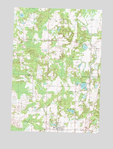
Rosholt, WI USGS Topographic Map
Click on map above to begin viewing in our Map Viewer.

This topographic map contains these locations and features:
Feature Name Type Latitude Longitude GNIS ID View Map
AlbanPopulated PlaceN44.6278°W89.2848°1560725View Map
Camp F CreekStreamN44.7375°W89.2862°1577363View Map
Crow LakeLakeN44.7344°W89.3618°1563569View Map
GallowayPopulated PlaceN44.7128°W89.2643°1565385View Map
Galloway Census Designated PlaceCensusN44.7109°W89.2682°2586488View Map
Green School (historical)SchoolN44.7341°W89.3671°1844139View Map
HoltPopulated PlaceN44.7175°W89.3254°1577645View Map
Holt CreekStreamN44.6816°W89.2648°1566568View Map
Klondike CreekStreamN44.6791°W89.2701°1567554View Map
Lions LakeLakeN44.6469°W89.2900°1568159View Map
Long LakeLakeN44.7288°W89.3106°1568545View Map
Moen LakeLakeN44.7422°W89.3638°1569631View Map
Moss LakeLakeN44.6927°W89.2798°1569784View Map
Mud LakeLakeN44.6747°W89.2825°1569927View Map
Penny LakeLakeN44.6699°W89.2705°1571181View Map
Peterson ParkParkN44.6750°W89.2693°1571273View Map
RosholtPopulated PlaceN44.6278°W89.3087°1572619View Map
Rosholt Elementary SchoolSchoolN44.6296°W89.3128°2716343View Map
Rosholt Fire DepartmentBuildingN44.6264°W89.3294°2697628View Map
Rosholt High SchoolSchoolN44.6299°W89.3145°1851552View Map
Rosholt Middle SchoolSchoolN44.6298°W89.3133°2716508View Map
Stenson LakeLakeN44.7119°W89.2731°1574858View Map
Town of AlbanCivilN44.6367°W89.2839°1582664View Map
Town of FranzenCivilN44.7254°W89.2852°1583237View Map
Tree LakeLakeN44.6729°W89.2739°1575584View Map
Village of RosholtCivilN44.6300°W89.3053°1584066View Map
Washington School (historical)SchoolN44.6322°W89.3634°1851593View Map

Note: Coordinates in the location and feature list above are referenced to NAD83 datum.


Copyright (C) 2008-2025 Ryan Niemi / Sunset Dynamics ... All Rights Reserved