TopoQuest Logo
Do you find TopoQuest useful?
Help keep TopoQuest running and adding new maps/features by donating!
Bitcoin:  19c7KJd3qBynnjoSw5npx9KScwjBe4ifkT
Litecoin:  LXs6TkuXGGXo1vDsWCkWVdjQX94eUKd6ui
Home View Maps Find Maps Find Places Resources & Links


Iola, Wisconsin Topographic Map

USGS Map Title: Iola, WI
USGS Map MRC: 44089E2
DRG (GeoTIFF) Download: o44089e2.tif


Neighboring USGS Topographic Map Quads:


  Rosholt, WI  
44089F3
 

  Tigerton NW, WI  
44089F2
 

  Tigerton, WI  
44089F1
 

  New Hope, WI  
44089E3
 

  Iola, WI  
44089E2
 

  Big Falls, WI  
44089E1
 

  Amherst, WI  
44089D3
 

  Scandinavia, WI  
44089D2
 

  Ogdensburg, WI  
44089D1


Map MRC Location:

N45°
W90°
N45°
W89°
H8 H7 H6 H5 H4 H3 H2 H1
G8 G7 G6 G5 G4 G3 G2 G1
F8 F7 F6 F5 F4 F3 F2 F1
E8 E7 E6 E5 E4 E3 E2 E1
D8 D7 D6 D5 D4 D3 D2 D1
C8 C7 C6 C5 C4 C3 C2 C1
B8 B7 B6 B5 B4 B3 B2 B1
A8 A7 A6 A5 A4 A3 A2 A1
N44°
W90°
N44°
W89°

Iola, WI USGS 1:24K Topographic Map Preview:
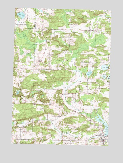
Iola, WI USGS Topographic Map
Click on map above to begin viewing in our Map Viewer.

This topographic map contains these locations and features:
Feature Name Type Latitude Longitude GNIS ID View Map
Anderson School (historical)SchoolN44.5316°W89.1690°1850400View Map
Budsberg PondLakeN44.5469°W89.2436°1562347View Map
Flume CreekStreamN44.6186°W89.1423°1565088View Map
Graham LakeLakeN44.5664°W89.1518°1565708View Map
Griffin CreekStreamN44.5503°W89.1807°1565900View Map
Hitterdahl CemeteryCemeteryN44.5586°W89.1251°1566487View Map
Honkens Hilltop FarmLocaleN44.5358°W89.1928°2631605View Map
IolaPopulated PlaceN44.5080°W89.1307°1566947View Map
Iola - Scandinavia High SchoolSchoolN44.5015°W89.1276°2716355View Map
Iola 1870C480 DamDamN44.5100°W89.1318°1792298View Map
Iola and Rural Volunteer Fire Department and Ambulance ServiceBuildingN44.5063°W89.1347°2697819View Map
Iola Emergency HeliportAirportN44.5069°W89.1362°1582020View Map
Iola LakeLakeN44.5222°W89.1323°1566948View Map
Iola Lake 100ReservoirN44.5100°W89.1318°1792299View Map
Iola Police DepartmentBuildingN44.5063°W89.1312°2759498View Map
Johnson LakeLakeN44.5188°W89.2482°1567239View Map
Lake HelenLakeN44.6183°W89.2417°1566275View Map
Langdock School (historical)SchoolN44.5769°W89.1679°1850482View Map
Leer CreekStreamN44.5661°W89.1618°1567940View Map
Nace CreekStreamN44.5066°W89.1484°1570094View Map
North LakeLakeN44.5720°W89.1318°1570454View Map
NorthlandPopulated PlaceN44.5950°W89.2079°1570526View Map
Northland CemeteryCemeteryN44.5983°W89.2096°1850524View Map
Northland School (historical)SchoolN44.6169°W89.2140°1850525View Map
Our Saviors Lutheran ChurchChurchN44.5064°W89.1262°1850534View Map
PeruPopulated PlaceN44.5700°W89.2434°1581576View Map
Petersville (historical)Populated PlaceN44.5383°W89.1834°1850537View Map
Pleasant Hill School (historical)SchoolN44.5728°W89.2037°1850540View Map
Siemer LakeLakeN44.5639°W89.1323°1574090View Map
Town of IolaCivilN44.5493°W89.1645°1583432View Map

Note: Coordinates in the location and feature list above are referenced to NAD83 datum.


Copyright (C) 2008-2025 Ryan Niemi / Sunset Dynamics ... All Rights Reserved