TopoQuest Logo
Do you find TopoQuest useful?
Help keep TopoQuest running and adding new maps/features by donating!
Bitcoin:  19c7KJd3qBynnjoSw5npx9KScwjBe4ifkT
Litecoin:  LXs6TkuXGGXo1vDsWCkWVdjQX94eUKd6ui
Home View Maps Find Maps Find Places Resources & Links


New Lisbon South, Wisconsin Topographic Map

USGS Map Title: New Lisbon South, WI
USGS Map MRC: 43090G2
DRG (GeoTIFF) Download: o43090g2.tif


Neighboring USGS Topographic Map Quads:


  Camp Douglas, WI  
43090H3
 

  New Lisbon North, WI  
43090H2
 

  Kelly, WI  
43090H1
 

  Kendall East, WI  
43090G3
 

  New Lisbon South, WI  
43090G2
 

  Mauston, WI  
43090G1
 

  Hillsboro, WI  
43090F3
 

  Wonewoc, WI  
43090F2
 

  Potato Hill, WI  
43090F1


Map MRC Location:

N44°
W91°
N44°
W90°
H8 H7 H6 H5 H4 H3 H2 H1
G8 G7 G6 G5 G4 G3 G2 G1
F8 F7 F6 F5 F4 F3 F2 F1
E8 E7 E6 E5 E4 E3 E2 E1
D8 D7 D6 D5 D4 D3 D2 D1
C8 C7 C6 C5 C4 C3 C2 C1
B8 B7 B6 B5 B4 B3 B2 B1
A8 A7 A6 A5 A4 A3 A2 A1
N43°
W91°
N43°
W90°

New Lisbon South, WI USGS 1:24K Topographic Map Preview:
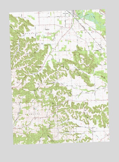
New Lisbon South, WI USGS Topographic Map
Click on map above to begin viewing in our Map Viewer.

This topographic map contains these locations and features:
Feature Name Type Latitude Longitude GNIS ID View Map
0.2 ReservoirReservoirN43.7993°W90.1989°1793556View Map
Aquarian Garden Holistic Wellness CenterHospitalN43.8580°W90.2040°2678886View Map
Baker SchoolSchoolN43.8430°W90.1321°1561111View Map
Braund HillSummitN43.8064°W90.2126°1562160View Map
Church ValleyValleyN43.8287°W90.1985°1563082View Map
Duckworth RidgeRidgeN43.8236°W90.1532°1564159View Map
East Lemonweir Lutheran CemeteryCemeteryN43.8225°W90.2107°1834295View Map
East Lemonweir Lutheran ChurchChurchN43.8216°W90.2104°1564350View Map
Johnson HillSummitN43.8008°W90.2287°1567227View Map
Johnson ValleyValleyN43.8126°W90.1465°1567249View Map
Juneau County LandfillLocaleN43.8353°W90.1483°2635568View Map
Lenandowski Floyd G3407 DamDamN43.8000°W90.2001°1793555View Map
LindinaPopulated PlaceN43.7600°W90.1471°1577705View Map
Mauston-New Lisbon Union AirportAirportN43.8368°W90.1329°1581042View Map
Mount Zion CemeteryCemeteryN43.7744°W90.2204°1569866View Map
New Lisbon Wastewater Treatment PlantLocaleN43.8685°W90.1628°2729076View Map
Norwegian GapGapN43.8233°W90.1799°1570559View Map
Pleasant Acres CemeteryCemeteryN43.8573°W90.2046°2678884View Map
Pleasant Acres Nursing Home (historical)HospitalN43.8580°W90.2040°1834327View Map
Plymouth CemeteryCemeteryN43.7966°W90.1723°1834329View Map
Plymouth ChurchChurchN43.7964°W90.1710°1571711View Map
Riley HollowValleyN43.7565°W90.1578°1572316View Map
Rock Valley CemeteryCemeteryN43.7636°W90.1471°1572476View Map
Ryder RidgeRidgeN43.8139°W90.1585°1572772View Map
Sarazin G3407 DamDamN43.7966°W90.1985°1792697View Map
Suldal CemeteryCemeteryN43.8027°W90.1615°1575041View Map
Suldal ValleyValleyN43.7992°W90.1569°1575042View Map
Teachout ValleyValleyN43.8561°W90.2156°1575287View Map
Town of LindinaCivilN43.7724°W90.1362°1583575View Map
Town of LisbonCivilN43.8541°W90.1287°1583578View Map
Twin BluffsSummitN43.8108°W90.1304°1575769View Map
Webster CreekStreamN43.8680°W90.1562°1576382View Map
Windy GapGapN43.8133°W90.1593°1576860View Map
Wood HillSummitN43.8083°W90.2399°1576965View Map
WRJC-FM (Mauston)TowerN43.7877°W90.1979°1582409View Map
Zindorf CemeteryCemeteryN43.8439°W90.2068°1577127View Map

Note: Coordinates in the location and feature list above are referenced to NAD83 datum.


Copyright (C) 2008-2025 Ryan Niemi / Sunset Dynamics ... All Rights Reserved