TopoQuest Logo
Do you find TopoQuest useful?
Help keep TopoQuest running and adding new maps/features by donating!
Bitcoin:  19c7KJd3qBynnjoSw5npx9KScwjBe4ifkT
Litecoin:  LXs6TkuXGGXo1vDsWCkWVdjQX94eUKd6ui
Home View Maps Find Maps Find Places Resources & Links


Kendall East, Wisconsin Topographic Map

USGS Map Title: Kendall East, WI
USGS Map MRC: 43090G3
DRG (GeoTIFF) Download: o43090g3.tif


Neighboring USGS Topographic Map Quads:


  Oakdale, WI  
43090H4
 

  Camp Douglas, WI  
43090H3
 

  New Lisbon North, WI  
43090H2
 

  Kendall West, WI  
43090G4
 

  Kendall East, WI  
43090G3
 

  New Lisbon South, WI  
43090G2
 

  Trippville, WI  
43090F4
 

  Hillsboro, WI  
43090F3
 

  Wonewoc, WI  
43090F2


Map MRC Location:

N44°
W91°
N44°
W90°
H8 H7 H6 H5 H4 H3 H2 H1
G8 G7 G6 G5 G4 G3 G2 G1
F8 F7 F6 F5 F4 F3 F2 F1
E8 E7 E6 E5 E4 E3 E2 E1
D8 D7 D6 D5 D4 D3 D2 D1
C8 C7 C6 C5 C4 C3 C2 C1
B8 B7 B6 B5 B4 B3 B2 B1
A8 A7 A6 A5 A4 A3 A2 A1
N43°
W91°
N43°
W90°

Kendall East, WI USGS 1:24K Topographic Map Preview:
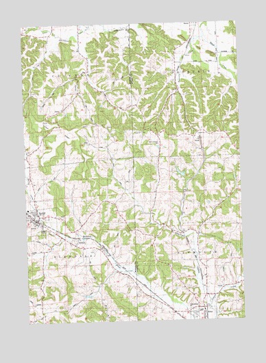
Kendall East, WI USGS Topographic Map
Click on map above to begin viewing in our Map Viewer.

This topographic map contains these locations and features:
Feature Name Type Latitude Longitude GNIS ID View Map
0.1 ReservoirReservoirN43.7783°W90.2501°1793510View Map
0.36 ReservoirReservoirN43.8118°W90.2846°1792534View Map
Calvin Manson G-9509 DamDamN43.7783°W90.2501°1793509View Map
Cleaver CreekStreamN43.7569°W90.2690°1563172View Map
Clifton RidgeRidgeN43.8308°W90.3568°1563191View Map
Doyle G3410 DamDamN43.8100°W90.2818°1792533View Map
Elroy Elementary SchoolSchoolN43.7540°W90.2752°2715785View Map
Fountain ChurchChurchN43.8291°W90.3076°1565170View Map
Fountain Lutheran CemeteryCemeteryN43.8294°W90.3068°1834301View Map
Fowler-Sherman CemeteryCemeteryN43.7550°W90.2812°1565201View Map
GlendalePopulated PlaceN43.7822°W90.3457°1565569View Map
Grassman ValleyValleyN43.8744°W90.3706°1565774View Map
Hoton CreekStreamN43.8725°W90.2704°1566756View Map
Indian CreekStreamN43.8747°W90.3643°1566911View Map
KendallPopulated PlaceN43.7922°W90.3685°1567404View Map
Kendall Area AmbulanceBuildingN43.7919°W90.3678°2698421View Map
Kendall Elementary SchoolSchoolN43.7975°W90.3740°2715793View Map
Kendall Fire DepartmentBuildingN43.7919°W90.3678°2697730View Map
Kendall Police DepartmentBuildingN43.7936°W90.3703°2759513View Map
Lydon Valley CreekStreamN43.7955°W90.3726°1565234View Map
Mack ValleyValleyN43.7503°W90.2851°1568866View Map
Number One TunnelTunnelN43.8280°W90.2743°1575715View Map
Rocky RunStreamN43.8702°W90.3429°1572508View Map
Royall Middle / High SchoolSchoolN43.7540°W90.2752°2715863View Map
Sherman ValleyValleyN43.7600°W90.2703°1574036View Map
Spring Valley CreekStreamN43.7936°W90.3665°1577212View Map
Town of CliftonCivilN43.8564°W90.3742°1582980View Map
Town of FountainCivilN43.8561°W90.2514°1583222View Map
Town of GlendaleCivilN43.7718°W90.3727°1583282View Map
Town of PlymouthCivilN43.7768°W90.2510°1583945View Map
TunnelLocaleN43.8241°W90.2721°1575712View Map
Village of KendallCivilN43.7927°W90.3676°1583469View Map
West Lemonweir CemeteryCemeteryN43.8255°W90.2979°1576529View Map

Note: Coordinates in the location and feature list above are referenced to NAD83 datum.


Copyright (C) 2008-2025 Ryan Niemi / Sunset Dynamics ... All Rights Reserved