TopoQuest Logo
Do you find TopoQuest useful?
Help keep TopoQuest running and adding new maps/features by donating!
Bitcoin:  19c7KJd3qBynnjoSw5npx9KScwjBe4ifkT
Litecoin:  LXs6TkuXGGXo1vDsWCkWVdjQX94eUKd6ui
Home View Maps Find Maps Find Places Resources & Links


Camp Douglas, Wisconsin Topographic Map

USGS Map Title: Camp Douglas, WI
USGS Map MRC: 43090H3
DRG (GeoTIFF) Download: o43090h3.tif


Neighboring USGS Topographic Map Quads:


  Wyeville, WI  
44090A4
 

  Shennington, WI  
44090A3
 

  Cutler, WI  
44090A2
 

  Oakdale, WI  
43090H4
 

  Camp Douglas, WI  
43090H3
 

  New Lisbon North, WI  
43090H2
 

  Kendall West, WI  
43090G4
 

  Kendall East, WI  
43090G3
 

  New Lisbon South, WI  
43090G2


Map MRC Location:

N44°
W91°
N44°
W90°
H8 H7 H6 H5 H4 H3 H2 H1
G8 G7 G6 G5 G4 G3 G2 G1
F8 F7 F6 F5 F4 F3 F2 F1
E8 E7 E6 E5 E4 E3 E2 E1
D8 D7 D6 D5 D4 D3 D2 D1
C8 C7 C6 C5 C4 C3 C2 C1
B8 B7 B6 B5 B4 B3 B2 B1
A8 A7 A6 A5 A4 A3 A2 A1
N43°
W91°
N43°
W90°

Camp Douglas, WI USGS 1:24K Topographic Map Preview:
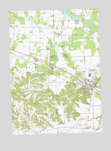
Camp Douglas, WI USGS Topographic Map
Click on map above to begin viewing in our Map Viewer.

This topographic map contains these locations and features:
Feature Name Type Latitude Longitude GNIS ID View Map
Allen CreekStreamN43.9775°W90.3418°1560773View Map
Bear BluffSummitN43.9583°W90.3185°1561341View Map
Bear CreekStreamN43.9936°W90.2926°1561354View Map
Bee BluffCliffN43.9452°W90.3179°1561489View Map
Bellevue HillSummitN43.9061°W90.3451°1561538View Map
Bethel ChurchChurchN43.9886°W90.3129°1561640View Map
Camels BluffSummitN43.9533°W90.3165°1562564View Map
Camp DouglasPopulated PlaceN43.9225°W90.2715°1562599View Map
Camp Douglas CemeteryCemeteryN43.9238°W90.2823°1834289View Map
Camp Douglas Elementary SchoolSchoolN43.9211°W90.2796°1843066View Map
Camp Douglas Police DepartmentBuildingN43.9183°W90.2687°2759673View Map
Camp Douglas RescueBuildingN43.9185°W90.2687°2698315View Map
Camp Douglas Volunteer Fire DepartmentBuildingN43.9185°W90.2688°2697945View Map
Camp WilliamsMilitaryN43.9249°W90.2688°2512406View Map
Castle RockSummitN43.9208°W90.2582°1834290View Map
Chinaman BluffSummitN43.9325°W90.2799°1563032View Map
CliftonPopulated PlaceN43.8791°W90.3568°1563187View Map
Clifton CemeteryCemeteryN43.8775°W90.3373°1563188View Map
Clifton Corners SchoolSchoolN43.8761°W90.3432°1563189View Map
Devils MonumentPillarN43.9533°W90.3140°1563945View Map
Diamond ValleyValleyN43.9461°W90.3436°1563968View Map
Fountain CreekStreamN43.8902°W90.2524°1565176View Map
HustlerPopulated PlaceN43.8800°W90.2718°1566833View Map
Long BluffSummitN43.9525°W90.2979°1568520View Map
Mill BluffSummitN43.9414°W90.3171°1846246View Map
Mill Bluff State Natural AreaParkN43.9536°W90.3140°2057513View Map
Mill Bluff State ParkParkN43.9411°W90.3190°1569463View Map
Mount EveSummitN43.9133°W90.3571°1846206View Map
Nelson ParkParkN43.9244°W90.2782°1834321View Map
Ragged RockPillarN43.9630°W90.3026°1572028View Map
Ranney CemeteryCemeteryN43.8794°W90.2626°1834332View Map
Round BluffSummitN43.9355°W90.3187°1572631View Map
Saint James CemeteryCemeteryN43.9241°W90.2832°1572975View Map
Sorenson CemeteryCemeteryN43.9319°W90.3243°1574379View Map
Town of OakdaleCivilN43.9401°W90.3731°1583837View Map
Town of OrangeCivilN43.9384°W90.2516°1583866View Map
Tug HollowValleyN43.9219°W90.3232°1575706View Map
Tug Hollow SchoolSchoolN43.9177°W90.3324°1575707View Map
Village of Camp DouglasCivilN43.9197°W90.2697°1582914View Map
Village of HustlerCivilN43.8771°W90.2658°1583427View Map
Volk FieldAirportN43.9355°W90.2639°1581909View Map
Volk Field Air National Guard BaseMilitaryN43.9368°W90.2526°2512378View Map
Wildcat BluffSummitN43.9605°W90.3221°1576735View Map
Wisconsin Air National Guard Volk Field Fire DepartmentBuildingN43.9351°W90.2620°2697654View Map

Note: Coordinates in the location and feature list above are referenced to NAD83 datum.


Copyright (C) 2008-2025 Ryan Niemi / Sunset Dynamics ... All Rights Reserved