TopoQuest Logo
Do you find TopoQuest useful?
Help keep TopoQuest running and adding new maps/features by donating!
Bitcoin:  19c7KJd3qBynnjoSw5npx9KScwjBe4ifkT
Litecoin:  LXs6TkuXGGXo1vDsWCkWVdjQX94eUKd6ui
Home View Maps Find Maps Find Places Resources & Links


Potato Hill, Wisconsin Topographic Map

USGS Map Title: Potato Hill, WI
USGS Map MRC: 43090F1
DRG (GeoTIFF) Download: o43090f1.tif


Neighboring USGS Topographic Map Quads:


  New Lisbon South, WI  
43090G2
 

  Mauston, WI  
43090G1
 

  Round Bluff, WI  
43089G8
 

  Wonewoc, WI  
43090F2
 

  Potato Hill, WI  
43090F1
 

  Lyndon Station, WI  
43089F8
 

  La Valle, WI  
43090E2
 

  Reedsburg West, WI  
43090E1
 

  Reedsburg East, WI  
43089E8


Map MRC Location:

N44°
W91°
N44°
W90°
H8 H7 H6 H5 H4 H3 H2 H1
G8 G7 G6 G5 G4 G3 G2 G1
F8 F7 F6 F5 F4 F3 F2 F1
E8 E7 E6 E5 E4 E3 E2 E1
D8 D7 D6 D5 D4 D3 D2 D1
C8 C7 C6 C5 C4 C3 C2 C1
B8 B7 B6 B5 B4 B3 B2 B1
A8 A7 A6 A5 A4 A3 A2 A1
N43°
W91°
N43°
W90°

Potato Hill, WI USGS 1:24K Topographic Map Preview:
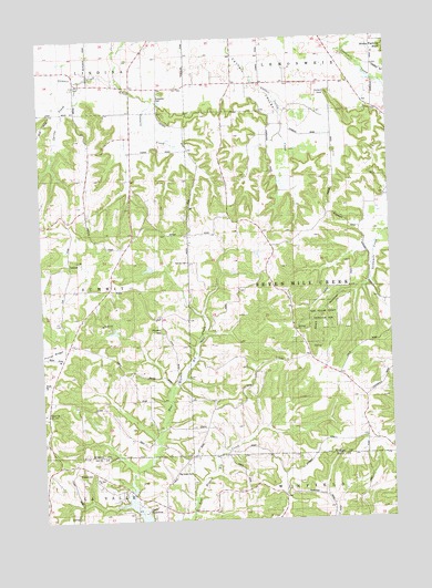
Potato Hill, WI USGS Topographic Map
Click on map above to begin viewing in our Map Viewer.

This topographic map contains these locations and features:
Feature Name Type Latitude Longitude GNIS ID View Map
0.48 ReservoirReservoirN43.6903°W90.0864°1792562View Map
0.58 ReservoirReservoirN43.6741°W90.0995°1792475View Map
Barney CemeteryCemeteryN43.6922°W90.0723°1561184View Map
Barney School (historical)SchoolN43.6853°W90.0726°1831767View Map
Bass HollowValleyN43.6937°W90.0057°1561224View Map
Bass Hollow County Recreation AreaParkN43.6775°W90.0246°1561225View Map
Bass Hollow State Natural AreaParkN43.6830°W90.0248°2057355View Map
Big Creek CemeteryCemeteryN43.6375°W90.0785°1561701View Map
Borge G5080 DamDamN43.6733°W90.1001°1792474View Map
Cattail Valley School (historical)SchoolN43.7383°W90.0504°1834292View Map
Darrow School (historical)SchoolN43.6569°W90.0937°1834294View Map
Evergreen CemeteryCemeteryN43.7350°W90.0823°1564747View Map
Pawlisch E6039 DamDamN43.6900°W90.0851°1792561View Map
Plainview School (historical)SchoolN43.6516°W90.0112°1834326View Map
Pollard RockPillarN43.7358°W90.0210°1571740View Map
Potato HillSummitN43.6744°W90.0818°1571830View Map
Rock Valley School (historical)SchoolN43.7383°W90.0965°1834335View Map
Saint Paul CemeteryCemeteryN43.6369°W90.1137°1573431View Map
Saint Paul ChurchChurchN43.6361°W90.1065°1573443View Map
Saint Paul School (historical)SchoolN43.6358°W90.1065°1846930View Map
Sheep Pasture Bluff School (historical)SchoolN43.7430°W90.0051°1834347View Map
Spring CreekStreamN43.7394°W90.1096°1574635View Map
Stewart CreekStreamN43.7397°W90.0965°1574890View Map
Town of Seven Mile CreekCivilN43.6863°W90.0135°1584126View Map
Wafle School (historical)SchoolN43.6547°W90.0562°1831768View Map

Note: Coordinates in the location and feature list above are referenced to NAD83 datum.


Copyright (C) 2008-2024 Ryan Niemi / Sunset Dynamics ... All Rights Reserved