TopoQuest Logo
Do you find TopoQuest useful?
Help keep TopoQuest running and adding new maps/features by donating!
Bitcoin:  19c7KJd3qBynnjoSw5npx9KScwjBe4ifkT
Litecoin:  LXs6TkuXGGXo1vDsWCkWVdjQX94eUKd6ui
Home View Maps Find Maps Find Places Resources & Links


Bellefontaine, Mississippi Topographic Map

USGS Map Title: Bellefontaine, MS
USGS Map MRC: 33089F3
DRG (GeoTIFF) Download: o33089f3.tif


Neighboring USGS Topographic Map Quads:


  Big Creek, MS  
33089G4
 

  Calhoun City, MS  
33089G3
 

  Atlanta, MS  
33089G2
 

  Cadaretta, MS  
33089F4
 

  Bellefontaine, MS  
33089F3
 

  Hohenlinden, MS  
33089F2
 

  Little Sand Creek, MS  
33089E4
 

  Eupora, MS  
33089E3
 

  Sapa, MS  
33089E2


Map MRC Location:

N34°
W90°
N34°
W89°
H8 H7 H6 H5 H4 H3 H2 H1
G8 G7 G6 G5 G4 G3 G2 G1
F8 F7 F6 F5 F4 F3 F2 F1
E8 E7 E6 E5 E4 E3 E2 E1
D8 D7 D6 D5 D4 D3 D2 D1
C8 C7 C6 C5 C4 C3 C2 C1
B8 B7 B6 B5 B4 B3 B2 B1
A8 A7 A6 A5 A4 A3 A2 A1
N33°
W90°
N33°
W89°

Bellefontaine, MS USGS 1:24K Topographic Map Preview:
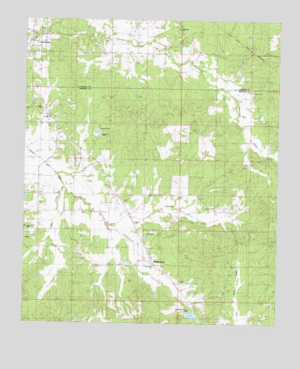
Bellefontaine, MS USGS Topographic Map
Click on map above to begin viewing in our Map Viewer.

This topographic map contains these locations and features:
Feature Name Type Latitude Longitude GNIS ID View Map
American LegionReservoirN33.6283°W89.2913°666241View Map
BellefontainePopulated PlaceN33.6487°W89.3101°666791View Map
Bellefontaine CreekStreamN33.6651°W89.3295°666792View Map
Bellefontaine Methodist ChurchChurchN33.6471°W89.3078°690005View Map
Bellefontaine Post OfficePost OfficeN33.6485°W89.3103°712657View Map
Bellefontaine School (historical)SchoolN33.6482°W89.3106°705672View Map
Bellefontaine Volunteer Fire DepartmentBuildingN33.6501°W89.3133°2665925View Map
Dorroh LakeReservoirN33.7037°W89.3392°682833View Map
Dorroh Lake ChapelChurchN33.7023°W89.3376°682834View Map
Dorroh Lake DamDamN33.7051°W89.3467°682305View Map
Double Springs CemeteryCemeteryN33.7137°W89.3692°669349View Map
Double Springs ChurchChurchN33.7137°W89.3692°669354View Map
Double Springs SchoolSchoolN33.7137°W89.3692°669355View Map
Dumas ChurchChurchN33.6662°W89.3192°669495View Map
Dumas SchoolSchoolN33.6662°W89.3192°669496View Map
EmbryPopulated PlaceN33.6562°W89.3690°691840View Map
Fellowship ChurchChurchN33.6485°W89.3115°682835View Map
Ford CemeteryCemeteryN33.6429°W89.3234°670075View Map
Hardy Lake DamDamN33.6385°W89.3051°682261View Map
Little CreekStreamN33.6810°W89.3548°672587View Map
Lovette CemeteryCemeteryN33.6629°W89.3473°672907View Map
McCain (historical)LocaleN33.6785°W89.3056°705704View Map
Middleton (historical)LocaleN33.6626°W89.3098°705705View Map
New Hope Baptist ChurchChurchN33.7093°W89.3623°674720View Map
New Hope CemeteryCemeteryN33.7140°W89.3737°674661View Map
North Union CemeteryCemeteryN33.6626°W89.3115°674964View Map
North Union ChurchChurchN33.6629°W89.3109°682852View Map
Old Bellefontaine (historical)LocaleN33.6540°W89.2945°705715View Map
Pilgrim Rest CemeteryCemeteryN33.6626°W89.3728°675738View Map
Pilgrim Rest ChurchChurchN33.6626°W89.3728°675757View Map
Point Pleasant School (historical)SchoolN33.6632°W89.3128°705721View Map
Quinn CemeteryCemeteryN33.6426°W89.2967°676436View Map
Sabougla CreekStreamN33.6812°W89.3553°676988View Map
Slate SpringPopulated PlaceN33.7407°W89.3712°677875View Map
Spencer CemeteryCemeteryN33.7207°W89.2626°678050View Map
Spring Hill CemeteryCemeteryN33.7443°W89.2959°678103View Map
Spring Hill ChurchChurchN33.7462°W89.2984°678132View Map
Vance (historical)LocaleN33.7418°W89.3376°705982View Map
Vance CemeteryCemeteryN33.7421°W89.3353°679185View Map
West Lake DamDamN33.7484°W89.3417°682323View Map

Note: Coordinates in the location and feature list above are referenced to NAD83 datum.


Copyright (C) 2008-2024 Ryan Niemi / Sunset Dynamics ... All Rights Reserved