TopoQuest Logo
Do you find TopoQuest useful?
Help keep TopoQuest running and adding new maps/features by donating!
Bitcoin:  19c7KJd3qBynnjoSw5npx9KScwjBe4ifkT
Litecoin:  LXs6TkuXGGXo1vDsWCkWVdjQX94eUKd6ui
Home View Maps Find Maps Find Places Resources & Links


New Ross, Indiana Topographic Map

USGS Map Title: New Ross, IN
USGS Map MRC: 39086H6
DRG (GeoTIFF) Download: o39086h6.tif


Neighboring USGS Topographic Map Quads:


  Darlington, IN  
40086A7
 

  Shannondale, IN  
40086A6
 

  Hazelrigg, IN  
40086A5
 

  Ladoga, IN  
39086H7
 

  New Ross, IN  
39086H6
 

  Lizton, IN  
39086H5
 

  Roachdale, IN  
39086G7
 

  North Salem, IN  
39086G6
 

  Danville, IN  
39086G5


Map MRC Location:

N40°
W87°
N40°
W86°
H8 H7 H6 H5 H4 H3 H2 H1
G8 G7 G6 G5 G4 G3 G2 G1
F8 F7 F6 F5 F4 F3 F2 F1
E8 E7 E6 E5 E4 E3 E2 E1
D8 D7 D6 D5 D4 D3 D2 D1
C8 C7 C6 C5 C4 C3 C2 C1
B8 B7 B6 B5 B4 B3 B2 B1
A8 A7 A6 A5 A4 A3 A2 A1
N39°
W87°
N39°
W86°

New Ross, IN USGS 1:24K Topographic Map Preview:
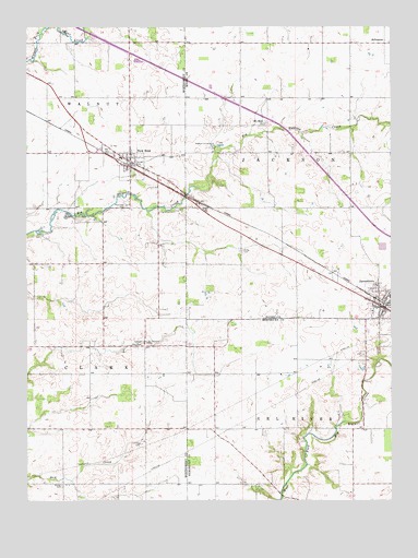
New Ross, IN USGS Topographic Map
Click on map above to begin viewing in our Map Viewer.

This topographic map contains these locations and features:
Feature Name Type Latitude Longitude GNIS ID View Map
Adams CemeteryCemeteryN39.8786°W86.6594°2093777View Map
Advance Conservation ClubLocaleN39.9692°W86.6850°452278View Map
Brown CemeteryCemeteryN39.9522°W86.6898°431595View Map
Fullen CemeteryCemeteryN39.9150°W86.6289°2093781View Map
Granville Wells Elementary SchoolSchoolN39.9284°W86.6253°446540View Map
Hicks CemeteryCemeteryN39.8903°W86.7132°436118View Map
Hypes CemeteryCemeteryN39.8975°W86.6808°2093783View Map
JamestownPopulated PlaceN39.9267°W86.6289°436931View Map
Jamestown Fire DepartmentBuildingN39.9257°W86.6276°2701380View Map
Jamestown Volunteer Fire DepartmentBuildingN39.9287°W86.6337°2626049View Map
Kidd Farm CemeteryCemeteryN39.8942°W86.6444°2093784View Map
Ladoga Rest ParkParkN39.9162°W86.7100°437498View Map
Mount Pleasant CemeteryCemeteryN39.9167°W86.7089°439658View Map
Mount Zion ChurchChurchN39.9748°W86.6678°439793View Map
New RossPopulated PlaceN39.9648°W86.7145°440106View Map
New Ross CemeteryCemeteryN39.9531°W86.7156°440107View Map
Pennington CemeteryCemeteryN39.8825°W86.6656°2093787View Map
Porter CemeteryCemeteryN39.9408°W86.6761°441461View Map
Town of JamestownCivilN39.9285°W86.6263°2397010View Map
Town of New RossCivilN39.9647°W86.7146°2396809View Map
Walnut Elementary SchoolSchoolN39.9653°W86.7175°447346View Map
Walnut Township Fire DepartmentBuildingN39.9640°W86.7137°2626596View Map
Wesley CemeteryCemeteryN39.8789°W86.7384°445691View Map

Note: Coordinates in the location and feature list above are referenced to NAD83 datum.


Copyright (C) 2008-2024 Ryan Niemi / Sunset Dynamics ... All Rights Reserved