TopoQuest Logo
Do you find TopoQuest useful?
Help keep TopoQuest running and adding new maps/features by donating!
Bitcoin:  19c7KJd3qBynnjoSw5npx9KScwjBe4ifkT
Litecoin:  LXs6TkuXGGXo1vDsWCkWVdjQX94eUKd6ui
Home View Maps Find Maps Find Places Resources & Links


Newbern, Tennessee Topographic Map

USGS Map Title: Newbern, TN
USGS Map MRC: 36089A3
DRG (GeoTIFF) Download: o36089a3.tif


Neighboring USGS Topographic Map Quads:


  Miston, TN  
36089B4
 

  Lane, TN  
36089B3
 

  Trimble, TN  
36089B2
 

  Dyersburg, TN  
36089A4
 

  Newbern, TN  
36089A3
 

  Tatumville, TN  
36089A2
 

  Fowlkes, TN  
35089H4
 

  Bonicord, TN  
35089H3
 

  Friendship, TN  
35089H2


Map MRC Location:

N37°
W90°
N37°
W89°
H8 H7 H6 H5 H4 H3 H2 H1
G8 G7 G6 G5 G4 G3 G2 G1
F8 F7 F6 F5 F4 F3 F2 F1
E8 E7 E6 E5 E4 E3 E2 E1
D8 D7 D6 D5 D4 D3 D2 D1
C8 C7 C6 C5 C4 C3 C2 C1
B8 B7 B6 B5 B4 B3 B2 B1
A8 A7 A6 A5 A4 A3 A2 A1
N36°
W90°
N36°
W89°

Newbern, TN USGS 1:24K Topographic Map Preview:
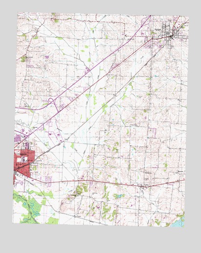
Newbern, TN USGS Topographic Map
Click on map above to begin viewing in our Map Viewer.

This topographic map contains these locations and features:
Feature Name Type Latitude Longitude GNIS ID View Map
BishopPopulated PlaceN36.0048°W89.3281°1314686View Map
Bishops LakeLakeN36.0053°W89.3566°1309775View Map
Church Grove CemeteryCemeteryN36.1103°W89.2970°1650094View Map
Church Grove ChurchChurchN36.1095°W89.2942°1305930View Map
Church of ChristChurchN36.0370°W89.3737°1960121View Map
Church of the Lord Jesus ChristChurchN36.0340°W89.3715°1960124View Map
Clark CemeteryCemeteryN36.0465°W89.3673°1643419View Map
Commissioner District 2CivilN36.1044°W89.2555°2463916View Map
Commissioner District 8CivilN36.0380°W89.3250°2464669View Map
Commissioner District 9CivilN36.0788°W89.3579°2464719View Map
District 7 (historical)CivilN36.0334°W89.2834°1310261View Map
Dyer County CemeteryCemeteryN36.0695°W89.3376°1309786View Map
Dyer County Central Elementary SchoolSchoolN36.0376°W89.3715°1309788View Map
Dyer County FairgroundsLocaleN36.0473°W89.3681°1309790View Map
Dyer County Farm (historical)LocaleN36.0695°W89.3679°1309859View Map
Dyer County High SchoolSchoolN36.1142°W89.2834°1309791View Map
Dyersburg Fire Department Station 3BuildingN36.0614°W89.3446°2654145View Map
Dyersburg Industrial ParkLocaleN36.0537°W89.3459°1309794View Map
Dyersburg Second Baptist ChurchChurchN36.0423°W89.3651°1643394View Map
Fair View School (historical)SchoolN36.0512°W89.2906°1316128View Map
Fairview CemeteryCemeteryN36.1065°W89.2634°1283995View Map
Fairview CemeteryCemeteryN36.0462°W89.3745°1283999View Map
Fairview ChurchChurchN36.0570°W89.3615°1284019View Map
Fort Hudson ChurchChurchN36.0753°W89.3381°1309803View Map
Fort Hudson School (historical)SchoolN36.0753°W89.3373°1309804View Map
Gauldin CemeteryCemeteryN36.0759°W89.2848°1285255View Map
Good HopePopulated PlaceN36.0592°W89.2862°1285615View Map
Hawthorne Baptist ChurchChurchN36.0295°W89.3656°1643400View Map
Hunsacker CreekStreamN36.0395°W89.3251°1288708View Map
Hurricane Hill CemeteryCemeteryN36.0962°W89.3692°1643403View Map
Hurricane Hill ChurchChurchN36.0976°W89.3687°1288822View Map
Hurricane School (historical)SchoolN36.0995°W89.3679°1309815View Map
Interchange 15CrossingN36.0731°W89.3473°1309860View Map
Jennie Bell Elementary SchoolSchoolN36.0373°W89.3656°1648390View Map
Jones CreekStreamN36.0256°W89.3303°1289780View Map
Lewis CreekStreamN36.0145°W89.3673°1291082View Map
Light CreekStreamN36.0548°W89.3223°1291266View Map
Memorial Park CemeteryCemeteryN36.0359°W89.3581°1293589View Map
Monroe SchoolSchoolN36.1209°W89.2628°1294176View Map
Neal Thomas SchoolSchoolN36.0356°W89.3729°1295285View Map
NewbernPopulated PlaceN36.1128°W89.2617°1295678View Map
Newbern Area Vocational Technical SchoolSchoolN36.1187°W89.2606°1309861View Map
Newbern CemeteryCemeteryN36.1062°W89.2765°1295679View Map
Newbern City HallBuildingN36.1123°W89.2640°1309829View Map
Newbern City LibraryBuildingN36.1137°W89.2617°1309830View Map
Newbern City ParkParkN36.1095°W89.2712°1309831View Map
Newbern First Baptist ChurchChurchN36.1123°W89.2648°1643410View Map
Newbern Grammar SchoolSchoolN36.1173°W89.2601°1309832View Map
Newbern Police DepartmentBuildingN36.1126°W89.2634°2765786View Map
Newbern Post OfficePost OfficeN36.1119°W89.2769°1650107View Map
Newbern Volunteer Fire DepartmentBuildingN36.1125°W89.2632°2653664View Map
Oakview Recreation ParkParkN36.1153°W89.2792°1309838View Map
Old Union ChurchChurchN36.0248°W89.2828°1309842View Map
Pierce CemeteryCemeteryN36.0304°W89.3004°1297418View Map
Pillow LakeReservoirN36.0177°W89.2977°1302308View Map
Pillow Lake DamDamN36.0184°W89.2951°1302309View Map
Pond CreekStreamN36.0045°W89.3606°1298102View Map
Poplar CemeteryCemeteryN36.1201°W89.2506°1298173View Map
RehobothPopulated PlaceN36.0323°W89.2556°1315797View Map
Rehoboth CemeteryCemeteryN36.0306°W89.2520°1309847View Map
Rehoboth ChurchChurchN36.0312°W89.2542°1309848View Map
Reynolds CemeteryCemeteryN36.0140°W89.3070°1299255View Map
Ro Ellen Division (historical)CensusN36.0253°W89.2590°1648682View Map
Rock SpringsPopulated PlaceN36.0323°W89.2795°1299795View Map
RoEllenPopulated PlaceN36.0237°W89.2815°1299543View Map
Roellen Baptist ChurchChurchN36.0234°W89.2831°1643414View Map
RoEllen CemeteryCemeteryN36.0281°W89.2795°1299544View Map
RoEllen CreekStreamN36.0120°W89.2703°1269902View Map
Self CemeteryCemeteryN36.0687°W89.2651°1301042View Map
Shaw CemeteryCemeteryN36.0470°W89.3617°1269934View Map
Town of NewbernCivilN36.1171°W89.2693°2406983View Map
Union Grove ChurchChurchN36.0170°W89.3292°1273224View Map
ViarPopulated PlaceN36.0178°W89.3281°1273444View Map
Viar CemeteryCemeteryN36.0103°W89.3173°1273445View Map
Viar School (historical)SchoolN36.0187°W89.3281°1309856View Map
Walker CemeteryCemeteryN36.0440°W89.3009°1273602View Map
WDSG-AM (Dyersburg)TowerN36.0506°W89.3687°1639936View Map

Note: Coordinates in the location and feature list above are referenced to NAD83 datum.


Copyright (C) 2008-2024 Ryan Niemi / Sunset Dynamics ... All Rights Reserved