TopoQuest Logo
Do you find TopoQuest useful?
Help keep TopoQuest running and adding new maps/features by donating!
Bitcoin:  19c7KJd3qBynnjoSw5npx9KScwjBe4ifkT
Litecoin:  LXs6TkuXGGXo1vDsWCkWVdjQX94eUKd6ui
Home View Maps Find Maps Find Places Resources & Links


Newberry, Florida Topographic Map

USGS Map Title: Newberry, FL
USGS Map MRC: 29082F5
DRG (GeoTIFF) Download: o29082f5.tif


Neighboring USGS Topographic Map Quads:


  High Springs SW, FL  
29082G6
 

  High Springs, FL  
29082G5
 

  Alachua, FL  
29082G4
 

  Waters Lake, FL  
29082F6
 

  Newberry, FL  
29082F5
 

  Gainesville West, FL  
29082F4
 

  Newberry SW, FL  
29082E6
 

  Archer, FL  
29082E5
 

  Arredondo, FL  
29082E4


Map MRC Location:

N30°
W83°
N30°
W82°
H8 H7 H6 H5 H4 H3 H2 H1
G8 G7 G6 G5 G4 G3 G2 G1
F8 F7 F6 F5 F4 F3 F2 F1
E8 E7 E6 E5 E4 E3 E2 E1
D8 D7 D6 D5 D4 D3 D2 D1
C8 C7 C6 C5 C4 C3 C2 C1
B8 B7 B6 B5 B4 B3 B2 B1
A8 A7 A6 A5 A4 A3 A2 A1
N29°
W83°
N29°
W82°

Newberry, FL USGS 1:24K Topographic Map Preview:
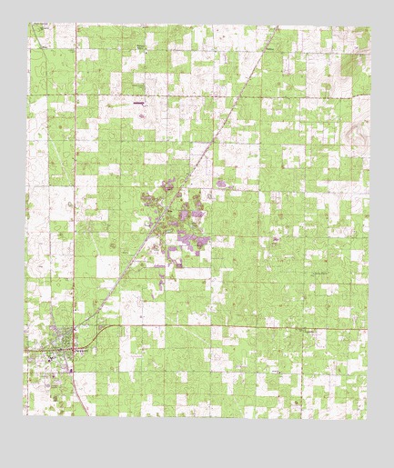
Newberry, FL USGS Topographic Map
Click on map above to begin viewing in our Map Viewer.

This topographic map contains these locations and features:
Feature Name Type Latitude Longitude GNIS ID View Map
African Methodist Episcopal ChurchChurchN29.7316°W82.6190°300421View Map
Bethel African Methodist Episcopal ChurchChurchN29.6492°W82.6100°2112566View Map
CadillacPopulated PlaceN29.7416°W82.5387°295169View Map
Christian Life FellowshipChurchN29.6536°W82.5517°2112573View Map
City of NewberryCivilN29.6346°W82.6047°2404370View Map
Country Side Mobile Home AnnexPopulated PlaceN29.6687°W82.6077°2451193View Map
Destiny Community ChurchChurchN29.6425°W82.6069°2112560View Map
Evergreen Church (historical)ChurchN29.7483°W82.6204°282312View Map
First Baptist of NewberryChurchN29.6464°W82.6133°301987View Map
First United Methodist ChurchChurchN29.6461°W82.6050°2112570View Map
Forest GrovePopulated PlaceN29.7419°W82.5821°295286View Map
Forest Grove Baptist ChurchChurchN29.7411°W82.5812°300419View Map
Forest Grove CemeteryCemeteryN29.7301°W82.5823°282656View Map
Forest Grove Forestry SiteTowerN29.7411°W82.6073°300420View Map
HailePopulated PlaceN29.6905°W82.5734°295331View Map
Jones Temple Church of God Before FaithChurchN29.6522°W82.6097°2112563View Map
JonesvillePopulated PlaceN29.6541°W82.5232°294820View Map
Jonesville Baptist ChurchChurchN29.6397°W82.5315°284926View Map
Jonesville Baptist Church (historical)ChurchN29.6530°W82.6096°301988View Map
Jonesville CemeteryCemeteryN29.6386°W82.5317°2112555View Map
Mount Zura Baptist ChurchChurchN29.6502°W82.6123°301984View Map
NewberryPopulated PlaceN29.6464°W82.6065°307635View Map
Newberry Branch Alachua County LibraryBuildingN29.6453°W82.6108°2112565View Map
Newberry Church of ChristChurchN29.6464°W82.6075°2112561View Map
Newberry City HallBuildingN29.6464°W82.6128°2112562View Map
Newberry Elementary SchoolSchoolN29.6378°W82.6139°297137View Map
Newberry Fire Rescue Station 28BuildingN29.6496°W82.6071°2112568View Map
Newberry High SchoolSchoolN29.6426°W82.6153°297136View Map
Newberry High School Football StadiumParkN29.6436°W82.6136°2112558View Map
Newberry Municipal CemeteryCemeteryN29.6381°W82.6169°2112556View Map
Newberry Post OfficePost OfficeN29.6490°W82.6070°2112569View Map
Newberry Sports Complex NorthParkN29.6692°W82.6025°2112567View Map
Oak Dale Baptist ChurchChurchN29.6536°W82.5237°287930View Map
Oak View Middle SchoolSchoolN29.6410°W82.6054°2112559View Map
Pleasant Plain ChurchChurchN29.6714°W82.5198°289073View Map
Sullivan FieldAirportN29.7336°W82.5662°2717280View Map
Union Baptist ChurchChurchN29.6475°W82.6137°301983View Map
WadePopulated PlaceN29.7414°W82.6193°295692View Map
West ParkParkN29.6414°W82.6197°2112557View Map
Westside Church of ChristChurchN29.6447°W82.6158°2112564View Map

Note: Coordinates in the location and feature list above are referenced to NAD83 datum.


Copyright (C) 2008-2024 Ryan Niemi / Sunset Dynamics ... All Rights Reserved